California
Looking for the best fishing in California? We've got you covered with the top trails, trips, hiking, backpacking, camping and more around California. The detailed guides, photos, and reviews are all submitted by the Outbound community.
Top Fishing Spots in and near California
-
Pinecrest, California
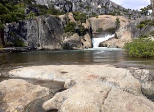
Hike to Cleo's Bath
4.56.5 mi / 1263 ft gainThis 6+ mile hike is located at Pinecrest Lake in the Stanislaus National Forest located in Tuolumne County and features a lake, river, forest, waterfall, and swimming hole. It is accessible year-round, in winter there will be snow, and the hike is dog friendly except between May 15th-September ...Read more -
Tahoma, California
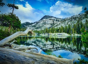
Backpack to Crag Lake
4.011.1 mi / 1220 ft gainDay 1:This trip is a great early season trip while you are waiting for the snow to melt in the high country or it could be a good first backpacking trip because of its proximity to the trailhead and the fact that it's a relatively easy hike. Also, you get to camp by a beautiful lake with a drama...Read more -
Mammoth Lakes, California
Agnew Meadows to Tuolumne Meadows
5.030.27 mi / 4757 ft gainUnlike most through hikes that require two cars or hitchhiking, you can accomplish this with only one car by using a YART. Another benefit is that by entering in Mammoth, it is usually much easier to get permits as opposed to starting in Yosemite where permits can be harder to get. Then once yo...Read more -
June Lake, California
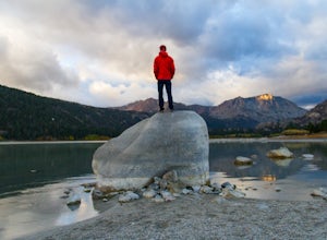
Explore June Lake
4.7June Lake is a hidden gem in the Eastern Sierra, just north of Mammoth Lakes. June Lake is a quaint little lake with spectacular views. The neighboring town of the same name also boasts a brewery with tasty brews. For a truly unforgettable sunset, grab some brews and walk over to June Lake for th...Read more -
Castaic, California
Hiking the Piru Creek Gorge Trail
Take the I-5 exit North of Castaic, CA at Templin Hwy. Turn onto Golden State Hwy heading the only direction it goes from the exit, North. When it dead-ends in a few miles at the National Forest Gate, you are at Frenchman's Flat.You can camp here, or hang with the day hikers. Heading North along ...Read more -
Trinity Center, California
Stuart Fork Trail to Emerald and Sapphire Lakes
5.027.06 mi / 4213 ft gainThe trail begins just past the Trinity Alps Resort, a private collection of cabins near Weaverville, CA. Hikers wanting an early start can spend the night at the Bridge Camp Campground, located next to the trailhead. The path starts out wide and level, following an old road to the wilderness bou...Read more -
Santa Rosa, California
Hiking, Swimming, and Fishing in Wine Country
5.0Annadel State Park is located in the historic Valley of the Moon, just 60 miles north of San Francisco, in Sonoma. This popular 5,200 acre park features a wonderful variety of options to explore, boasting views of the Sonoma Valley, rolling meadows of wildflowers, and direct access to 26 acre Lak...Read more -
Crescent City, California
Devil's Punchbowl, Six Rivers National Forest
4.08.33 mi / 1660 ft gainLocated in extreme Northern California, the Siskiyou Mountains are the largest sub-range of the Klamath Mountain range and among the most rugged. The Siskiyou Wilderness, designated in 1984, encompasses three national forests: Siskiyou, Klamath and Six Rivers for a total of 182,802 acres. Because...Read more -
Shaver Lake, California
Camp at Voyager Rock Campground
4.0The paved road ends at the Maxson Trailhead parking lot on the SE side of Courtright Reservoir. The adventure starts with a glance to the left, down a rock-strewn dirt track that leads off further into the wilderness. You're wondering, "Is that the trail?" and "Do I dare?"The Dusy-Ershim Trail of...Read more -
Sequoia National Park, California
Hike to Pear Lake via the Lakes Trail
5.012.4 mi / 2300 ft gainThe Lakes Trail to Pear Lake can be done as either an overnight stay or a day hike. For overnight, you'll need to get a permit but there are beautiful camping spots available at both Emerald Lake and Pear Lake. As a day hike, plan to spend all day since you'll undoubtedly pause at each lake for...Read more -
Lakeshore, California
Evolution Valley via Florence Lake
4.530.36 mi / 3238 ft gainYou can get to the Evolution Basin a variety of ways, but the easiest is through the Florence Lake Trailhead. Here, you can choose to either take the Florence Lake Ferry across the lake, or save $25 and hike the extra 4 miles around the lake. Personally, I would choose the ferry. About five mile...Read more -
Los Altos, California
Park Day at Foothills Park
1.7Disclaimer: Foothills Park requires proof of residence in Palo Alto or being accompanied by a resident of the city. Learn more here.Foothills Park is 2.7 miles west of 280 after exiting Page Mill. After exiting you take a short scenic drive up the hill and come to the park entrance on your right...Read more -
Mammoth Lakes, California
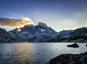
Backpack to Garnet Lake
5.014 mi / 2030 ft gainAlthough this trip specifically describes how to get to Garnet Lake, there are several other pristine alpine lakes (Shadow Lake and Thousand Islands Lake) along this looped trail, only a few short miles away from each other, that are just as worthy if you have the time. A minimum of 3 days/2 nigh...Read more -
YOSEMITE NATIONAL PARK, California
Young Lakes
4.714.14 mi / 1700 ft gainThe Young Lakes trail starts from the Lembert Dome parking area and then winds up around 6 miles into the high country past alpine meadows and stunning views of the surrounding mountains. Lower and Middle Young Lakes are beautiful, but you're going to want to push on to Upper Young Lake, where y...Read more -
El Dorado County, California
Camp at Ice House Reservoir
4.01 mi / 1 ft gainDesolation Wilderness is just west of Lake Tahoe, a part of Eldorado National Forest. It's a very popular backpacking destination as the PCT and Tahoe Rim Trail both run through the area. There are what seems to be endless amounts of mountain lakes, creeks, and rivers that run through this area w...Read more -
Madera County, California
Ediza Lake via Agnew Meadows
4.013.54 mi / 1804 ft gainStart at the Agnew Meadows Trailhead. You will need to arrive before 7:30AM or take the Shuttle from Mammoth Mountain. Start out by heading north on the John Muir Trail. You will pass Shadow Lake; walk around the south side of the lake for mountain views. Then, follow the trail up Shadow Creek u...Read more

