Fallbrook, California
Looking for the best hiking in Fallbrook? We've got you covered with the top trails, trips, hiking, backpacking, camping and more around Fallbrook. The detailed guides, photos, and reviews are all submitted by the Outbound community.
Top Hiking Spots in and near Fallbrook
-
Canyon Lake, California
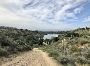
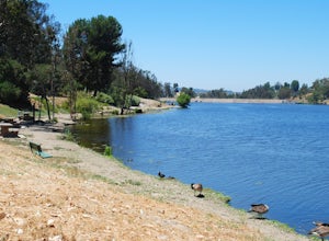
Kabian Memorial Park Loop
5.03.48 mi / 335 ft gainKabian Memorial Park Loop is a loop trail that takes you by a lake located near Quail Valley, California.Read more -
Escondido, California
Bernardo Mountain Summit Trail
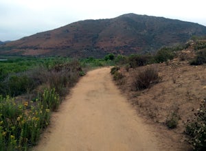
5.07.15 mi / 1060 ft gainBernardo Mountain is located on the Coast to Crest Trail in San Dieguito River Park. The 7.15-mile out-and-back trail to the 1060 ft. summit starts on the east side of I-15. It's a relatively easy hike all the way to the top. It picks up a little once you make it to the Summit Trail junction, wh...Read more -
San Diego, California
Battle Mountain's Cross
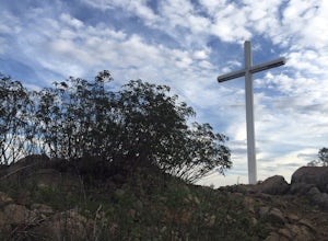
5.00.45 mi / 256 ft gainThis is a quick and easy hike for everyday explorers desiring a 20-minute sweat-inducing power walk leading to incredible views of urban development, Iron Mountain, Mt. Woodson, Mule Hill, and The 15. Come enjoy the views while sitting under the beautiful 20ft cross you've been admiring from the ...Read more -
Solana Beach, California
Annie’s Canyon Trailhead
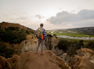
4.72 mi / 100 ft gainIf you're looking for a super short hike, this 10 minute flat walk couldn't be more ideal. Start at 840 N Rios Avenue, Solana beach and walk east towards the FWY 5 where you will see Annie’s Canyon on your right. There is only one way to go up the canyons and it gets pretty tight in places, but y...Read more -
Corona, California
Hike to Santiago Peak via Holy Jim
5.015 mi / 4500 ft gainWhen you think of Orange County, you think of beaches, boardwalks, but what you may not know is that there are some great hikes in our very own backyard! My favorite is a fairly strenuous day hiking adventure that only the strong survive. Not to dissuade any interested parties, since this is a ...Read more -
Corona, California
Hike to Holy Jim Falls
3.02.9 mi / 570 ft gainTo start, directions on how to get to the trail there are two different ways, the most common , which I will explain, being through Rancho Santa Margarita you will head east on Santa Margarita Parkway, turn left at the dead end (into a parking lot for a shopping center) on Plano Trabuco Road, thi...Read more -
Lake Elsinore, California
Explore Walker Canyon
4.3Walker canyon is within easy driving distance from most places in Orange County and San Diego which makes for a great day trip. While there is no official parking lot for the trail you will be able to find parking all along Lake Street and Walker Canyon Road. The trail begins at the corner of L...Read more -
Trabuco Canyon, California
Hike the Bellview to Dove Lake Trail
2.5 mi / 75 ft gainThis hike will be about going from the Bellview Trailhead to Dove Lake and back. Note that once you get to Dove Lake there are numerous offshoots that can take you in different directions (you can follow the road into the Dove Canyon housing community, take a paved road back to the Bellview parki...Read more -
Laguna Niguel, California
Colinas Ridge Trail
2.01 mi / 131 ft gainFirst, you'll be parking in the parking lot for the dog park. It's free parking and there are roughly 40 spaces, so there is plenty of parking. I've never seen more than 20 cars here at any one time. Once parked you'll find the trail head/ start on the northwest side of the lot (opposite the dog ...Read more -
Dana Point, California
Walk the Dana Point Preserve Trail
5.00.5 miOcean views the whole time, plenty of wildlife and different species of native plants make this short hike beautiful. With the hike being short enough to complete in the afternoon after a day at the beach you can see a beautiful view of the coastline north and south. There is plenty of parking in...Read more -
San Diego, California
Black Mountain Peak via Miner's Ridge Loop Trail
2.54.3 mi / 951 ft gainThe Miner's Ridge Loop Trail is a relatively mild 4.3-mile loop that takes you to the 1554-foot summit of Black Mountain Peak. Even from the parking lot, the views to the east are stunning. Get there early in the morning on a clear day, or arrive just before sunset to get the full experience. T...Read more -
Dana Point, California
Hike the Salt Creek Trail
5.03 mi / 20 ft gainStarting from the Salt Creek Beach parking lot (a paid lot that takes cash, debit, and credit cards and charges by the hour. There are pay stations at a few points in the parking lots), you head west towards the ocean...through a tunnel and down the hill towards the beach. Once you get to the bas...Read more -
Poway, California
Blue Sky Ecological Reserve to Ramona Dam
3.05.3 mi / 984 ft gainStarting at the trail head where you park your car, head south along the Green Valley Truck Trail. After less than a mile, you will notice the city and noise start to fade behind you, and a beautiful sight of towering oaks, willows, and sycamores appear as you walk along the Creekside Trail. You ...Read more -
San Diego, California
Black Mountain via Nighthawk Trail
5.04.05 mi / 764 ft gainStarting at the trail head at the end of Oviedo way, you will see a power line on top of the small hill across from the rec center, which is the start of the South Point View Trail. Follow this trail about a mile until you see a sign for the 'Little Black Mountain Loop' . This is a 4.1 mile loop ...Read more -
Laguna Niguel, California
Kick Back at Laguna Niguel Regional Park
This is an awesome tucked away little adventure that will have you occupied all day! With plenty of picnic tables you can be sure to have your own privacy tucked into a corner free from other people. Grab a lake side picnic table or even the numerous ones around the grass fields, they are all won...Read more -
Poway, California
Mount Woodson and Potato Chip Rock
4.66.45 mi / 900 ft gainMt. Woodson is located in Poway's most eastern region and is one of San Diego's most popular and most iconic hiking trails. Known for its grand photo opportunistic "Potato Chip Rock", Mt. Woodson is a 7.5mi out-and-back trail with amazing vistas, convenient rest stops and breathtaking views. The...Read more

