Echo Lake, California
Looking for the best hiking in Echo Lake? We've got you covered with the top trails, trips, hiking, backpacking, camping and more around Echo Lake. The detailed guides, photos, and reviews are all submitted by the Outbound community.
Top Hiking Spots in and near Echo Lake
-
Arnold, California
Hiking Disaster Creek
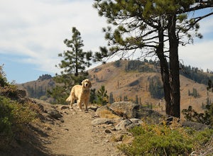
While this is not a terribly scenic hike, the trees, creek, and terrain are very beautiful, and the entire area is quiet and peaceful. You're likely not to pass a single other person on the hike, which is great for letting dogs off-leash.The trail starts off with a series of switchbacks, which ga...Read more -
New Washoe City, Nevada
Chicadee Ridge
5.01.69 mi / 289 ft gainChicadee Ridge is an out-and-back trail where you may see beautiful wildflowers located near Incline Village-Crystal Bay, Nevada.Read more -
Reno, Nevada
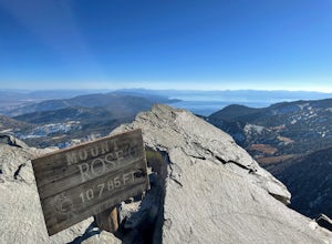
Mt. Rose Summit Loop
5.010.74 mi / 2392 ft gainThis challenging hike offers great views of the greater Tahoe area. The first part of the hike to the waterfall is relatively easy, but once you pass that, you'll be doing a decent climb to the summit. During the summer months, you'll want to get an early start as there can be a decent crowd head...Read more -
Coleville, California
Hike to Tamarack Lake, Carson-Iceberg Wilderness
4.010 mi / 2000 ft gainThe trailhead begins at the end of Golden Gate Rd in Coleville, Ca on highway 396. There are very limited signs, so maps are necessary! Depending on how fast of a hiker you are, you can most likely reach the lake in 6 hours with minimal breaks. If you cannot start in the morning, there are beauti...Read more -
Truckee, California
China Cove Loop at Donner Lake
4.63.11 miThis is a casual hike in an area with a ton of history. Stop by the museum before or after your hike to learn about the Donner Party, the Transcontinental Railroad, and local Native Americans Park at the Donner Lake and Memorial State Park Visitor Center and walk west towards the lake. Cross the...Read more -
Truckee, California
Hike the Truckee Tunnels
5.0To get here, drive along Donner Pass Rd. There is a turnoff about 100 yards away from the Donner Summit Bridge where you can park. The hike begins at a plaque for the China Wall- a large retaining wall built by Chinese railroad workers. Hike up the trail towards the tunnels. Some spots may requi...Read more -
39.333252,-120.289482
Donner Lake Rim Trail: Johnson Canyon to Trout Creek
A perfect Sunday hike on your way back from a weekend at Lake Tahoe. Exit I-80 at Donner Lake and take the dirt road on the north side of I-80 to a large parking lot. A mild climb followed by a set of tougher switchbacks leads you to great views from Donner Ridge. Although adventuring out on t...Read more -
Reno, Nevada
Jones Creek Loop
1.5 mi / 335 ft gainNestled in a forested area on the eastern slope of the Sierra Nevada, Galena Creek Regional Park is seven miles up the Mt. Rose Highway from the intersection with I-580. Galena Creek flows through the park creating separate north and south portions of the park, and the Jones Creek Loop is a great...Read more -
Reno, Nevada
Church's Pond via the Jones-Whites Creek Trail
4.06.49 mi / 2185 ft gainFor the first 0.6 miles the trail follows a peaceful creek, before upping the steepness as it ascends the mountain sides via multiple switchbacks. At 2.5 miles in, you reach a peak that allows you to see from Reno to Washoe City; a perfectly good place for sane people to enjoy and turn back. Howe...Read more -
Placerville, California
Rock Climb the Cosumnes River Gorge
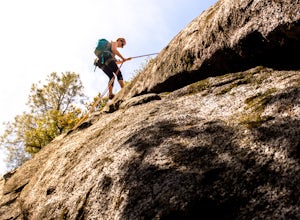
5.0Consumes River Gorge is a good climbing spot that is relativity close to Sacramento, California. it is located just outside of Placerville, California, making it a must-stop climbing spot for any Sacramento or Eldorado county local. The climbing spot boasts granite climbing areas with over a hund...Read more -
Reno, Nevada
Jones Whites Creek Loop
5.09.65 mi / 2405 ft gainStarting at about 6500 ft of elevation Jones Creek Trail is a 9.2 mi loop trail starting in Galena Creek Park. The park itself is very accessible off of Mt. Rose Highway, parking is free, and there is plenty of it during a typical weekend. When entering the park simply follow the signs that say "...Read more -
Pinecrest, California
Camp at Baker Campground
5.0/ 6224 ft gainBaker Campground is a first come, first serve campground. Each site is equipped with a fire ring, picnic table, and bear boxes. The cost for a single family site is $20 per night and a double family site is $40 per night. The campground provides bathrooms and potable water. The campground is typi...Read more -
Truckee, California
Mt. Judah Loop Trail
5.05.5 mi / 1700 ft gainA wonderful hike in Lake Tahoe is the Mt. Judah Loop Trail that offers sweeping views of Donner Lake and the surrounding Sierra Nevada mountains on the North Shore. As a resident on the North Shore, many of my recreational activities favor this side of the Lake but there are marvelous hikes in ...Read more -
Soda Springs, California
Hike to the Peter Benson Hut
5.011.6 mi / 1800 ft gainDrive to the top of Donner Summit via the Old Hwy 40 and park at the Donner Summit PCT trailhead, just past the Sugar Bowl Academy Building. Begin hiking up-hill through a somewhat forested area for about 2 miles. Shortly after you pass the trail sign for the Mt. Judah Loop, you will come to a sm...Read more -
Truckee, California
Backpack the Palisades Creek Trail
4.015 mi / 2200 ft gainAfter driving out to Kidd Lakes and parking at the trailhead, you take off through some easy forest hiking past Cascade Lakes and Long Lake. Pay attention to the cairns marking the trail as you traverse across a large granite section with Devils Peak to your West. The trail is easy to follow and ...Read more -
Soda Springs, California
Hike to the Top of Andesite Peak
5 mi / 1000 ft gainFrom the trail map sign, follow the dirt path straight, following signs for the cross-country skiing route, not snowmobiling. Continue until you see a trail marker. You'll veer left to head over to the Hole in the Ground trail. Once you see another identical trail map board, you'll head left. Thi...Read more

