Del Mar, California
Looking for the best fitness in Del Mar? We've got you covered with the top trails, trips, hiking, backpacking, camping and more around Del Mar. The detailed guides, photos, and reviews are all submitted by the Outbound community.
Top Fitness Spots in and near Del Mar
-
San Diego, California
Bayside Trail
4.01.99 mi / 397 ft gainThe Bayside Trail features beautiful spring wild flowers and is accessible year-round. The trail is wide with a few rest stops and benches along the way. The trail is breezy, much cooler than many trails inland, featuring ocean views throughout the duration. This monument commemorates the landi...Read more -
Lakeside, California
Hike El Cajon Mountain
4.512 mi / 4100 ft gainThis challenging trek is a great way to get in shape for that spring or summer trip to the Sierras. You may have heard others tell you how tough the hike is and they're not kidding. You'll be gaining 4100 feet over the 12 miles to the peak and back. If you have the time and the energy, you should...Read more -
Chula Vista, California
Hike Mother Miguel Mountain
5.04.5 mi / 977 ft gainAt the summit, your work will be rewarded with stunning views from downtown San Diego all the way to Mexico. You can also see the surrounding mountain peaks and the Sweetwater Reservoir. This is a great hike to do at sunset - but bring a headlamp / flashlight for the hike back down. This trail i...Read more -
Jamul, California
Hike Mt. McGinty
4.8 mi / 1263 ft gainBalancing a good workout, gorgeous views, and minimal time commitment, these 4.8-mile steep trail is definitely a San Diego point of interest, and despite its proximity to the city of San Diego, it remains a low trafficked hike. The Hike: Right away the trail weaves you through beautiful vegetati...Read more -
San Diego, California
Hike to the beach at Border Field State Park
2 mi / 26 ft gainThe beach at Border Field State Park is southernmost beach in California. This beach begins (on US Maps) at the Mexican border and continues north to the mouth of the Tijuana River. The State Park shares its land with the Tijuana River National Estuarine Research Reserve which are both operated b...Read more -
Jamul, California
Hike the Hollenbeck Canyon Trail
4.6 mi / 626 ft gainThe trail is wide and well maintained. The first mile of the trail is well shaded by oak trees. You'll see stunning rocky peaks and rolling green hills as the trail continues. There are three creek crossings to be aware of. Cleveland National Forest is dog friendly, but bring a leash! Hunting is ...Read more -
Temecula, California
Dripping Springs Trail
4.013.68 mi / 3287 ft gainThe trail immediately begins to climb out of the campground on a well-graded incline. The next mile contains some climbing leading to a set of switchbacks. A long strenuous climb ensues until the 3200' elevation is reached. The trail then makes an easy southward traverse to the basin before resum...Read more -
Warner Springs, California
Eagle Rock via the Pacific Crest Trail
5.06.2 mi / 807 ft gainWith doing more hikes in the SoCal area, I've realized half the battle is just trying to find the damn trailhead.Technically you have 2 ways to enter this trail ... Start from 79 and add a very enjoyable extra 3ish miles, or start from the Warner Springs Fire Station, for a total 7 mile hike.We c...Read more -
Dana Point, California
Walk the Dana Point Preserve Trail
5.00.5 miOcean views the whole time, plenty of wildlife and different species of native plants make this short hike beautiful. With the hike being short enough to complete in the afternoon after a day at the beach you can see a beautiful view of the coastline north and south. There is plenty of parking in...Read more -
San Diego County, California
Hike Garnet Peak Trail
3.02.6 mi / 500 ft gainWhile there are a few trail options, the designated Garnet Peak Trail begins off of Sunrise Highway at Mile Marker 27.8. There is a small pull-off on the east side of the road with a sign denoting the trail. An Adventure Pass is required for parking in this area of Cleveland National Forest.The f...Read more -
Laguna Niguel, California
Kick Back at Laguna Niguel Regional Park
This is an awesome tucked away little adventure that will have you occupied all day! With plenty of picnic tables you can be sure to have your own privacy tucked into a corner free from other people. Grab a lake side picnic table or even the numerous ones around the grass fields, they are all won...Read more -
Laguna Niguel, California
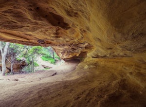
Dripping Cave in the Aliso & Wood Canyons Wilderness
4.47.68 mi / 889 ft gainDripping Cave sits tucked away in a corner of Wood Canyon, part of the Aliso and Wood Canyons Wilderness Park, and the trail to the cave, while short, requires *at least* a 2.25 mile hike in from the nearest trailhead (West Ridge Trail to Mathis Canyon), though this is less than ideal as that rou...Read more


