Dawson Saddle, California
Looking for the best hiking in Dawson Saddle? We've got you covered with the top trails, trips, hiking, backpacking, camping and more around Dawson Saddle. The detailed guides, photos, and reviews are all submitted by the Outbound community.
Top Hiking Spots in and near Dawson Saddle
-
Los Angeles, California
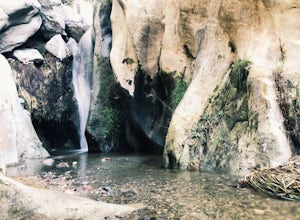
Santa Ynez Falls
3.52.25 mi / 243 ft gainThe Santa Ynez Canyon Trail is located 10 minutes away from the beach providing you the opportunity to do this hike early in the morning and spend the rest of the day hanging out at the beach. To get to the trailhead, take Vereda de la Montura Road until you reach the private residential area (th...Read more -
Lake Forest, California
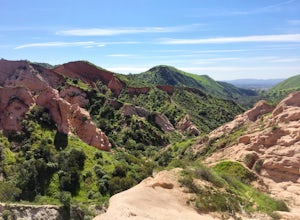
Hike Borrego Canyon to Red Rock Canyon Trails
4.64.2 mi / 500 ft gainJust south east of the city of Irvine, on the southern end of Orange County, is the scenic Whiting Ranch Wilderness Park. Don't let the newly developed shopping centers restaurants fool you, because just beyond the parking lot ($3 Daily Use Fee) of the Borrego Canyon Trailhead, you will find your...Read more -
Topanga, California
Top of Topanga Overlook
1 mi / 1613 ft gainThe Top of Topanga Overlook is where you can simply park your car, and sit in one of the benches to view the San Fernando Valley. But there is one hiking trail in that area which lets you get better vantage points, as well as a quick workout. Once you get to the overlook, park your car and safel...Read more -
Los Angeles, California
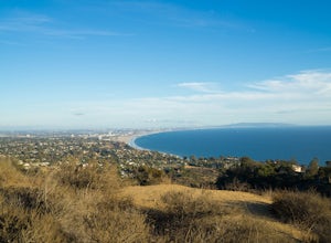
Parker Mesa Overlook via Paseo Miramar
4.25.32 mi / 1099 ft gainThis 5.4-mile out-and back trail takes off from the end of the residential area of Paseo Miramar. Once you hike a little less than a quarter mile in, you'll connect with Los Liones Canyon Trail. Continue on Paseo Miramar Trail, which in another 2.5 miles, will connect you with the Parker Mesa Ove...Read more -
Trabuco Canyon, California
The Luge: Santiago Truck Trail Loop
5.07.46 mi / 1371 ft gainThe Luge: Santiago Truck Trail Loop is a loop trail that takes you through a nice forest located near Lake Forest, California.Read more -
Los Angeles, California
Los Liones Trail
5.04.41 mi / 1115 ft gainLos Liones Trail is an out-and-back trail that is moderately difficult located near Pacific Palisades, California.Read more -
Topanga, California
Eagle Rock in Topanga State Park
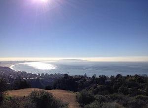
4.45.99 mi / 1106 ft gainEagle Rock is located in Topanga State Park in the Santa Monica Mountains, and it is a unique formation that provides an amazing panoramic view of Santa Monica. On a clear day, the Catalina Islands and Palos Verdes Peninsula are visible. You can park on along the street of Entrada Rd. or pay $10 ...Read more -
Topanga, California
Parker Mesa Overlook via Trippet Ranch
4.06.75 mi / 1181 ft gainThis is a 6.8 mile round-trip hike that starts at Trippet Ranch in Topanga Canyon. Even though the range in elevation is 400 feet from peak to trough, the up and down trail totals to approximately 1800 feet elevation gain making this a beginner to intermediate adventure. The trail itself is pre...Read more -
Fawnskin, California
Castle Rock Trail at Big Bear Lake
4.52.7 mi / 719 ft gainFollow the directions to the trail head, and park on the side of the road. You will see a sign that says Castle Rock Trail, and the path is directly behind that sign. The hike up to the peak is steep, sandy, and very rocky, so shoes with good traction is recommended. There are also lots of oak a...Read more -
Fawnskin, California
Grays Peak Trail
1.06.95 mi / 1293 ft gainThis is a fairly easy mountain peak to climb. The trailhead is easily accessible right off of Hwy 38 by the town of Fawnskin. There is a large National Forest sign noting the parking area to Grays Peak Trail. Note that parking in this lot requires either a day pass or a California Adventure pa...Read more -
Forest Falls, California
Summit Mt. San Bernardino from Angelus Oaks
16 mi / 4775 ft gainThe trailhead is somewhat 'interesting' to get to given the dirt roads are in questionable shape and some of the roads in Angelus Oaks are not easily identifiable but I didn't have any problems finding it by closely following Google Maps. Trailhead parking requires an Adventure Pass parking pe...Read more -
Angelus Oaks, California
San Bernardino Peak
3.015.82 mi / 4911 ft gainThe San Bernadino Peak Trail out of Angelus Oaks is a very challenging hike, which can either be done as a day hike or an overnight trip. Free permits are required for day hiking and overnights in the San Gorgonio Wilderness. These permits can be accessed via Sgwa.org/permits. If you choose to ...Read more -
Lake Elsinore, California
Explore Walker Canyon
4.3Walker canyon is within easy driving distance from most places in Orange County and San Diego which makes for a great day trip. While there is no official parking lot for the trail you will be able to find parking all along Lake Street and Walker Canyon Road. The trail begins at the corner of L...Read more

