Dawson Saddle, California
Looking for the best chillin in Dawson Saddle? We've got you covered with the top trails, trips, hiking, backpacking, camping and more around Dawson Saddle. The detailed guides, photos, and reviews are all submitted by the Outbound community.
Top Chillin Spots in and near Dawson Saddle
-
San Fernando, California
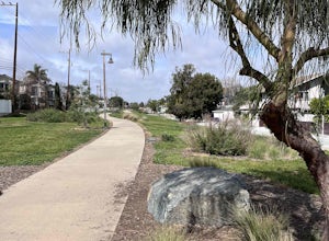
Pacoima Park Natural Wash Park
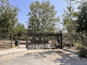
0.54 mi / 13 ft gainPacoima Park Natural Wash Park makes for a wonderful & pleasant walk. The entrance to the park is located at the corner of Newton St and 8th St and runs up to Foothill Blvd in San Fernando California. The park is ADA accessible and allows for dogs on leash. There are also picnic tables and dr...Read more -
Anaheim, California
Oak Canyon Bluebird and Wren Trail
1.42 mi / 187 ft gainThe Oak Canyon Bluebird and Wren Trail features beautiful wildflowers and is accessible year-round. The trail is well kept and offers lots of shady spots. The first portion of this hike will take you up a hill, and then to a fork. One direction will take you around a reservoir and another will ta...Read more -
Los Angeles, California
Watts Towers
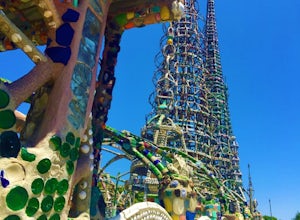
3.0Watts Towers are a quick 15-20 minute ride from Downtown Los Angeles on the Metro. Since I love weird, interesting things, plus the towers are in my backyard, I had to take a trip to check them out! When getting off the train, I half expected to see the towers spiraling off in the distance. After...Read more -
San Bernardino County, California
Aztec Falls
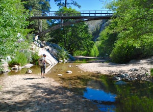
3.31.23 mi / 16 ft gainFrom Lake Arrowhead, take the 173 to Hook Creek Road until you dead end onto Squint Ranch Road. Take a right at the first fork in the road, and park in the lot for Splinters Cabin. The dirt road can be a bit rocky and might not be the best for small cars. Once you're there, be sure to display you...Read more -
Los Angeles, California
Kenneth Hahn Recreation Area Loop
2.85 mi / 328 ft gainThe Kenneth Hahn Recreation Area is just outside of downtown LA, a perfect location for hiking, trail running, and biking. The trail loops up to the top of a hill, where hikers get sweeping views of LA. Dogs are allowed, but must be kept on leash. This is also a great location for trail running...Read more -
Redlands, California
Run the Carriage Trail
3.52.5 mi / 300 ft gainThere is room to park just off San Timoteo Road. On the other side of the trail is more parking off Alessandro. You can park your car on either side and start your run/walk/bike ride. This is a nice little "get away" trail to take a break from suburbia.Read more -
Lancaster, California
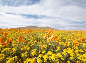
Antelope Valley Poppy Reserve
5.02 mi / 900 ft gainIf you're going during wildflower season, start your adventure at the visitors center at the end of 150th St. W. Parking in the lot outside the visitors center is $10, but there is ample street parking that is free. In the visitors center you can read more about the reserve, plan your hike, and s...Read more -
Santa Clarita, California
Hike to Saint Francis Dam Disaster National Monument
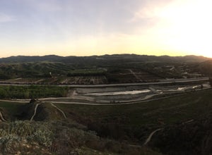
3.2 mi / 153 ft gainThe Saint Francis Dam Disaster National Monument, established in 2019, memorializes the site where the Saint Francis Dam, built by famed engineer William Mulholland, collapsed in 1929, tragically killing more than 400 people in the middle of the night as a 150+ foot wave of water crashed through ...Read more -
Silverado, California
Hike to Black Star Canyon Falls
4.87.5 mi / 913 ft gainWaterfalls in Orange County are far and few between, with the best lying near and inside the Cleveland National Forest. Black Star Canyon Falls are some of the best just after a rain if you are heading out during a dry time of the season you should still expect to see some water. Free parking, ea...Read more -
Los Angeles, California
Reseda Point
4.00.2 mi / 30 ft gainFrom the 118 FWY, exit Reseda and head north until you pass by Calle Vista Circle. Once passed, make a U-turn and park on the side of the street. Here you will find the trailhead for the Palisades Trail Hike. To get to the scenic lookout, simply walk up the short trail leading up the hill, and h...Read more -
Stevenson Ranch, California
Hike the Towsley Canyon Loop
4.75.1 mi / 1340 ft gainThe Towsley Canyon Loop can be done in either a clockwise or counter-clockwise loop. The clockwise path starts with a gradual ascent through Wiley Canyon and steep descent into the Towsley Gorge while a counter-clockwise route starts with a steep climb out of Towsley Canyon and a gradual descent ...Read more -
Long Beach, California
Red Car Greenbelt
5.00.63 mi / 0 ft gainThe Greenbelt used to be the right-of-way for the long lost Pacific Electric Red Car, an amazing system of public transportation that connected Long Beach, LA, Orange Coutny, and even San Bernardino. The pathways are landscaped with plants typical of the area and plenty of native flowers for the...Read more -
Long Beach, California
Colorado Lagoon
5.00.95 mi / 30 ft gainThe Colorado Lagoon is a wetland that is being restored. To make this 1 mile walk into a loop, you have to walk along sidewalks near the park. This is a very kid-friendly destination. This trail crosses over the lagoon on a boardwalk. It also accesses a sandy swimming beach with restrooms, picnic...Read more -
Los Angeles, California
Kayak the Marina Del Rey Harbor
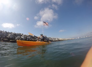
5.0The Marina Del Rey harbor covers 1.5 square miles making it the world’s largest small-craft harbor. Located southwest of Los Angeles, it is the homeport to nearly 6,500 local boats, ranging from small fishing boats, large private yachts, and even a multitude of unique houseboats. The harbor is ea...Read more -
Los Angeles, California
Inspiration Point Loop Trail
2.36 mi / 486 ft gainThe Inspiration Point 2.3 mile loop hike in Will Rogers State Park is a family-friendly hike or after-work run near Los Angeles, California. It’s a great dirt trail for all skill levels and features scenic views and beautifully budding wildflowers. You’ll get to escape the city and take in the br...Read more -
Los Angeles, California
Hike to Vanalden Vista
2 mi / 300 ft gainTo get to the trailhead take Vanalden Ave until it dead ends. Follow the trail at the end of the road as it winds up into the mountains and to the left. You can easily find the trail on Google Maps, so you can use this as a guide. The trail will fork to the left after half a mile. The trail, Vana...Read more

