Camp Nelson, California
Camp Nelson, California offers some of the best trails and outdoor activities for those seeking scenic outdoor adventures. The Trail of 100 Giants is a must-visit, boasting towering sequoias and unique rock formations. This 1.3-mile loop is easy to moderate, making it accessible for all ages. For a more challenging hike, the Belknap Campground trail offers a steep climb with rewarding river views. Also, don't miss the Dome Rock trail, a short but steep climb leading to a panoramic view of the Sierra Nevada. For water activities, the nearby Tule River offers fishing and swimming spots. Remember to pack a picnic to enjoy in the numerous picnic areas scattered throughout the trails. Enjoy your visit to Camp Nelson, where outdoor fun and breathtaking views await.
Top Spots in and near Camp Nelson
-
Lone Pine, California
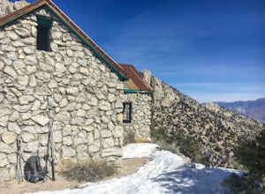
Hike to The Tuttle Creek Ashram
4.33 mi / 1500 ft gainThe Tuttle Creek Ashram is an abandoned stone building, "church" or place of enlightenment tucked away in the beautiful Eastern Sierra. Sitting at an elevation around 8000 feet, construction on the beautiful building was first started in 1928. The building took 20 years of hard manual labor to fi...Read more -
Tulare County, California
Tokopah Falls
4.23.77 mi / 617 ft gainThis hike starts from the Lodgepole area of Sequoia National Park. Parking is easy at the easternmost end of the paved road prior to entering the campground. From the south side, the trail starts off by crossing the Marble Fork of the Kaweah River to the north side. It then loosely follows the r...Read more -
Sequoia National Park, California
Mount Silliman, Sequoia NP
5.011.24 mi / 4449 ft gainThere is available parking at the campgrounds at the Lodgepole Visitor Center. Lodgepole's elevation starts at 6720 ft. Twin Lakes Trailhead starts right at the base, which you will be following to get to Mount Silliman. Along Twin Lakes Trail are several campgrounds for your journey, you can go...Read more -
Tulare County, California
John Muir Trail: Camping at Bighorn Plateau
Another rare but welcomed flat open space along the JMT. The night sky here will blow you away so if you're a photographer this is a great opportunity to capture the incredibel Sierra night sky. Do be careful about camping in the open space in regards to weather. A thunderstorm in this area could...Read more -
Inyo County, California
Summit of Mt. Whitney
5.020.85 mi / 6100 ft gainMt. Whitney is the highest peak in the contiguous United States. It stands over 14,500ft high at its peak (elevation gain of 6100') and it sure feels like it when you are up there. Getting There Located just West of Lone Pine, CA you take Whitney Portal Road West for 13 miles all the way to its...Read more -
Inyo County, California
Lone Pine Lake via Mount Whitney Trail
5.05.88 mi / 1883 ft gainFrom the parking lot at the end of Whitney Portal Road, look for the trailhead, which is marked with a wooden "gate" that shows the map and description of the trail. Starting out at 8,350 ft in elevation, the trail begins a series of switchbacks that lead you into the Sierra Nevada. Take more br...Read more -
Inyo County, California
Summit Mount Whitney via the Mountaineers Route
5.05 mi / 6600 ft gainWith over 6,600 feet of elevation gain and class 4 climbing, this is not for the casual hiker, but can provide an excellent challenge to a budding mountaineer.Park your car at Whitney Portal, 12 miles west of the town of Lone Pine, and start up the main Whitney Trail. After 1 mile you will encou...Read more -
Inyo County, California
Scramble up Mt. Muir
5.018.5 mi / 6200 ft gainFrom the Whitney Trail - beyond trail crest - you will see a big cairn (right side). If you make it to the first "window of Mt. Whitney" you have gone too far. The cairn marks the start of an class 2 use trail up to the Mt. Muir headwall.The headwall is a fun climb with good handholds and has lit...Read more -
Inyo County, California
Winter Summit Mt. Whitney
22 mi / 6500 ft gainDay 1: We arrived at the Lone Pine Visitors Center at the intersection of HWY 395 and HWY 136 just south of Lone Pine, CA. We issued ourselves our overnight permits to climb Mt. Whitney and picked up our Wag Bags. You can self issue yourself the free permit Nov. 2 through Apr 30. Climbing during ...Read more -
Inyo County, California
Meysan Lakes Trail
9.23 mi / 3724 ft gainMeysan Lakes Trail is located on the ever popular Whitney Portal Road. Park on the side of the road next to the Whitney Portal Campground. Start the hike by cutting through the campground, and passing some seasonal cabin style residences. Follow the Meysan Lakes Trail signs. The trail cuts throu...Read more -
Inyo County, California
Green & Camp Lakes via Meysan Lakes
5.08.16 mi / 3248 ft gainGreen Lake via Meysan Lakes Trail is hiked from mid-June to end of September most seasons. Once the snow starts to fall, the road to the trailhead will be closed. A permit is require for overnight. You can obtain the permits online or at the ranger station in Lone Pine. Book online if you plan on...Read more -
Kern County, California
Off-Road to McIver's Cabin
5.0A little over 2 hours north of LA on Highway 14, there is an abrupt turnoff for Horse Canyon Road, which is also SC65. Just a few hundred meters off the 14 there is a large map which you continue straight by and follow SC65 for about 7 miles, along relatively flat dirt roads. The trail does bec...Read more -
Lone Pine, California
Camp at Tuttle Creek Campground
4.5Tuttle Creek Campground is a beautiful place to camp during any time of year. The campground offers uninterrupted breath taking views of the entire Eastern Sierra Nevada and Owens Valleys. Whether you are looking for a place to crash for the night while traveling down the 395, rock climbing in th...Read more -
Three Rivers, California
Hike Little Baldy
5.03.5 mi / 700 ft gainA short hike with impressive views of Sequoia National Park, the Little Baldy trail is the less touristy version of Moro Rock. When we hiked it on a beautiful Sunday morning in the summer, we had the entire summit to ourselves. Even if other hikers had been up there, it would have still felt em...Read more -
Inyo County, California
Camp at Lone Pine Campground
4.0The Lone Pine Campground is located 6 miles west of Lone Pine California, and 7 miles east of Mt Whitney Portal. The campsite is nestled next to Lone Pine Creek, which is the perfect place to fish for Sierra Nevada trout. The campground sits at 6,000 feet and in clear view of Mt. Whitney, the hig...Read more -
Lone Pine, California
Rock Climb the Candy Store
The Candy Store is a group of boulders and small spires with around 30 climbing routes ranging from 5.6 to 5.11. The majority are trad routes with a significant portion toprope and a couple of sport. The major features/boulders are: First BoulderThe GumdropLollipop BoulderRock Candy TowerSecond B...Read more

