Berkeley, California
Berkeley, California is a great destination for adventure and exploration. From scenic hikes to must-visit parks and beaches, the area offers a plethora of activities and attractions. Tilden Regional Park is a favorite spot for visitors, home to a botanical garden, a steam train, and a redwood grove. Those looking for a more active experience can head to Berkeley Marina for kayaking, paddle boarding, or windsurfing. For an outdoor escape, Point Reyes National Seashore is nearby, with endless coastal trails, beaches, and more awaiting exploration. Berkeley, California has truly something for everyone.
Top Spots in and near Berkeley
-
Vacaville, California
Bike the Lake Berryessa Loop
55.82 mi / 1007 ft gainBegin your ride in Vacaville, California out of Alamo Creek Park (street parking is available and free). Head north on Alamo Drive and veer left onto Foothill Drive, then left (South) onto Pleasants Valley Road. After two miles, veer left onto Cherry Glen Road. Stay to the right when you reach th...Read more -
Glen Ellen, California
Corridor Ridge Loop Trail
4.02.48 mi / 289 ft gainCorridor Ridge Loop Trail is a loop trail where you may see wildflowers located near Glen Ellen, California.Read more -
Glen Ellen, California
Sonoma Ridge Trail
9.2 mi / 1955 ft gainSonoma Ridge Trail is a beautiful 9.2-mile out-and-back hike located near Glen Ellen, California. This hike is moderately difficult, with about 1955 feet in elevation change. 95% of the trail is covered in forest shade. Important Notes:Bikes and Horses are permitted on the trails. Dogs are NOT p...Read more -
Glen Ellen, California
Wolf House in Jack London SP
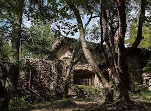
There is a museum in "The House of Happy Walls" which Mrs. London built in redwood grove find park information, exhibits and a small sales area there. A nearby trail leads to Jack London’s grave and to the remains of "Wolf House," London’s dream house which was destroyed by fire in 1913. The par...Read more -
Livermore, California
Del Valle Regional Park
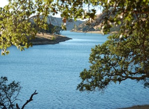
4.0Looking for a quick summer escape filled with stand up paddling, canoeing, fishing, hiking, and picnics? Look no further than Del Valle Regional Park. Consistently considered one of the best campgrounds in the Bay Area, the centerpiece of Del Valle is a 5-mile long lake that allows swimming, fish...Read more -
Yountville, California
Bike the Napa Valley Wine Trail
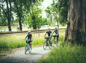
12.5 mi / 100 ft gainThe Napa Vally Vine Trail is an ongoing project of the Napa Valley Vine Coalition which has the stated goal of creating a 47 mile long bike trail along the entire length of Napa Valley. Currently 12.5 miles of trail is available between downtown Yountville and Kennedy Park in the city of Napa. Yo...Read more -
Santa Clara County, California
Black Mountain via Rhus Ridge Trail
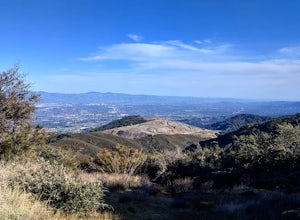
9.75 mi / 2992 ft gainJust outside of Los Altos is a very long ridge of mountains, one of which is Black Mountain. This is a very dry hike, with no tree canopy, so it can get very hot! Be aware that this can make the hike feel a lot more difficult with the sun beating down on you. Follow Rhus Ridge Trail to Black Mo...Read more -
Livermore, California
Paddle Lake Del Valle
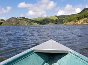
4.0Lake Del Valle is a reservoir located in Livermore, California. The lake has boat motor boats, pedal boats, patio boats, canoes, and row boats available for rent. There is a dock and rental house in the marina.The lake is also a popular destination for picnics, barbecues, and camping. Parking fi...Read more -
Livermore, California
Hike to Murietta Falls
4.012 mi / 4175 ft gainGet ready for one of the toughest, lung busting hikes in the east bay with over 6-miles and 4,000ft of climbing in one direction. When you make it to the hike, it's also important to realize that without recent rain, there many not actually be a waterfall. With that said, you're still getting in ...Read more -
Inverness, California
Hike the Estero Trail
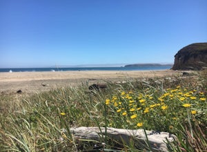
5.08 mi / 200 ft gainJune sunshine blazes on your shoulders during this scenic stroll through the Point Reyes Seashore. The trail is alive and awash with colorful wildflowers around every corner.Beginning at the trailhead, just off Home Ranch Road, with a convenient parking lot and bathroom, you'll wade through a hal...Read more -
Los Altos, California
Hike the Monte Bello Open Space Preserve Loop
4.52.9 mi / 600 ft gainThis hike is best done in the late fall, winter, and spring so that the creek is running and the hills are green. Starting at the preserve parking lot, the first half of the hike is predominantly downhill. At the main trailhead, start in the direction of the Stevens Creek Nature Trail, as told by...Read more -
Los Altos, California
Hike to Black Mountain and Stevens Creek Canyon
4.06 mi / 950 ft gainThis hike can be done during any season, but for the creek to be running and for more comfortable temperatures, it is best to go on a cool winter or spring day. Starting at the preserve parking lot, take the Stevens Creek nature trail, allowing you to witness spectacular views of a large, foreste...Read more -
Santa Rosa, California
Hike Crane Creek Regional Park
4.03.5 miWith multiple loops of varying length, this park is great for anyone looking for a casual hike around a beautiful area in the foothills of Rohnert Park. Crane Creek has nice secluded picnic areas next to the creek in the cover of willow, alder, buckeye and bay trees. There's also an 18-hole disc ...Read more -
Point Reyes Station, California
Drake's Beach, Pt. Reyes
5.0Named after the famed explorer, Sir Francis Drake, Drakes Beach is part of the scenic Point Reyes National Seashore. If you're looking to spend a day and an evening at the beach, grab some snacks and some firewood and head out to Drakes Beach. Key things to remember with the bonfire: Build th...Read more -
Rancho San Antonio Open Space Preserve, California
Hike Deer Hollow Farm Trail
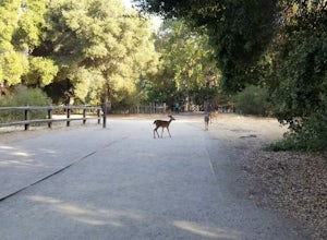
4.02.7 mi / 259 ft gainRancho San Antonio Open Space Preserve has many beginner to intermediate hiking trails. Deer Hollow Farm Trail Loop is a hiking trail for beginners, families, or anyone wanting to go on a short hike with nice views of the bay. The trail passes by a farm and deer can often be seen wandering aroun...Read more -
Half Moon Bay, California
Stroll along the Southern Beaches at San Gregorio State Beach
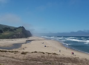
4.02.9 mi / 413 ft gainNot a trail per se, but approximately 3 miles (down and back) of beautiful beach to walk down. Lots of interesting caves, wild animals, and rock formations to discover. This is a popular location for sea kayakers. San Gregorio State Beach was originally founded to protect the estuary at the back ...Read more

