Badger, California
Looking for the best hiking in Badger? We've got you covered with the top trails, trips, hiking, backpacking, camping and more around Badger. The detailed guides, photos, and reviews are all submitted by the Outbound community.
Top Hiking Spots in and near Badger
-
Independence, California
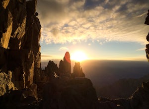
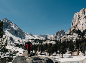
Onion Valley to Mt. Whitney
47.35 mi / 11745 ft gainTrip Guide ***Please note, all images after the first one are arranged in chronological order of the trip so you can easily follow along Day 1 Depending on where you are coming from your day one is most likely going to be setting up your car shuttle from Whitney Portal to Onion Valley. Our fi...Read more -
Independence, California
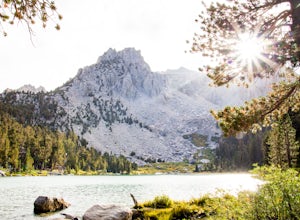
Flower Lake from Onion Valley
5.04 mi / 1352 ft gainMake sure to obtain an overnight permit up to 6 months in advance. You will have to pick up your permit at one of the Inyo National Forest Visitor Centers (here) before you begin. Once you have your permit in hand, drive to the Onion Valley Trailhead (see map), which is about 15 miles west of th...Read more -
Shaver Lake, California
Balsam Forebay
4.01.05 mi / 62 ft gainAccess to the forebay starts at the trail head from the parking lot 6,700 ft up, also from the parking lot there is access to two different sets of boulder patches separate from the ones encountered along the hike in. Hike Start the 1 mile out and back hike from the parking lot following the t...Read more -
Seven Pines, California
Mt. Williamson via Shepherd Pass
5.026.66 mi / 10653 ft gainThis trail starts at the lowest, and generally regarded hardest, trailhead in the Southern Sierras. You quickly gain elevation in what many describe as manageable but relentless. The first section of the hike has nice shade and adequate water access. Very enjoyable company to boot! Once you cros...Read more -
Inyo County, California
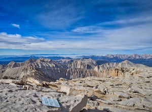
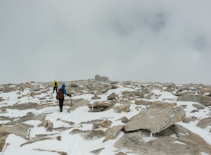
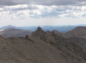
Summit of Mt. Whitney
5.020.85 mi / 6100 ft gainMt. Whitney is the highest peak in the contiguous United States. It stands over 14,500ft high at its peak (elevation gain of 6100') and it sure feels like it when you are up there. Getting There Located just West of Lone Pine, CA you take Whitney Portal Road West for 13 miles all the way to its...Read more -
Inyo County, California
Lone Pine Lake via Mount Whitney Trail
5.05.88 mi / 1883 ft gainFrom the parking lot at the end of Whitney Portal Road, look for the trailhead, which is marked with a wooden "gate" that shows the map and description of the trail. Starting out at 8,350 ft in elevation, the trail begins a series of switchbacks that lead you into the Sierra Nevada. Take more br...Read more -
Inyo County, California
Summit Mount Whitney via the Mountaineers Route
5.05 mi / 6600 ft gainWith over 6,600 feet of elevation gain and class 4 climbing, this is not for the casual hiker, but can provide an excellent challenge to a budding mountaineer.Park your car at Whitney Portal, 12 miles west of the town of Lone Pine, and start up the main Whitney Trail. After 1 mile you will encou...Read more -
Inyo County, California
Scramble up Mt. Muir
5.018.5 mi / 6200 ft gainFrom the Whitney Trail - beyond trail crest - you will see a big cairn (right side). If you make it to the first "window of Mt. Whitney" you have gone too far. The cairn marks the start of an class 2 use trail up to the Mt. Muir headwall.The headwall is a fun climb with good handholds and has lit...Read more -
Inyo County, California
Winter Summit Mt. Whitney
22 mi / 6500 ft gainDay 1: We arrived at the Lone Pine Visitors Center at the intersection of HWY 395 and HWY 136 just south of Lone Pine, CA. We issued ourselves our overnight permits to climb Mt. Whitney and picked up our Wag Bags. You can self issue yourself the free permit Nov. 2 through Apr 30. Climbing during ...Read more -
Inyo County, California
Meysan Lakes Trail
9.23 mi / 3724 ft gainMeysan Lakes Trail is located on the ever popular Whitney Portal Road. Park on the side of the road next to the Whitney Portal Campground. Start the hike by cutting through the campground, and passing some seasonal cabin style residences. Follow the Meysan Lakes Trail signs. The trail cuts throu...Read more -
Lakeshore, California
Hike to George Lake
9.2 mi / 1050 ft gainThe hike to George Lake starts out about 4 miles after you turn off 168 onto Kaiser Pass Rd. You'll want to park at the parking lot right before Badger Flat Campground. The parking lot is easy to notice and it is located on the right hand side of the road, two pit toilets and bear lockers are loc...Read more -
Bishop, California
Evolution Basin via South Lake
35.66 mi / 7769 ft gainIt’s been called the crown jewel of the Sierra Nevada, the highlight of the entire 211-mile John Muir Trail. Whatever superlatives are used to describe it, Evolution Basin is undoubtedly one of the most incredible landscapes you’ll ever explore. There is a small catch, though: There is no easy ...Read more -
Bishop, California
Bishop Pass Trail
5.011.13 mi / 2165 ft gainTo get to the hike drive twenty miles west from the town of Bishop, California up Hwy 168 to South Lake. There are two parking lots but make sure to get there early because later in the day it's harder to get a spot. The trail starts from South Lake at an an elevation of 9,750 feet. Initially ...Read more -
Bishop, California
Treasure Lakes Trail
5.05.79 mi / 1375 ft gainThe Treasure Lakes Trail is dog and kid friendly, just make sure all parties can handle the elevation gain. The scenery throughout the entire hike is amazing, and early in the summer, the creeks roar. The lake is perfect for cooling off on a hot summer day. The trail is best used in the summer an...Read more -
Bishop, California
Bishop Pass Trail to John Muir Trail to Piute Trail
52.67 mi / 9173 ft gainBishop Pass Trail to John Muir Trail to Piute Trail is a point-to-point trail that takes you by a lake located near Bishop, California.Read more -
Lakeshore, California
Evolution Valley via Florence Lake
4.530.36 mi / 3238 ft gainYou can get to the Evolution Basin a variety of ways, but the easiest is through the Florence Lake Trailhead. Here, you can choose to either take the Florence Lake Ferry across the lake, or save $25 and hike the extra 4 miles around the lake. Personally, I would choose the ferry. About five mile...Read more

