Apple Valley, California
Apple Valley, California, is a prime location for the best trails and outdoor activities. One of the top trails is the Mojave Riverwalk, which offers scenic views of the Mojave River and its surrounding landscapes. This trail is moderately difficult, making it suitable for most hikers. Another must-visit trail is the Victor Valley Museum trail, where you can spot various unique rock formations and native plants. If you're into water activities, the Jess Ranch Lakes are perfect for fishing. For those who prefer bird watching or wildlife photography, the Apple Valley Bird Sanctuary is a great spot. Near Apple Valley, you'll find the Deep Creek Hot Springs, a natural hot spring that's a popular attraction. For a mix of history and outdoor adventures, the Calico Ghost Town and its surrounding trails are worth exploring.
Top Spots in and near Apple Valley
-
San Bernardino County, California
Off-Road Jacoby Canyon
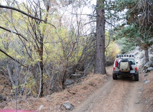
2.9 miThis is now my favorite trail in the San Bernardino National Forest. Ranging from desert scenes at the bottom and pine trees at the top, you experience such high levels of outdoors feel you can't resist. This trail has so many awesome spots for camping and off-roading that it has a great mix for ...Read more -
Lytle Creek, California
Old CC Spur Trail via Big Tree Cucamonga Rd
5.11 mi / 1138 ft gainOld CC Spur Trail via Big Tree Cucamonga Rd is an out-and-back trail that takes you by a waterfall located near Fontana, California.Read more -
Forest Falls, California
Summit Mt. San Bernardino from Angelus Oaks
16 mi / 4775 ft gainThe trailhead is somewhat 'interesting' to get to given the dirt roads are in questionable shape and some of the roads in Angelus Oaks are not easily identifiable but I didn't have any problems finding it by closely following Google Maps. Trailhead parking requires an Adventure Pass parking pe...Read more -
Angelus Oaks, California
San Bernardino Peak
3.015.82 mi / 4911 ft gainThe San Bernadino Peak Trail out of Angelus Oaks is a very challenging hike, which can either be done as a day hike or an overnight trip. Free permits are required for day hiking and overnights in the San Gorgonio Wilderness. These permits can be accessed via Sgwa.org/permits. If you choose to ...Read more -
Angelus Oaks, California
Jenks Lake
4.00.77 mi / 49 ft gainIf you want to experience beauty and solitude in SoCal look no further than Jenks Lake. Not too far from Big Bear Lake, but secluded enough to keep most away in the winter, Jenks Lake is a small but lovely alpine lake near HWY 38 in Angelus Oaks. Driving to the lake is beautiful in itself as HWY...Read more -
Angelus Oaks, California
South Fork to Dollar Lake Trail
11.3 mi / 449 ft gainSouth Fork to Dollar Lake Trail is an out-and-back trail that takes you by a lake located near Banning, California.Read more -
Llano, California
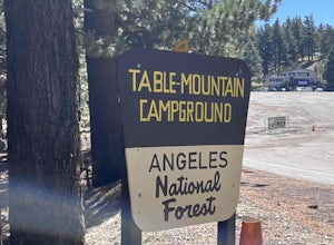
Table Mountain Campground
Table Mountain Campground is a hilly campground that offers ADA-accessible sites, pit toilets, fire rings, picnic tables, BB! grill, water, and parking spaces for a two-car limit. Rules are strictly enforced, which is great, so we can enjoy nature and not someone’s party/music. Book your campgro...Read more -
Mount Baldy, California
Mt. San Antonio (Mt. Baldy) via the Ski Hut Trail
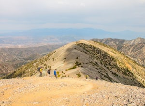
5.09.7 mi / 3990 ft gainMt. San Antonio, or Mt. Baldy as it is known locally, is one of the cans of the challenging "six-pack of peaks" in Southern California. For this one, start before the Manker campground and head up the fire road. This is known as the "Baldy Bowl or Ski-Hut Trail". You'll see some cabins on your l...Read more -
Wrightwood, California
Snow Hike Lightning Ridge
5.1 mi / 900 ft gainWhen you hear the report about snow in the San Gabriels, it's time to plan this hike!Only a short 90 minute drive is all that separates nearly a third of California's population from high-altitude snowy adventures. This isn't about Yosemite, but Southern California's very own San Gabriel Mountain...Read more -
Mount Baldy, California
Cucamonga Peak via Icehouse Canyon
4.611.13 mi / 4157 ft gainStart hiking early, before the sun rises so you can maximize the day out of the heat and to give yourself plenty of time for the hike. As you get to higher elevations, it will be a little cooler and there might be snow on the ground, so be sure to pack layers. This hike requires a permit. If yo...Read more -
Mount Baldy, California
Icehouse Saddle via Icehouse Canyon Trail
3.86.62 mi / 2562 ft gainThe hike is accessible in all seasons, but in winter there can be snow and ice so special equipment may be useful, but not required. In mid-January there were patches of ice on the trail but were easily crossed in boots and trainers. You can take the trail and end at Ice house Saddle or continue ...Read more -
Mount Baldy, California
Ontario Peak and Cucamonga Peak via Icehouse Canyon Trailhead
16.22 mi / 5610 ft gainWe started out at 8am on a Sunday, usually parking at Ice House Saddle can be tricky, I would advise going earlier. We headed out on our journey hiking up to the saddle, when you reach the switchbacks there is a fresh water spring, it's the last place you can get water...so stock up! We pressed o...Read more -
Mount Baldy, California
Cedar Glen Camp
4.88 mi / 1650 ft gainCedar Glen Camp is a great beginner backpacking trip just outside of Los Angeles, California. Starting from the Icehouse Trailhead (also used for Cucamonga Peak), head out on the Icehouse Canyon Trail from the parking area. The trail will intersect with the Chapman Trail, at which point, you'll t...Read more -
Valyermo, California
Blue Ridge Trail via Inspiration Point
4.97 mi / 692 ft gainThere are two trail heads for the Blue Ridge Trail, one via the Grassy Hollow Visitor Center, and the other across from Inspiration Point. When parking gets crowded over at Grassy Hollow Visitor Center, than parking at Inspiration Point is the better option. To access the Blue Ridge Trail from In...Read more -
Redlands, California
Run the Carriage Trail
3.52.5 mi / 300 ft gainThere is room to park just off San Timoteo Road. On the other side of the trail is more parking off Alessandro. You can park your car on either side and start your run/walk/bike ride. This is a nice little "get away" trail to take a break from suburbia.Read more -
Mount Baldy, California
Summit Mt. Baldy
4.812.12 mi / 5958 ft gainLocated only an hour’s drive from Los Angeles is the top of highest mountain in LA County—at 10,064 feet. Bear Flat Trail (also called the Old Mt. Baldy Trail) offers some of the finest scenery and most rewarding views in the San Gabriel Mountains high country. With nearly 6000 ft of elevation g...Read more

