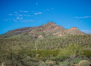
Fountain Hills, Arizona
Looking for the best photography in Fountain Hills? We've got you covered with the top trails, trips, hiking, backpacking, camping and more around Fountain Hills. The detailed guides, photos, and reviews are all submitted by the Outbound community.
Top Photography Spots in and near Fountain Hills
-
Tempe, Arizona
Catch a Sunset from Tempe Town Lake and the Mill Avenue Bridge
4.5Last year I went to Phoenix for a few days for work. I googled lots of places to shoot pictures around Phoenix, but the majority of them were in neighboring areas, and I only had an hour or two after work and couldn't drive an hour to a better photography spot. One place that kept coming up was...Read more -
Phoenix, Arizona
Mojave Connector Trail #202
2.18 mi / 820 ft gainThe best starting point to access this hike is parking at the Mojave Picnic Area and heading up the Mojave Trail #200. At .4 miles, you will hit the junction and stating point for the Mojave Connector Trail. Head left at the saddle and begin a rapid ascent up switchbacks to a small flattened summ...Read more -
Apache Junction, Arizona
White Rock Springs Camp Loop via First Water Trailhead
4.724.18 mi / 3635 ft gainThe Superstition Wilderness is a stunning 160,200 acre area outside Apache Junction, AZ, with over 170 miles of (variously maintained) trail networks. There are any number of trips you can design to fit your time and skill level. This adventure offers a three day/ two night backpacking trip cover...Read more -
Apache Junction, Arizona
Hike the Dutchman's Second Canyon Loop
5.016 miTo get to the trail head, drive past Lost Dutchman State Park on the 88 and then take the dirt road (on your right) with arrows leading you to First Water Trail Head. There is an outhouse at the trailhead, so I suggest visiting it before you begin this hike. I also started this hike about an ho...Read more -
Apache Junction, Arizona
Hike Black Mesa Loop
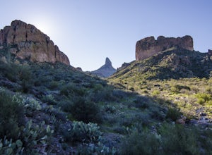
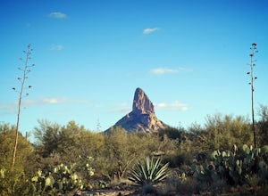
4.59 miFrom First Water Trailhead, a short walk east brings you to the junction of the Dutchman trail and the Second Water trail. If you follow the Dutchman trail to the right you'll be heading southeast for a while, catching glimpses of Weaver's Needle in the distance. You can complete the loop going...Read more -
Phoenix, Arizona
Freedom Trail Loop
5.03.8 mi / 1093 ft gainAs the third longest trail in the Phoenix Mountain Preserve, the Freedom Trail provides a great option for those looking for a longer hike, which can also be made even a bit longer by bolting on the Piestewa Summit hike along the way (adds 1.2 miles additional and a view from the top!). Many look...Read more -
Phoenix, Arizona
Piestewa Peak Summit
4.42.25 mi / 1050 ft gainPiestewa Peak, formerly known as Squaw Peak and conveniently located in the heart of the Phoenix metropolitan area, is a relatively short hike that yields impressive views of the city and is a perfect spot to watch the sunset. Piestewa Peak is a popular spot for locals who do not want to drive or...Read more -
Apache Junction, Arizona
Monument Canyon and Broadway Cave
3.63.69 mi / 866 ft gain...Who doesn't enjoy a short adventure to an scenic location?! If I were to guess, I'd say a good majority of us. This four mile, low trafficked hike to the Broadway Cave will lead you to one of the best spots to hang out or watch the sunset. The Broadway trailhead is located by taking Highway 60...Read more -
Phoenix, Arizona
North Mountain Trail
4.71.42 mi / 571 ft gainBeginning from the start of the trail on 7th Street, this short hike can be a good quick workout that offers great views of the greater Phoenix area. Be aware that this hike is a fairly steep climb 600 feet to the top. Once you reach the summit of North Mountain you'll find great views of the...Read more -
Phoenix, Arizona
Apache Wash Loop Trail
5.79 mi / 541 ft gainThis hike begins at the Apache Wash Trailhead where you will find restrooms and a covered rest area. This loop is simple to follow and offers various shortcuts along with an access to an optional summit climb. The loop begins from the north-east end of the parking lot near the restrooms. Turn l...Read more -
Cave Creek, Arizona
Hike the Go John Trail
5.05.6 mi / 804 ft gainAs you park at the trailhead, you have the option to take this trail in either direction. I recommend that you travel north, which will immediately provide 0.75 miles of elevation gain. You will then reach a pass with panoramic views of the Tonto National Forest. A bench in this area provides the...Read more -
Tonto Basin, Arizona
Hike to Brown's Peak
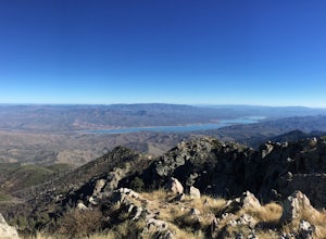
5.06 mi / 1957 ft gainStarting at the trailhead you will begin hiking through oak trees and forest. At numerous times throughout the hike Roosevelt Lake can be seen to the northwest. Approximately 3 miles into your hike you will reach a small campsite in the saddle of the mountain. This is your turnaround point if you...Read more -
Gold Canyon, Arizona
Hieroglyphic Trail
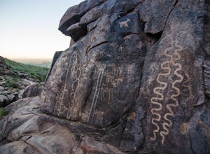
5.02.9 mi / 614 ft gainThis hike is a great beginner hike for those who want to experience the beauty of the Superstitions. I suggest going early in the morning because this trail gets very crowded later in the day (especially on weekends). To get to the trailhead from US60, turn north onto Kings Ranch Road where you ...Read more -
Gold Canyon, Arizona
Peak 5057 via Hieroglyphic Trail
5.07.45 mi / 3045 ft gainTo get to the trailhead from US60, turn north onto Kings Ranch Road where you will begin the winding path through the neighborhoods. From Kings Ranch Road, turn east on Baseline Ave, north on Mohican Road, west on Valley View Drive, north on Whitetail Road, and east on Cloudview Ave until it com...Read more -
Phoenix, Arizona
Hike Marcos de Niza Ridgeline / National Loop
5.02.8 mi / 640 ft gainThis is somewhat of a hidden gem in South Mountain Park, the largest municipal park in the United States, even though it's right there for all to see. The best way to take advantage of this trail is to attack the ridgeline with an intense hiking pace or trail run, connecting it to the National Tr...Read more -
Cave Creek, Arizona
Elephant Mountain Fortress Hike
5.05.5 mi / 867 ft gainThis hike beings at Spur Cross Ranch in Cave Creek, which is a lush riparian area flowing with Saguaros. Starting at the trailhead, you will start this loop by hiking clockwise on Tortuga trail which will connect with the Elephant Mountain trail at 1.5 miles. As you start to ascend the Elephant M...Read more


