Leesburg, Alabama
Looking for the best hiking in Leesburg? We've got you covered with the top trails, trips, hiking, backpacking, camping and more around Leesburg. The detailed guides, photos, and reviews are all submitted by the Outbound community.
Top Hiking Spots in and near Leesburg
-
Rising Fawn, Georgia
Cloudland Canyon's Waterfall Trail
4.91.21 mi / 325 ft gainWhen you enter Cloudland Canyon State Park you will drive straight through all of the 4 way stops for about 1 mile before you reach the parking lot for the Waterfall Trail. The parking area does have restrooms and picnic tables if you would like to bring a lunch. What goes down must come up! I...Read more -
Rising Fawn, Georgia
Cloudland Rim Loop via East Rim Campground
4.66 mi / 873 ft gainCloudland Rim Loop via East Rim Campground is a loop trail in Cloudland Canyon State park, which offers up stunning vistas and several waterfalls. This trail is located near Rising Fawn, Georgia.Read more -
Rising Fawn, Georgia
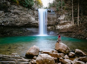
Hike the West Rim Trail to Cherokee Falls
4.54.77 mi / 814 ft gainGood luck finding something you dislike about Cloudland Canyon State Park - one of Georgia's largest and most scenic parks. Sitting on the western edge of Lookout Mountain, it is home to a plethora of luscious trails, easily-accessible campgrounds or yurts, and flowing waterfalls. The West Rim L...Read more -
Delta, Alabama
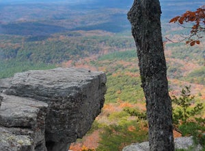
Hike to Pulpit Rock
5.02 mi / 100 ft gainAtop a rocky perch on the side of Mt. Cheaha (the highest point in Alabama), you'll have a breathtaking view and ample opportunities for photography. The trail to Pulpit Rock in Cheaha State Park, near Anniston, AL is a mere mile. The terrain is not too challenging, but it is a bit steep on the w...Read more -
LaFayette, Georgia
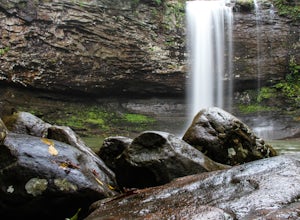
Hike to Keown Falls
1.8 mi / 450 ft gainKeown Falls Trail is a moderate loop perfect for a Spring day (especially after those April showers). The trailhead is located in the Keown Falls picnic area which is very spacious spotted with several picnic tables. This would be a great place for a family gathering and is spacious enough that ...Read more -
Delta, Alabama
McDill Point via Cheaha Trailhead
4.66.78 mi / 1024 ft gainStart hiking at Cheaha Trailhead, located at the far end of a parking area just before you get to Cheaha State Park on Highway 281. Follow the Cave Creek Trail until you reach the Pinhoti connector, and hang a right to take the Pinhoti Trail northbound. Look for a sign that points to McDill overl...Read more -
Delta, Alabama
Cave Creek/Pinhoti Trail Loop
6.78 mi / 1024 ft gainThe Cave Creek Trail is a very comfortable, three-mile trail with some amazing views and relatively little elevation gain. At roughly two miles along the trail, you’ll come to a rocky overlook facing the south. This area provides a nice place to stop and rest or even eat a nice picnic lunch. Roug...Read more

