8 Best places to hike near Minneapolis

Minneapolis is an outdoorsy city with tree-lined trails winding through forests and along lakes. There are paved pathways perfect for strollers and wheelchairs, and gravel trails ready for hiking boots and puppy paws. Grab your camera before heading out to these 8 hikes near Minneapolis!
1. Minnehaha Falls Loop

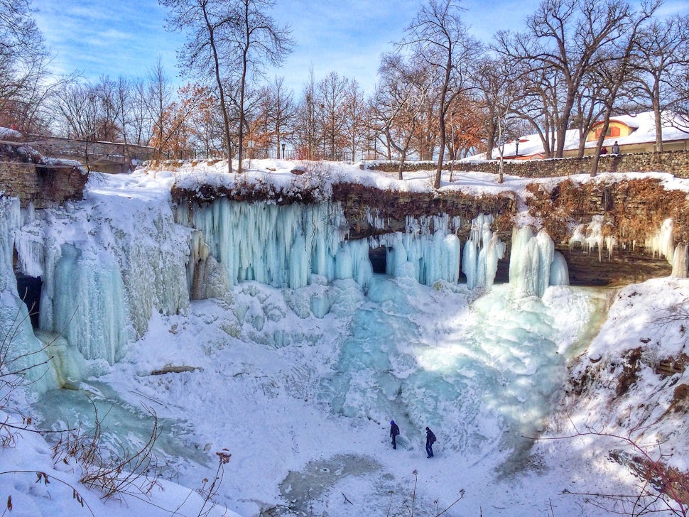
Drive five minutes from downtown Minneapolis to Minnehaha Falls. Located in Minnehaha Regional Park, one of the state’s oldest public recreation areas, this 53-foot waterfall is a site to behold in all seasons!
Stroll the 0.73-mile walking path that loops around the falls and through the park. Summer and fall are the busiest times, but it’s a beautiful hike when there’s snow and the water is frozen into cascading ice towers!
2. Lake Nokomis Trail

Need a hike that your whole family can enjoy? Grab your stroller and head to the Lake Nokomis Trail! This 2.5-mile walk is paved, making it wheelchair and stroller-accessible.
Expect to share the path with walkers, runners, skaters, and bikers. The route winds along the edge of beautiful Lake Nokomis, and can get windy in the wide open areas! In the summer, wear a bathing suit and take a dip at one of the two beaches!
3. Lake Harriet Loop

Lake Harriet is one of the local favorite spots to cool off in the summer and stroll year-round. The three-mile loop passes two beaches and a rose garden!
Bring your family to hike (or bike, rollerblade, scoot, skate!) this nearly flat trail. Lake Harriet is especially gorgeous during the fall, thanks to the changing leaves! Bird watch from March to October, or watch for blooming wildflowers all summer.
4. Lake Como Loop Trail

This 1.71-mile loop follows the shores of Lake Como and has two lanes - one for each direction. With just 33 feet of elevation gain, you’re not likely to break a sweat unless it’s a humid summer day or you’re really cruising!
Expect heavy traffic here during even the coldest months - Minnesotans are a hardy bunch and the trails are plowed in the winter! People love the summer wildflowers along the trail, and that they can bring leashed pups anytime.
5. Pike Island Loop

Looking for a slightly longer hike? Try the four-mile Pike Island Loop! This beloved trail is in Fort Snelling State Park, a National Historic Landmark. The area is well-known for stunning bluffs overlooking where the Mississippi and Minnesota rivers meet.
Dakota Tribe members who once resided in the area referred to it as the heart of the earth because of this unique confluence. If you start hiking and realize you don’t want to do the full trail, there are shortcuts across the middle so you can cut down on mileage. Watch the skies for bald eagles and scan the edge of the river for beavers!
6. Nicollet and Boom Islands

This easy hike in Northeast Minneapolis is 2.1-miles-long and features two islands connected via pedestrian bridges. The river views are beautiful no matter the season!
Visit in the summertime for free yoga classes on Boom Island! The island is named for barriers placed in the water to separate logs running the Mississippi River on powerful currents from St. Anthony Falls!
7. Mississippi River Flats

This partially paved 2.5-mile loop trail has a gradual incline starting at Franklin Bridge. On the flats, you'll pass the Weisman Art Museum while meandering the University of Minnesota Campus. Then, the trail wanders across the Mighty Mississippi on an elevated walkway!
During the summer, you may pass live music at the concert hall, and spot neat vessels at the U of M boathouse. Stoked on frisbee? Stop at East River Flats Park for a game of toss and a picnic.
8. Winchell Trail

Not a fan of sharing a walking trail with a bike path? Take this 5-mile walking-only route along the West bank of the Mississippi. It starts at 44th street and goes to Franklin Avenue. Walk out and back to get the full five miles, or go one way for a shortened trek.
You'll pass a beautiful white beach while strolling past the famous Minnesota bluffs. Take in the oak savanna restoration project at the end of East 36th Street. Here, oak trees are surrounded by prairie grasses and clovers.
Other than the restoration area, the trail is mostly shaded by towering trees, so it's a great spot to cool off in the summer! River views are more accessible in the winter when the trees have dropped their leaves.
Feature image by Dan Mirocha.
We want to acknowledge and thank the past, present, and future generations of all Native Nations and Indigenous Peoples whose ancestral lands we travel, explore, and play on. Always practice Leave No Trace ethics on your adventures and follow local regulations. Please explore responsibly!
Do you love the outdoors?
Yep, us too. That's why we send you the best local adventures, stories, and expert advice, right to your inbox.


