
The Profile Trail at Grandfather Mountain State Park
The Profile Trail at Grandfather Mountain State Park is challenging in ways that you will take with you forever. Read on to learn of my adventures here.
As you prepare yourself to hike into a place like Grandfather Mountain it's always best to read up and learn everything you can. I should add that this is the case for ALL parks you are planning to visit, but I really mean it for this one.
State Park Website: https://www.ncparks.gov/grandfather-mountain-state-park
For starters, Grandfather Mountain State Park is a completely separate entity from the "attraction" park most known for the mile high swinging bridge. That's the first and most important thing to know before coming, as parking is not allowed in the swinging bridge lot after dark, and it also costs $20/person to enter.
Attraction Website: https://grandfather.com/
The state park is free and camping is currently free, but not for much longer, so it's good to utilize that free thing while it's here.
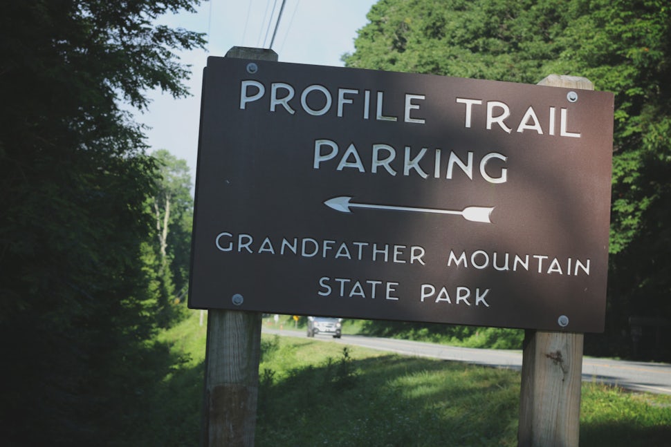
 As you can see in the sign above, that's the famous Profile Trail (3.10M). This trail is known for kicking people's ass. Why? Not only rated strenuous in difficulty, it's an ascent of 1,775 feet, includes a rock scramble that requires strength and coordination, and is a straight uphill hike for most of the 3.10 miles.
Oh and that's just the beginning. Here's our journey...


After getting up at 5am and making the 2-ish hour drive from Winston Salem into Banner Elk, NC we arrived at the Park Office on Hwy 105 around 8am on a sunny Saturday morning.
Backpacks packed to the brim full of food and gear, we were ready to hike this beast and camp for the night. The Ranger suggested NOT to hike the Profile Trail with packs (we don't listen), but if we did, that we should drop our stuff at camp before heading onto the Grandfather Trail as it is more technical and would be easier without a 40 pound pack. We agreed, got our stamps, and moved onward to the Profile Trail parking lot located just a few miles down the road.


To hike ANY of the Grandfather Mountain trails, you MUST have a permit on you. We saw a couple of Rangers coming in on the trail when we were leaving so yes, they do hike the trails and check for these. Just fill it out and slide it in the box. If camping, there is a reservation board to write your dates on so people know if a certain campsite is taken.
Our plan was to hike up the Profile Trail, head left onto the Daniel Boone Scout Trail (3.0M), set up camp at Briar Patch, and then head back across the Daniel Boone and hit the Grandfather Trail (2.4M). A day full of adventure was awaiting us, and at 8:30am we filled out our Permit, picked our campsite, and hit the trail.

The first part of the trail is very scenic, with the Watauga River running alongside, plenty of canopy, and beautiful ferns (for you, Mom). Once across the river it starts getting slightly steeper.


Once to the Foscoe Viewpoint (pictured above), the clouds started rolling in. It's a great idea to grab a little snack here and hydrate, because just after this stopping point is where a couple of ladies that had been trailing alongside us started heading back and bid us farewell stating "it gets bad up there". I laugh at that statement looking back now because truthfully, what in the world was I thinking bringing a 6-pack of eggs, tortillas, steak, bacon, cheese, oranges, trail mix, beef jerky, oreos, cheese-its, guacamole, and I mean I can keep going...
The next stop was the Profile View that wasn't much of a view because the clouds were getting worse. The weather had been calling for an 80% downpour to last throughout the night, but we stayed positive about that. There is a campsite right before the lookout, so if you wanted an easy spot to stay, that's it. Spotting many things like slugs, orange lizards, birds, and all kinds of weird looking bugs, it was very beautiful, but again, getting noticeably steeper as we kept going.


About 2.7 miles in, we arrived at Shanty Spring. Your possible last water source for miles, so we took a nice break here. Coming out of a small pipe from the high rock above, the water was cold and refreshing. Rhododendron filled the ground and the air was crisp, but comfortable.


 As we filled our water bottles up, and grabbed a quick snack, we were off again to hit the last 0.4 miles of the Profile Trail.
 As I looked at the path ahead, a couple of older gentlemen came hiking up behind us. Taking a break to catch their breaths, we passed them and headed up the huge rock scramble that was now the trail.


 Slippery and steep, all I can say is the trail at this point is not for people with knee issues. Stopping for a breath about every minute, the older gentlemen caught up with us and we continued up alongside them for most of the way. This is the part of the trail where pets aren't recommended, and I haven't even mentioned this yet: our girl Caroline wasn't with us. Although other people brought dogs, they stated once to some of the ladders and ropes, it was not suitable for them and you will see why.
As we continued along this rock hell, we at some point surpassed Mile 3.

 It got a little easier, and the cool breeze coming in felt amazing. I seriously wasn't even in my own body at this point, as I'm not quite sure how I made it 3 miles up this trail with a 30+ pound pack on my back. It's amazing what your body can do when you ditch your mind and go on autopilot, push yourself beyond your limit, and just breathe. It took about an hour for each mile on the Profile Trail. It took us, experienced hikers, a mile an hour. It's not for beginners and can be comparable to The Grand Canyon of the East.
We made it.
 If I had a beer, it would have been celebratory as we approached the sign pictured above. My body ached as we turned left and headed towards Calloway Peak. But on the way there, a little stop off to the left happened as we noticed a plane in the woods.


Never knowing this even existed, I did a little research and didn't find very much. The below article states it happened in 1978 in white out conditions, with the pilot being the only one on-board, and the only fatality as well. A very interesting sight to see as the remains of the plane have been left right where they landed.
Article: http://imgur.com/a/fYJug
We continued on and arrived at the Watauga View. There were a good amount of people here sitting and checking the wonderful view out as the clouds would clear every so often and provide something to see. You are riding the ridge-line of a mountain at this point, as Watauga View is really just a rock off the trail. Caution should be used as any amount of accident could cost a life.
We didn't stay here very long -- just enough to indulge in a few conversations with the others, and then we were off to hit our first ladder.
 The first ladder was a breeze, yet prepared me for the upcoming ones as they get worse going along coming in from this side of the Daniel Boone Scout Trail. The next viewpoint was Calloway Peak and is known for being the highest point in the Blue Ridge Range with a height of 5,946 feet. If felt high, but the view was obstructed as the clouds were getting worse and it had even started to drizzle. About 1pm now, we started to wonder if the weather was going to cooperate.
 Continuing onto the next ladder, this one included a little bit of a rock climb first, so that you can get atop the rock, and onto the ladder that brings you atop another rock. Easy to fall off for sure, I now understand the Ranger's advice with carrying our packs this way.

 *This picture obtained from random Grandfather Mountain web search, not mine.*
Sitting high in the sky, we hit 3 more ladders after this. Getting bigger and taller as we approached each one, I was scared as some of them are steep and I found myself holding on for dear life and taking deep breaths. I don't typically have a height issue, but I was more or less worried that because of the extra weight (those damn eggs) that I was going to just fall off...


*This picture obtained from random Grandfather Mountain web search, not mine.*
There are cables to aid in some of the steep hills going through the Daniel Boone Trail, and the trail is very narrow and rocky.
 Actually, I'm quite certain that the trail is really a river path. At about 1:30pm, the bottom of the sky fell out and we were walking in the pouring rain on a trail, but it was really a river. We were two campsites away from Briar Patch, but just so happened to be coming up on the Hi-Balsm Shelter Campsite (the only shelter campsite here). We immediately ran inside and took cover.


A little "cabin" in the woods, we sat here for a bit and ate our MRE Chili Mac & Cheese. Contemplating our next move, we decided to set up camp here. Pitching the tent inside the shelter was interesting, but it provided a clean space for us to lay down and grab a snooze.


After our nap, we attempted to head back out and finish the Daniel Boone trail and catch a glimpse of the Viaduct View. So close, but unfortunately it didn't happen as the "river Daniel Boone trail" was flooding and the rain had started back up again. Pouring. An absolute mess.

 Back inside now, we began to break apart our packs and empty out the contents of the food that we had somehow carried this far. THE EGGS DIDN'T BREAK. It's a miracle. The bacon was still cold, the tortillas were in perfect form. I rule, and, I wasn't going hungry in this monsoon that's for sure.


 The goal was to eat everything so we didn't have to carry it out the next day and I think we succeeded as I endured the best food coma of my life. We spent about 12 hours in the Hi-Balsm Shelter and the next morning, I was ready to leave. Not a drop in sight we packed up our things, and headed back down the Daniel Boone Scout Trail, and down the Profile Trail to our car.
I'm very thankful we arrived at the shelter just in time and were protected from the rain as this sleepover in Grandfather Mountain could have been a lot worse. I hate that we missed the trails, and my goal is to get back when the weather is right. Overall, I have to feel accomplished because we were the only ones with packs and we made it so far, and through some serious obstacles. I knew I could do it all along, it's just a matter of getting that mentality in check.
In the following week after our hike, my body was sore for almost 4 days straight. Thank you for the challenge Grandfather Mountain, I'll be back to destroy you another day. After-all, he was only preparing me for something bigger and greater...so stay tuned. <3

A map to show you what on earth I was talking about? RIGHT HERE
We want to acknowledge and thank the past, present, and future generations of all Native Nations and Indigenous Peoples whose ancestral lands we travel, explore, and play on. Always practice Leave No Trace ethics on your adventures and follow local regulations. Please explore responsibly!
Do you love the outdoors?
Yep, us too. That's why we send you the best local adventures, stories, and expert advice, right to your inbox.


