New Zealand
Looking for the best photography in New Zealand? We've got you covered with the top trails, trips, hiking, backpacking, camping and more around New Zealand. The detailed guides, photos, and reviews are all submitted by the Outbound community.
Top Photography Spots in and near New Zealand
-
Fiordland National Park, New Zealand
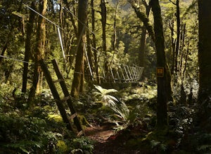
Backpack the Dusky Track
52.2 mi / 4265.1 ft gainThe Dusky Track is a tough and extraordinarily beautiful multi-day hike in central Fiordland. The trail is a one-way hike, with both the northern and southern terminal usually being accessed by boat. The southern terminal is situated on the northern shore of the large and deep Lake Hauroko. The ...Read more -
Fox River, New Zealand
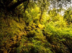
Hike to the Fox River Caves
4.6 mi / 492.1 ft gainThere are a few different options while exploring this track. The first is making your way all the way to the entrance of the caves. The second is making your way to where the trail splits, one way heading up towards the cave, and the other abruptly ends at a big river crossing. The third is to m...Read more -
Abel Tasman National Park, New Zealand
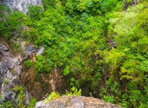
Hike to Harwood Hole
5.01.9 miGetting to this hike is a bit of a drive. It is 11km off of HWY 60, just north of Motueka. The road is unsealed, and quite narrow at points. If there is another car coming the other direction, be prepared for a tight squeeze. The road climbs up Tanaka Hill, and the descends down towards Canaan Ca...Read more -
Milford Sound, New Zealand
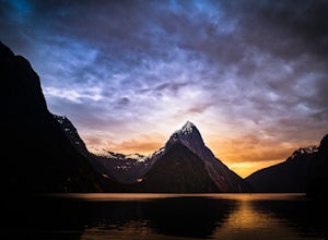
Overnight Cruise the Milford Sound
5.0If you are ever visiting New Zealand's south island, I cannot implore you more to consider doing the overnight cruise of the Milford Sound via Real Journeys. For roughly $300, you board, in Queenstown, a custom designed Real Journeys tour bus that has seats slightly angled towards the windows as ...Read more -
Rotoroa, New Zealand
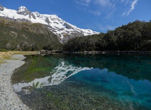
Backpack and Kayak to Blue Lake
5.031.1 mi / 1430.4 ft gainThis lake has the clearest visibility fresh water found anywhere in the world with visibility between the 70-80 meter range. And the Colours are beautiful! (We just ask that you do not swim in this lake or do your dish washing in it as it is a super fragile ecosystem, oh and the duck in the pictu...Read more -
Ashburton Lakes, New Zealand
Hike to the Summit of Mt Sunday
4.02.2 mi / 328.1 ft gainFrom the car park follow an old road track / stream bed until it narrows into a scenic walking track. Cross the swing bridge and ascend the south side of the mountain to its picturesque summit. Alpine views abound in all directions. It's easy to see why it was selected as a LOTR set location.This...Read more -
Glenorchy, New Zealand
Backpack the Magical Earnslaw Burn
8.7 mi / 1968.5 ft gainOnce you identify the parking area (Right turn off Glenorchy Paradise Road just before crossing the Earnslaw Burn, park a the bend in the road.) Cross the boggy meadow in a NW direction until you see the orange trail markers on trees.The trail below bush line is long, very rugged and covered with...Read more -
Mount Cook National Park, New Zealand
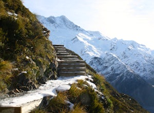
Hike to Muller Hut
6.2 mi / 5905.5 ft gainOne of the most spectacular hikes in New Zealand next to New Zealand's highest mountain - Mount Cook (aka Aoraki).5.2km one way, it is a tough ascent. The first part of the track ascends to Sealy tarns. This involves climbing zig zag stairs where you will be rewarded with a spectacular view over ...Read more -
Kaikoura Flat, New Zealand
Hike to the Summit of Mt. Fyffe
5.010.6 mi / 2952.8 ft gainFrom the car park follow the old road grade which eventually narrows into a hiking path. At about the halfway point you will pass the Mt. Fyffe hut, a popular overnight destination. Track continues ever upward in a north-easterly fashion until you arrive at the broad summit where views to east fa...Read more -
Picton, New Zealand
Hike The Snout Track
5.07.5 mi / 423.2 ft gainThis great track is located just outside of downtown Picton, offering very easy accessibility and a great place to get a little hike. Heading east out of Picton, turn left on Sussex road, and follow the steep hill up to the crest, keep driving until you come to a gate, this is the car park for Th...Read more -
Karekare, New Zealand
Explore Karekare Falls
0.2 mi / 98.4 ft gainA stunning horsetail waterfall that is only a short, uphill walk from the Karekare beach carpark (roughly 100m from carpark to track) in the Waitakere Ranges Regional Park. The waterfall is approximately 30m tall, casting a spray of clear fresh water down upon a cool swimming hole. The flow is s...Read more -
Bealey, New Zealand
Hike Lagoon Saddle
5 mi / 1200 ft gainRound trip about 5 hours including stops to enjoy the views and take pictures, it was a perfect day hike in the full sun compared to the rest of the park. The track starts out by heading uphill, and it doesn’t really stop until you get to the saddle. The first hour of the track is all through bee...Read more -
Greenstone, New Zealand
Hike to Lake Rere
The track begins from the Greenstone carpark. After walking for around 5 minutes, you will chose which direction you would like to complete the loop. For our hike we chose to go left over the swing bridge that crosses the river. After crossing the river you continue through open farm paddocks....Read more -
Evansdale, New Zealand
Backpack Silver Peaks Track
3.011.8 mi / 1400 ft gainThe trailhead is somewhat obscured on the side of the Mountain Track Rd - there is a sign that reads Silver Peaks Track. The rest of the trail is very well marked with orange posts and triangles.The trail starts with a gradual incline for 1.5 hours or so until you reach the top of a ridge line. F...Read more -
Moeraki, New Zealand
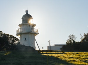
Explore Katiki Point Lighthouse
From the car park, the trail leads in two directions. Following the track to your left will take you down to a penguin hide overlooking the coast. Watch the rocky shoreline carefully as many of the large boulders are actually napping fur seals. From the hide, you can observe penguins going out to...Read more -
Tasman River, New Zealand
Climb Mt. Wakefield
4.03 mi / 4593.2 ft gainThe route begins on Tasman Valley Road right after it crosses over the Hooker River heading towards the Tasman Valley. Right after the bridge at Hooker corner there will be a small cutoff on the left side (as you head towards the Tasman). This gravel cutoff is where the trail starts up Mt. Wakefi...Read more

