Yellowstone Group Campground
Book this listing through our partner Recreation Gov
About Yellowstone Group Campground
Overview
Yellowstone Group Campground lies along its pretty namesake river on the southern slope of the Uinta Mountains, about 40 miles from Duchesne, Utah. Visitors come to the area to enjoy its extensive off-road trail system and great fishing opportunities.Recreation
The Yellowstone River offers fishing for rainbow, brown, brook and cutthroat trout.The Yellowstone ATV Trail System is conveniently close, with over 50 miles of trail on the Petty Mountain and Dry Gulch Loops. Hiking and biking are also allowed on these trails.
Facilities
The campground contains one group site with picnic tables and campfire rings. Forty people, four vehicles and four camp trailers/RV units can be accommodated. Vault toilets, drinking water and trash collection are provided. Roads and parking spurs are gravel. Several first come, first served single sites are available as well.Natural Features
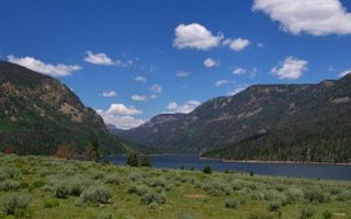
The campground sits on the banks of the Yellowstone River at an elevation of 7700 feet. A forest of aspen, maple and Ponderosa pine covers the area. Wildlife and summer wildflowers are abundant.Nearby Attractions
Yellowstone Canyon offers beautiful mountain scenery, additional first come, first served campgrounds, a small reservoir and trailheads with access to the High Uintas Wilderness.Hiking, backpacking and horseback riding are popular in the wilderness area and numerous sparkling lakes provide great backcountry fishing opportunities.
Yellowstone Group Campground Reviews
Have you stayed here? Be the first to leave a review!
Top Spots in or near Altonah
Backpack to Dead Horse Lake
Evanston, Utah
5.0
21 mi
/ 1400 ft gain
Dead Horse Lake is a lightly trafficked and highly scenic route in the High Uintas Wilderness. The trail is easy enough to do overnight but I recommend taking an extra day to explore the area around Dead Horse Lake. From the trailhead you will hike south on the West Fork Blacks Fork trail. The trail follows the West Fork Blacks Fork River through scenic meadows with steep rocky peaks on eith...
Kings Peak
Evanston, Utah
4.8
28.56 mi
/ 5213 ft gain
From the Henry Fork Trailhead (approx. 9400 feet elev.) the trail gains very little elevation during the first 5.5 miles with several lakes to camp by along the way. The first lake reached is Alligator Lake. At just under 3 miles from the trailhead, this beautiful lake is an excellent choice for those who are looking for a nice, easy introduction to the altitude and rigors of backpacking. After...
Explore Grandaddy Basin
Hanna, Utah
5.0
Grandaddy Lake is the largest lake in the High Unitas. While Grandaddy Lake can have plenty of hikers, there are over twenty lakes within a two-hour hike within the Grandaddy Basin. Most hikers don’t go beyond Grandaddy lake, making the area a fantastic area to explore and camp. Elevation in the basin ranges from 10,000 - 10,500 feet. This basin is one of the greenest and most beautiful parts o...
Red Castle and Red Castle Lakes
Evanston, Utah
4.6
23.13 mi
/ 2149 ft gain
The Red Castle is a stunning formation of crumbling red rock that rises around several small lakes, high in the Uinta Mountains. The trail begins at the China Meadows Trailhead. From there, it heads south for about 8 miles, winding through lodgepole pine forests and skirting vast alpine meadows, slowly gaining elevation all the while. There are clear, well-placed signs along the trail directing...
Backpack to Red Caslte Lake and Mt. Wilson
Evanston, Utah
27 mi
/ 4200 ft gain
Utah's 13ers are generally overshadowed by their 14er neighbors to the east, but do not be fooled, Utah's 13ers require a tremendous amount of effort to summit. The closest 13er to a road, Tokewanna, is about 18 miles round trip. The farthest 13er peaks are more than 30 miles round trip. These peaks are wild, see few summits each year, and do not have step by step guides. To take on the challen...
Hike to Tokewanna Peak in the High Uintas
Evanston, Utah
17 mi
/ 4202 ft gain
Climbing all of Utah's 13ers is nota popular trend, yet. Most people seek out Colorado's 14ers for their summit height, but don't let Utah's 13ers be overshadowed by their neighbors to the East. Utah's 13ers are remote. The closest 13er to a road is Tokewanna which comes in around 17-18 miles round trip. The farthest 13er from a road is more than a 30 mile round trip hike. There are no trails t...
Camping and Lodging in Altonah
Duchesne County, Utah
Moon Lake Group Campground
Overview
Moon Lake Group Campground is located on the shores of scenic Moon Lake on the southern slope of the Uinta Mountains. Visitors c...
Duchesne County, Utah
Moon Lake Campground
Overview
Moon Lake Campground is located on the shores of the scenic two mile long Moon Lake on the southern slope of the 13,000 foot pea...
Hanna, Utah
Miners Gulch
Overview
Miners Gulch Campground is located next to Rock Creek in the Rock Creek Drainage at an elevation of 7,500 feet. The drainage sit...
Hanna, Utah
Rock Creek Group
Overview
Rock Creek Group Campground is located next to Rock Creek in the Rock Creek Drainage at an elevation of 7200 feet. The drainage ...
Neola, Utah
Uinta River Group
Overview
Uinta River Group Campground is located about 25 miles from Roosevelt near the Uinta River at an elevation of 7,600 feet. Visito...
Hanna, Utah
Yellowpine
Overview
Yellowpine Campground is located next to Rock Creek in the Rock Creek Drainage on the southern slope of the beautiful Uinta Moun...
Unfortunately, we don't have up-to date pricing data for this listing, but you can check pricing through Recreation Gov.
Book NowAdd your business today to reach The Outbound's audience of adventurous travelers.
Community
© 2024 The Outbound Collective - Terms of Use - Privacy Policy


