Turlo Campground
Book this listing through our partner Recreation Gov
About Turlo Campground
Overview
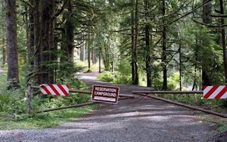
Turlo Campground is located just off the Mountain Loop Highway in the Mt.Baker-Snoqualmie National Forest. The campground is nestled in tall firs, cedars and hemlocks, adjacent to the south fork of the Stillaguamish River.The location offers individuals and families a tranquil camping experience with plenty of opportunities to fish, enjoy the river or relax at their campsite.
Recreation
The Mt. Baker-Snoqualmie National Forest has 1,500 miles of trails, ranging from smooth paths through deep, quiet forests to challenging ascents up boulder-studded mountains. Hiking opportunities abound for every skill level.The Mt. Dickerman Trail, close to the campground, switchbacks steeply for 3 miles through a dark forest to an alpine meadow, which was replanted in 1915 after a major forest fire. From this point, the trail rises above the timberline to an alpine meadow alive with masses of wildflowers in July and August.
The trail is generally in good condition, and spectacular views can be seen from all directions as the trail climbs to the 5,723 foot summit.
Facilities
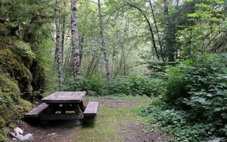
Turlo Campground offers standard sites, accommodating both tent and RV camping. Picnic tables, flush toilets and drinking water are also available, however there are no electrical hook-ups.Access to the Stillaguamish River is available from the campground.
Natural Features
Situated on the west side of the Cascades between the Canadian border and Mt. Rainier National Park, Mt. Baker-Snoqualmie National Forest is one of the most spectacular in the the country, showcasing glacier-covered peaks, wide mountain meadows and old-growth forests, rich in history and outdoor opportunities.On a clear day, visitors will see Mt. Baker, the most prominent feature of the Mt. Baker Wilderness Area. Rising to an elevation of 10,781 feet, the active volcano from which the forest takes its name, is perpetually snow-capped and mantled with an extensive network of creeping glaciers. Mt. Baker's summit, Grant Peak, is actually a 1,300-foot-deep mound of ice, which hides a massive volcanic crater.
Old-growth forests line the wide, gently-flowing river, known for its salmon run. Salmon and other species including, chinook, coho, chum, pink, and sockeye salmon, steelhead trout, sea-run cutthroat, and bull trout, use the Stillaguamish and its tributaries for spawning.
Nearby Attractions
Visit or stay in one of the historic lookouts in the area. Lookouts are tangible symbols of Forest Service heritage, perched on high peaks with unobstructed views where they have been used throughout the years to detect and control fires in remote wildlands.Take some time to visit nearby Mount Rainer National Park. Considered a wonderland, the park offers a fantasic glimpse into glaciers, subalpine ecology, and volcanic landscapes typical in the region.
Discover the Verlot Public Service Center, near the South Fork Stillaguamish River. Built by the Civilian Conservation Corps from 1933 to 1942, Verlot`s handsome buildings reflect the architectural style and fine craftsmanship of that era and are listed on the National Register of Historic Places.
Turlo Campground Reviews
Have you stayed here? Be the first to leave a review!
Top Spots in or near Granite Falls
Heather Lake Trail
Granite Falls, Washington
4.3
4.33 mi
/ 1165 ft gain
The trail takes you on a gradual climb up to Heather Lake with beautiful second growth to admire along the way. The trail can be very wet and muddy with many tree roots to catch your toes, so make sure to wear a sturdy pair of tennis shoes or hiking shoes. Dogs are permitted on this trail on-leash.
Make sure to notice the huge rotting stumps with the springboard notches alongside the trail; s...
Mount Pilchuck Lookout
Granite Falls, Washington
4.8
5.22 mi
/ 2113 ft gain
Hike the well-maintained Mount Pilchuck Lookout trail through a variety of terrain: old-growth forest and granite boulder fields. At the top, you'll reach a lookout tower perched on Mount Pilchuck. Pilchuck sits on the western edge of the Cascades, which offers up amazing panoramic views once you reach the summit of Mt. Baker, Glacier Peak, Mt. Rainier, the Olympic Peninsula, Puget Sound, the a...
Lake 22
Granite Falls, Washington
4.6
5.98 mi
/ 1434 ft gain
If you're looking for a taste of the Mountain Loop Highway area, but don't have it in you for a longer, steeper journey, look no further than Lake 22. The trail starts out as flat and well-maintained, from the parking lot, before becoming a true mountain rainforest trail. Water and dampness are fairly ubiquitous on this trail, so be prepared with your footwear!
At 0.6 miles, you'll be offered ...
Old Robe Canyon Trail
Granite Falls, Washington
3.69 mi
/ 771 ft gain
NOTE: The trail is currently closed about 1 mile in due to landslides.
This trail starts right off the Mountain Loop Highway outside of Granite Falls. Look out for a brick sign with the trail name, as it's easy to miss otherwise. There's parking next to the highway, but since there is a history of car break-ins around this area, keep valuables in the trunk.
After about .25 miles, you'll sta...
Three Fingers Lookout
Arlington, Washington
4.5
14.31 mi
/ 4357 ft gain
Approximately 11 miles east of Granite Falls, WA, on the Mt. Loop Highway, turn onto Forest Service road 41 and follow this road for 18.0 miles to the trailhead. The road is quite rough and it is recommended you have a four-wheel drive vehicle. There is a washout about halfway along the road, and many drivers stop here and hike or bike the rest of the way to the trailhead. The trailhead sign i...
Cutthroat Lakes via Walt Bailey Trail
Granite Falls, Washington
4.0
6.21 mi
/ 1978 ft gain
Along the Mountain Loop Highway, past the crowds crawling over Mt. Pilchuck, lies the muddy, unkempt Walt Bailey Trail into a verdant subalpine basin speckled with tiny tarns. The Cutthroat Lakes are a delightful location to spend the night with optional day hikes up to exposed ridgelines and craggy peaks.
While the trail’s pitch is rarely too strenuous, the mucky, rocky, rooty bootpath requir...
Camping and Lodging in Granite Falls
Granite Falls, Washington
Verlot Campground
Overview
Verlot Campground is located just off the Mountain Loop Highway in the stunning Mt. Baker-Snoqualmie National Forest.Situated on...
Verlot, Washington
Wiley Creek Group Camp
Overview
Wiley Creek, a popular campground for youth groups and organizations, is situated in an old-growth Douglas fir forest with lovel...
Granite Falls, Washington
Gold Basin Campground
Overview
Gold Basin Group Campground sits near the banks of the tranquil South Fork of the Stillaguamish River, close to several wilderne...
Mountain Loop Highway
Beaver Creek Group Camp
Overview
Beaver Creek campground is a popular group camp situated along the Stillaguamish River, with a spectacular view of Big Four Moun...
Mountain Loop Highway
Marten Creek Group Camp
Overview
Visitors traversing the scenic Mountain Loop Road through Mt. Baker-Snoqualmie National Forest will find Marten Creek Group Camp...
Granite Falls, Washington
Esswine Group Camp
Overview
Esswine Group Campground is located on the banks of the tranquil Stillaguamish River in The Mt. Baker-Snoqualmie National Forest...
Unfortunately, we don't have up-to date pricing data for this listing, but you can check pricing through Recreation Gov.
Book NowAdd your business today to reach The Outbound's audience of adventurous travelers.
Community
© 2024 The Outbound Collective - Terms of Use - Privacy Policy


