Raccoon Branch Campground
Book this listing through our partner Recreation Gov
About Raccoon Branch Campground
Overview
Raccoon Branch Campground, nestled at the base of Dickey Knob, offers scenic mountain views, hiking trail access from campsites and cool mountain streams. Campers can access Dickey Creek and the Raccoon Branch from the campground. The most notable time to visit is fall, when the trees boast gorgeous fall foliage.With a location just 11 miles from Interstate 81, the beautiful campground is easily reached by drivers heading out from one of the surrounding cities.
Recreation
The beautiful Dickey Knob Trail takes hikers through a Wilderness to the top of Dickey Knob for spectacular views of Sugar Grove and Rye Valley. The creek provides a setting for wading and fishing.Facilities
Every site accommodates RV or tent camping and nearly half the campsites have electric hookups. Perks of the campground include flush toilets, drinking water, paved roads and spurs and a dump station. A volunteer host is onsite to welcome visitors and offer advice on the region.Natural Features
The campground is at an elevation of 2,880 ft., along a large grassy area, surrounded by pines, hardwoods and rhododendrons. Perched in the Appalachian Mountains, Raccoon Branch is part of the Mount Rogers National Recreation Area, a 200,000-acre stretch of designated wilderness areas.Nearby Attractions
Hike the Appalachian Trail, which extends more than 2,175 miles throughout the Appalachian Mountains across 14 states. The trail was designated as the first National Scenic Trail. The Virginia Creeper Trail, Hungry Mother State Park and Grayson Highlands State Park are nearby.Raccoon Branch Campground Reviews
Have you stayed here? Be the first to leave a review!
Top Spots in or near Sugar Grove
Stamper's Branch Trail
Mouth of Wilson, Virginia
3.37 mi
/ 781 ft gain
Stamper's Branch Trail is an out-and-back trail that provides a good opportunity to view wildlife located near Mouth of Wilson, Virginia.
Mount Rogers via Appalachian Trail
Mouth of Wilson, Virginia
5.0
9.1 mi
/ 1549 ft gain
First of all, who doesn't love wild ponies! There are tons of ponies here, and although they are wild, they are not afraid of people and you can get pretty close (just don't feed them!).
Once you enter Grayson Highlands State Park, you will see a parking lot for Massie Gap a few miles in, park here. There is an obvious trail, the Rhododendron Trail, that you will follow for about .5 mile u...
Backpack the Grayson Highlands
Mouth of Wilson, Virginia
4.8
9.1 mi
/ 1549 ft gain
Spanning roughly 4500 acres, located in a portion of Jefferson National Forest, looming under the highest peak in Virginia lies the Grayson Highlands. A part of Virginia’s State Parks system and a United States National Landmark, located in Mouth of Wilson, Virginia, the Highlands are home to wild mountain ponies, rolling mountain balds with rocky outcroppings, densely spruce-fir covered Mt. Ro...
Mount Rogers Loop
Mouth of Wilson, Virginia
5.0
15.6 mi
/ 1079 ft gain
For an awesome 2-3 day trip, start hiking at the Massie Gap trailhead, which can be reached from Grayson Highlands State Park. Take the Rhododendron Trail up the ridge to connect with the AT, keeping an eye out for wild ponies in the Massie Gap area as they like to hang out here. Some of these ponies may approach close enough to get a great photo, but please help keep them wild by resisting the...
Photograph Wild Horses at Grayson Highlands State Park
Mouth of Wilson, Virginia
4.6
1.8 mi
/ 306 ft gain
The wild horses gather on top of the bald at the end of Horse Trail North located in Grayson Highlands State Park. Because they are wild, it is important to remember not to touch or feed the horses. The horses are accustomed to hikers and will allow you in their near proximity, but bring a zoom lens and keep a reasonable distance from the horses while photographing and observing.
Park in the M...
Hike and Fish Cabin Creek Trail
Mouth of Wilson, Virginia
5.0
1.8 mi
/ 400 ft gain
Starting at the Massie Gap Parking Area follow the paved road down towards the woods. You will see a gravel dirt path off the side of the road to your right that heads back towards the woods. A couple steps down the trail you will see a metal pole with "Cabin Creek Trail" written on it. Follow the beaten path back into the woods and go straight across the horse trail and through a wooden fence....
Camping and Lodging in Sugar Grove
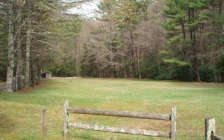
Sugar Grove, Virginia
Hurricane Campground
Overview
Hurricane Campground is one of the best kept secrets in southwest Virginia. Located along a rushing mountain stream under the sh...
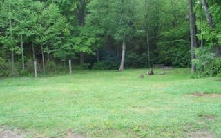
Mouth of Wilson, Virginia
Old Virginia Group Horse Camp
Overview
Old Virginia Group Horse Camp provides group equestrian camping just minutes from a large network of horse trails in the Mount ...
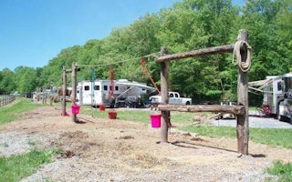
Troutdale, Virginia
Fox Creek Horse Camp
Overview
Fox Creek Horse Camp is a premiere destination for riding enthusiasts who are looking for the rare opportunity to ride from thei...
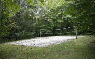
1946 Laurel Valley Road
Grindstone
Overview
Grindstone Campground is tucked in the Fairwood Valley among pastures and wooded hillsides. The surrounding Mount Rogers Nationa...

Elk Creek, Virginia
Blue Springs Gap Cabin
Overview
Blue Springs Gap Cabin is located high on a mountaintop near Camp, Virginia, giving visitors the feeling of being on top of the ...
Elk Creek, Virginia
Comers Rock Picnic Shelter
Overview
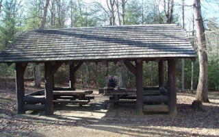
This historic log picnic shelter was built by the Civilian Conservation Corps. It is located next to Comers Rock Campground in ...
Unfortunately, we don't have up-to date pricing data for this listing, but you can check pricing through Recreation Gov.
Book NowAdd your business today to reach The Outbound's audience of adventurous travelers.
Community
© 2024 The Outbound Collective - Terms of Use - Privacy Policy


