Paris Springs Campground
Book this listing through our partner Recreation Gov
About Paris Springs Campground
Overview
Paris Springs Campground is situated in scenic Paris Canyon, about five miles from Paris, Idaho. It is about 20 miles from Bear Lake, at an elevation of 6,600 feet. The campground gives Bear Lake visitors the opportunity to camp in a quiet area with lush vegetation.Recreation
Paris Creek runs alongside the campground, after bubbling up from Paris Spring, which can be accessed from a 300-yard trail within the site. Campers enjoy hiking and fishing along the creek.Facilities
The campground contains three group sites and nine single-family campsites. Vault toilets and drinking water are provided, but there is no electricity. Roads and parking spurs within the campground are dirt.Natural Features
A mixed conifer and aspen forest covers the campground and much of Paris Canyon. Plentiful shade can be found throughout most of the campground. Summer wildflowers dot the landscape.Nearby Attractions
The Highline Trail, part of the National Trail System, can be accessed nearby. It is the premier trail of the Montpelier Ranger District, stretching 55 miles along the backbone of the Bear River Range. The trail is enjoyed by hikers, horseback riders, mountain bikers, motorcyclists and off-road vehicle enthusiasts from around the world.Paris Ice Cave is also not far from the campground. Self-guided tours of the cave offer a look into an unusual cavern filled with ice year-round. The cave is not developed but a footpath leads through it.
Beautiful Bear Lake State Park is about 20 miles away, with boating, water skiing, fishing and swimming. Bear Lake's Raspberry Days festival occurs annually the first weekend in August, with a parade, fireworks, craft booths and a rodeo.
Paris Springs Campground Reviews
Have you stayed here? Be the first to leave a review!
Top Spots in or near Preston
Hike to Bloomington Lake
Saint Charles, Idaho
4.8
0.5 mi
Bloomington Lake is deep in the mountains West of a small town called Bloomington. The road from the town to Bloomington Lake is a narrow dirt road. It takes about 35 minutes to take this road and most cars should be able to handle it. There's plenty of parking at the trailhead and some bathrooms as well. You can also get to the lake from the West side of the mountains. Just take Cub River Road...
Hike Mt. Magog
Richmond, Utah
5.0
5 mi
/ 1702 ft gain
Mt. Magog is one of the most visually striking mountains in the Bear River range. With its very rocky peak being visible from Tony Grove, it is often photographed, but rarely ever hiked. It is rarely hiked because there is not actually an official trail that goes to the summit. This makes the hike very burdensome and steep, but the views at the top are incredible. The peak is made up of several...
Backpack to White Pine Lake, Logan
Richmond, Utah
4.5
7.6 mi
/ 1344 ft gain
You will start from the Tony Grove Lake parking lot and start hiking northeast on the White Pine Lake trailhead. The trail is roughly 3.8 miles to the lake through beautiful Quaking Aspens and Pines. The first 2.5 miles are fairly easy with a slight incline. You will then reach the top of a ridge and be able to see a beautiful basin with Mt. Gog to your North and Mt. Magog to your West. White P...
Hike the Crimson Trail
Logan, Utah
4.5
From the start of Logan Canyon, it's a 4.3-mile drive up the canyon. Pull over at the Guinavah-Malibu campground (between mile marker 466 and 457). Enter the campground and drive to the east, over the Logan River bridge. The trailhead starts between campsites 29 and 30. Beginning at an elevation of 5200 feet, it's a smooth 6-mile round trip hike with 1000 feet of elevation gain. The Crimson Tra...
Hike to the Wind Caves, UT
Logan, Utah
4.5
3.7 mi
/ 1000 ft gain
As you drive up Logan Canyon, you'll see the trailhead on the left side of the road, just after Guinavah-Malibu Campground. It's a fairly steep hike, but also very well maintained.
The Wind Caves are probably the most popular hike in Northern Utah and for a good reason. As you can see in the pictures, you can look out to Logan Canyon from the cave with a great view. If you look across the canyo...
Hike to Saddleback Mountain Reflectors
Logan, Utah
2.6 mi
/ 2302 ft gain
Head east on the road going into Green Canyon, and just before the road turns Northeast, you will see a short dirt road continuing up towards the mountain next to a small power station. You can park anywhere along here. The trailhead is at the top of this road. The trail is hard to spot, but you will know it when you see it. The trail is incredibly steep. Due to the short distance, there are ba...
Camping and Lodging in Preston
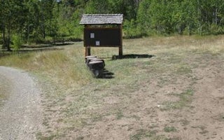
Saint Charles, Idaho
Davis Canyon Campground
Overview
Davis Canyon Campground is situated on St. Charles Creek a scenic canyon in the forests of southeast Idaho.Recreation
Nearby, th...
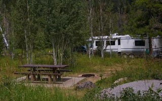
Saint Charles, Idaho
Porcupine (Id)
Overview
Porcupine Campground is situated on St. Charles Creek in a scenic canyon in the rolling Idaho forests. The campground is also cl...
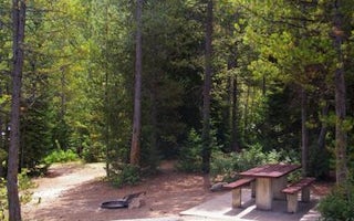
Saint Charles, Idaho
Cloverleaf Campground
Overview
Cloverleaf Campground is situated on St. Charles Creek in a scenic canyon in the forests of southeast Idaho. Recreation
Nearby, ...
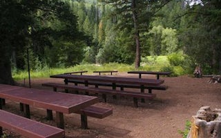
Preston, Idaho
Willow Flat Campground
Overview
Willow Flat is a popular campground, located on the banks of the Cub River, in southeastern Idaho. It sits in a pretty valley, s...
Saint Charles, Idaho
North Fork Campground St. Charles Canyon
Overview
North Fork Campground is located in scenic St. Charles Canyon in southern Idaho, near Bear Lake. Visitors enjoy hiking, biking, ...
Saint Charles, Idaho
St. Charles Campground
Overview
St. Charles Campground is situated on its namesake creek in the scenic St. Charles Canyon, approximately 8 miles from Bear Lake ...
Unfortunately, we don't have up-to date pricing data for this listing, but you can check pricing through Recreation Gov.
Book NowAdd your business today to reach The Outbound's audience of adventurous travelers.
Community
© 2024 The Outbound Collective - Terms of Use - Privacy Policy


