Meyers Creek Cabin
Book this listing through our partner Recreation Gov
About Meyers Creek Cabin
Overview
Meyers Creek Cabin is located within the Meyers Creek Work Center in Custer National Forest at an altitude of 5,646 feet. The cabin offers opportunities to enjoy relaxation and recreation in beautiful surroundings. It is reservable from May through November. The cabin is accessible by vehicle. 4-wheel drive is recommended during wet weather.Recreation
Trails crisscross the area, including the Meyers Creek and Lodgepole Creek Trails. This area offers recreation for hikers, mountain bikers and equestrians. Horse facilities are available at the cabin.Anglers can fish for rainbow and brown trout in nearby creeks.
Facilities
This cabin sleeps 6 people and comes equipped with 5 single mattresses, an electric refrigerator, cook stove, heat, indoor toilet and shower, cookware, dishes and utensils. A campfire ring is located outside.There are 2 corrals, a watering tank and hitching rails for horses. Potable water is available, but guests may wish to bring a water filter or provide their own water if they are concerned about quality or taste.
Items such as bedding, towels, washcloths and dish soap are not provided.
Natural Features
The cabin is situated in the western end of the Beartooth Mountains and surrounded by pastures, which are used for grazing cattle. Roses, irises, rhubarb and lilacs grow around the dwelling. The surrounding slopes are covered in pine, aspen and sagebrush, with wildflowers blooming in the summer.This area supports a large bear population ( bear safety ). Bighorn sheep, elk, deer and a variety of bird species also inhabit the mountainous terrain in the Beartooth Ranger District.
Nearby Attractions
The Stillwater River Trailhead, with access to the Absaroka/Beartooth Wilderness, is 16 miles south of the cabin.Meyers Creek Cabin Reviews
Have you stayed here? Be the first to leave a review!
Top Spots in or near Mc Leod
Hike to the Natural Bridge Falls
Mc Leod, Montana
5.0
2 mi
/ 300 ft gain
Although this recreation area is at minimum 30 minutes out from any town, the road leading to the location is amazing and allows for some sweet views. Once you arrive, there will be a relatively small, paved place to park as well as bathrooms. Right behind the bathroom is the start to the trail.The trail splits two ways; it is often thought that the trail is just a loop and it doesn't matter wh...
Summit Arrow Peak
Livingston, Montana
2.4 mi
/ 3600 ft gain
Starting in Livingston, MT, take Hwy 89 for 16 miles and take a left on Mill Creek Road. A junction with Road 540 will be reached. At this junction, continue on Mill Creek Road for another 8 miles until a large rock gully on the left is present and a wooden fence is on the right. The route is not clearly defined and starts directly at this large rock gully.From the parking area, a wooded area t...
Hike Sioux Charley Lake Trail
Nye, Montana
6.5 mi
/ 931 ft gain
From the trailhead hike about 2.5 miles to Sioux Charley lake with varying inclines of terrain, all in all a very easy and delightful hike.
Backpack the Beartooths via the West Rosebud Trail
Fishtail, Montana
22.69 mi
/ 6795 ft gain
The West Rosebud Trail functions as one of the major routes to Granite Peak, the highest point in Montana. The trailhead (6,558') is located approximately 80 miles south of Billings in the Beartooth Absaroka Wilderness. The road to the trail passes Emerald and West Rosebud Lakes just before arriving at the spacious parking area with available restrooms.
The trailhead is accessible by walking t...
Backpack the Aero Lakes to Granite Peak
Park County, Montana
26 mi
/ 6200 ft gain
Granite Peak is considered one of the most difficult state high-points, for its remoteness and its climbing challenge. Unfortunately, the access to this route is very remote. Fortunately, this route to the summer is the easiest way up in terms of the technical climbing challenge. This route, known as the southwest ramp, is the only way up by which rope is recommended as opposed to mandatory....
Beartooth Highway: Silver Gate to Red Lodge
Cooke City-Silver Gate, Montana
67.35 mi
/ 5817 ft gain
Beartooth Highway: Silver Gate to Red Lodge is a point-to-point trail that takes you by a lake located near Silver Gate, Montana.
Camping and Lodging in Mc Leod
Mc Leod, Montana
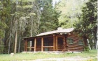
Fourmile Cabin
Overview
Fourmile Cabin is open year-round and offers guests a rustic mountain retreat surrounded by majestic scenery. The cabin offers a...
Mc Leod, Montana
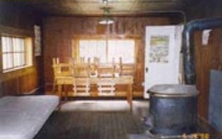
West Boulder Cabin
Overview
West Boulder Cabin is open year-round, offering a variety of recreational opportunities as well as relaxation. Guests can drive ...
Livingston, Montana
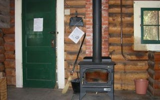
Mill Creek Cabin
Overview
Mill Creek Cabin was built in 1927 as a temporary lodging for traveling Forest Service personnel. The cabin can be accessed by v...
Livingston, Montana
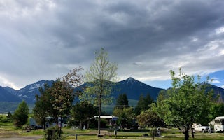
Livingston / Paradise Valley KOA Holiday
This award-winning KOA boasts 500 feet of Yellowstone River frontage in one of the most beautiful valleys in the U.S. Just 9 miles off of...
Nye, Montana
Woodbine Campground
Overview
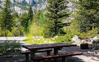
Woodbine Campground is remotely located adjacent to the Absaroka-Beartooth Wilderness in southwestern Montana, about three hours...
Livingston, Montana
Hyalite Pavilion
Overview
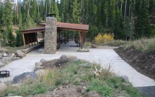
The Hyalite Pavilion is a day use picnicking area located next to scenic Hyalite Reservoir in the Gallatin National Forest. It ...
Unfortunately, we don't have up-to date pricing data for this listing, but you can check pricing through Recreation Gov.
Book NowAdd your business today to reach The Outbound's audience of adventurous travelers.
Community
© 2024 The Outbound Collective - Terms of Use - Privacy Policy


