Ice House
Book this listing through our partner Recreation Gov
About Ice House
Overview
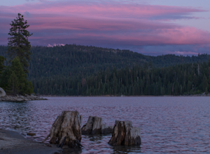
Ice House Campground is surrounded by a mixed conifer forest on the shores of Ice House Reservoir. Just 12 miles from Riverton, CA, the campground offers hiking, biking, jet skiing and fishing.Ponderosa pine is a pleasing part of the surrounding region. The trees fill the air with a vanilla aroma and it's the tallest known pine tree in the country. To date, the tallest Ponderosa measured was an impressive 268.35 feet tall.
Recreation
Enjoy swimming, fishing and boating on Ice House Reservoir. Rainbow, brown, and trout swim in these waters. A boat ramp is located on-site.Hike or bike on the Ice House Mountain Bike Trail, which stretches for 3.1 miles along ridge tops and shaded northern slopes. The trail boasts views of the reservoir and the Crystal Range.
Facilities
Amenities include a picnic area, drinking water faucets, vault toilets and a dump station. Firewood is sold on-site and a nearby resort offers a restaurant, gas and limited groceries.At the RV-only campsite area, there is a shared cooking area with tables and grills. This is the only place those staying in the area may grill.
Natural Features
Some campsites at Ice House are right on the shoreline while others are set back just enough for plenty of shade from towering ponderosa pines, cedars and Manzanita bushes. The reservoir spans 700 acres at 5,500 feet elevation.The area is part of the Eldorado National Forest, which stretches across the famed gold mining territory of the 1800s. Its climate is similar to that of the Mediterranean, with warm, dry summers and cold, wet winters.
Nearby Attractions
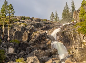
Head to Bassi Falls, which can be reached via a 1.2-mile hiking trail. The glorious waterfall cascades over a 109-foot granite cliff.Ice House Reviews
Have you stayed here? Be the first to leave a review!
Top Spots in or near El Dorado County
Hike to Bassi Falls
Kyburz, California
4.6
1.22 mi
/ 194 ft gain
109' tall Bassi Falls is located in the Crystal Basin area of the El Dorado National Forest. These gorgeous falls at peak Springtime flow crash over enormous boulders and the water sheets over huge, flat slabs of granite. It is located off a rural, pot-holed dirt road (high clearance vehicles recommended) . Afternoon is a preferable time to photograph here, since the light will be hitting the...
Camp at Ice House Reservoir
El Dorado County, California
4.0
1 mi
/ 1 ft gain
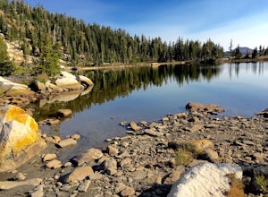
Desolation Wilderness is just west of Lake Tahoe, a part of Eldorado National Forest. It's a very popular backpacking destination as the PCT and Tahoe Rim Trail both run through the area. There are what seems to be endless amounts of mountain lakes, creeks, and rivers that run through this area which make it one of the more beautiful regions in California. Camping at Ice House Reservoir is a pe...
Gertrude Lake Trail
Kyburz, California
8.28 mi
/ 1362 ft gain
Gertrude Lake Trail is an out-and-back trail that takes you by a lake located near Kyburz, California.
Backpack Desolation's Primitive Western Edge through Rockbound Pass
Kyburz, California
4.4
26.28 mi
/ 5151 ft gain
This 26 mile loop meanders through some of the most primitive trails in Desolation Wilderness. Starting from Wrights Lake, the route proceeds over Rockbound Pass, loops around several lakes, and returns to Wrights Lake. Not many hikers venture past the steep and rocky Rockbound Pass to enter this part of the wilderness which makes for a truly desolate experience. Along with passing tens of name...
Hike to Twin and Island Lakes
Kyburz, California
5.0
7 mi
/ 1600 ft gain
The Twin Lakes trail starts winding through a pine forest, with a couple bridge crossings over crystal clear trout-filled streams. The marsh-like water is very slow moving, and even though it is indeed beautiful, it is also a prime location for pesky mosquitoes in the summertime. Be sure to load up on bug spray for this section.
The trail continues on a gentle climb as you leave a large sect...
Backpack to Smith Lake, Desolation Wilderness
Kyburz, California
5.0
5.6 mi
/ 1750 ft gain
To get to the Twin Lakes Trailhead from the Bay Area/Sacramento, head east on HWY 50 past Kyburz for 4 miles until you see the left-hand turnoff for Wrights Road. If coming westbound on HWY 50, this will be a right-hand turn 5 miles past Strawberry. Follow this paved road for 8 miles (watch for potholes) until you reach Wrights Lake. At the fork, turn right and continue for a mile past the cabi...
Camping and Lodging in El Dorado County
El Dorado County, California
Yellowjacket
Overview
Yellowjacket Campground provides plenty of opportunities for outdoor fun on Union Valley Reservoir. The water plays host to an a...
Unnamed Road
Wench Creek
Overview
Wench Creek Campground is located in a beautiful ponderosa pine forest on the east shore of Union Valley Reservoir. The campgrou...
Ice House Road
Big Silver Group
Overview
Big Silver Group Campground offers tent and RV camping for up to 50 guests. The campground is located 23 miles east of Placervil...
Kyburz, California
Fashoda
Overview
Fashoda Campground, located on a peninsula of the eastern side of Union Valley Reservoir, is an incredibly scenic place to camp....
Kyburz, California
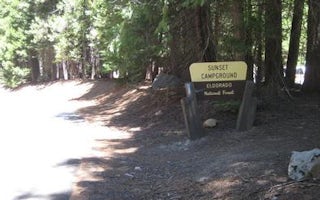
Sunset Union Valley
Overview
Sunset Campground is situated on the shores of Union Valley Reservoir, among the towering cedar and ponderosa pines of Eldorado ...
Helix Flat Avenue
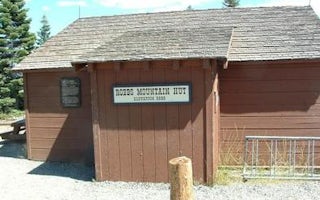
Robbs Hut
Overview
Robbs Hut offers a peaceful, rustic getaway with phenomenal views of the Sierra Nevada. The cozy, yet minimalistic cabin is open...
Unfortunately, we don't have up-to date pricing data for this listing, but you can check pricing through Recreation Gov.
Book NowAdd your business today to reach The Outbound's audience of adventurous travelers.
Community
© 2024 The Outbound Collective - Terms of Use - Privacy Policy


