Elizabeth Furnace Group Camp
Book this listing through our partner Recreation Gov
About Elizabeth Furnace Group Camp
Overview
Elizabeth Furnace Recreation Area is a highly esteemed destination known for its family friendly atmosphere. Spend the day fishing from a stocked trout stream, grilling at one of the many picnic spots, or taking a stroll across the swinging bridge to view the historic cabin.The campground was named for the Elizabeth Furnace, a blast furnace used to make pig iron in the 1800s. With water power from Passage Creek, the furnace purified iron ore to make high-carbon fuel used for forging.
Recreation
Enjoy hiking the Pig Iron and Charcoal Trail to learn how iron was made in the area. Another great hike heads up to Buzzard Rock.Passage Creek is seasonally stocked with trout to keep anglers entertained.
Facilities
The campground is open year-round and allows tent camping only. Site pads, campfire circles, picnic tables, vault toilets and grills are provided.Water is not available onsite, but campers have access to seasonal flush toilets and drinking water from a hand pump at the Elizabeth Furnace Family Campground.
Trash collection is not available so please pack-in and pack-out all trash.
Natural Features
The charming group campground sits in the Shenandoah Valley along Passage Creek, a tributary of the North Fork Shenandoah River. The area is part of the George Washington and Jefferson National Forests which spans across Virginia and parts of West Virginia and Kentucky. These forests protect 40 species of trees that are mostly Appalachian hardwood and mixed pine-hardwood forests, 60 species of mammals and 200 species of birds.Elizabeth Furnace Group Camp Reviews
Have you stayed here? Be the first to leave a review!
Top Spots in or near Fort Valley
Hike the Shenandoah River State Park Loop
Bentonville, Virginia
5.0
8 mi
/ 650 ft gain
Shenandoah River State Park is located in the heart of the Shenandoah Valley. The park is full of well-maintained trails great for hiking and mountain biking. The trails both parallel the banks of the river as it snakes through the Shenandoah Valley and through the rolling hills, which provides great views of the river and surrounding mountains. Shenandoah River State Park is nestled between ...
Explore Skyline Caverns
Front Royal, VirginiaSkyline Caverns is located right off Stonewall Jackson Highway with plenty of parking.
The cave tour is about 60 minutes with little walking and minimal elevation gain. If you time it right you and your friends can get the whole tour to yourselves.
The backstory the tour guide gives you, is interesting and the views of the cave are amazing.
Be sure to bring a light jacket and shoes that will n...
Explore Skyline Drive In Winter
Front Royal, Virginia
4.5
Skyline Drive is a winding highway that cuts straight through Shenandoah National Park. Being that we are in the south, you will find that the road is closed for the majority of the winter, and usually at the very mention of snow. The first few years of living here it was incredibly frustrating, then I realized that walking the road is one of the most scenic, peaceful hikes around. It's total...
Hike to Compton Peak
South River, Virginia
5.0
This unique hike on the Appalachian Trail in Shenandoah National Park is 2.4 miles round trip with an 835' elevation gain, and leads you to two viewpoints as well as a cool rock outcrop.Access this hike from the Compton Gap parking area (elevation 2,145') on the Skyline Drive at Mile 10.4. Cross the Skyline Drive and take the white-blazed Appalachian Trail south for a moderate but rocky 0.8 mil...
Camp along the South Fork Shenandoah River
Johnny's Road, Virginia
3.0
From Luray, follow Bixler's Ferry Road until you cross the river. The road will then T, go to the right along South Page Valley Road. Follow this road for about 6.5 miles until you pass Shenandoah River Outfitters. Shortly after this it will turn into a gravel road. Drive along the gravel road for roughly 2 miles until you see Riverwater Road, turn right onto this road. The road ultimately lead...
Hike to Overall Run Falls
Rileyville, Virginia
5.0
6.1 mi
/ 1700 ft gain
Start at the Hogback parking lot at MP 21.1 on the Skyline Drive. Take the Appalachian Trail south for 0.8 miles, and turn right onto the Tuscarora-Overall Run Trail. After 0.5 miles you will come to another intersection-keep right to stay on the Tuscarora-Overall Run Trail. A final intersection with the Mathews Arm Trail is after another 1.3 miles. Keep right at this intersection.The waterfal...
Camping and Lodging in Fort Valley
Rileyville, Virginia
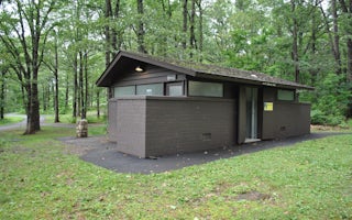
Mathews Arm Campground
Overview
Secluded in the thick trees and rolling hills of the Shenandoah National Park, Mathews Arm Campground is the ideal spot for a ca...
Lost City, West Virginia
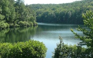
Trout Pond Recreation Area
Overview
Trout Pond Recreation Area boasts two bodies of water, Rock Cliff Lake and Trout Pond. Relax on a sandy mountain beach or fish f...
Stanley, Virginia
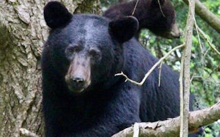
Big Meadows
Overview
Secluded in the thick trees and rolling hills of Shenandoah National Park, the Big Meadows Campground is the ideal spot for an o...
Broadway, Virginia
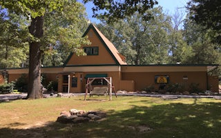
Harrisonburg / Shenandoah Valley KOA Holiday
This KOA in the heart of Shenandoah Valley is a family campground - all families are welcome! It's an easy on/off I-81 Exit 257, 4 miles ...
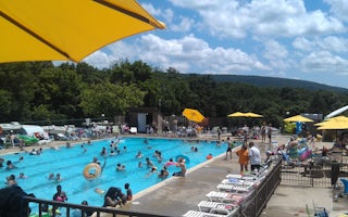
Harpers Ferry, West Virginia
Harpers Ferry / Civil War Battlefields KOA Holiday
Stay in the heart of Civil War country, just an hour from Washington, D.C. Camp next to a trench where American soldiers faced off. Explo...

Stanardsville
Getaway Shenandoah
Just a short distance from Shenandoah National Park, recharge at our Outpost near the Blue Ridge Mountains in Stanardsville, VA.
From $199 / night
Unfortunately, we don't have up-to date pricing data for this listing, but you can check pricing through Recreation Gov.
Book NowAdd your business today to reach The Outbound's audience of adventurous travelers.
Community
© 2024 The Outbound Collective - Terms of Use - Privacy Policy


