Driftwood Campsite On Grand Island
Book this listing through our partner Recreation Gov
About Driftwood Campsite On Grand Island
Overview
Grand Island is located in Lake Superior, about one half mile from the mainland community of Munising, Michigan. Munising is about 43 miles from Marquette and 55 miles from Manistique.Recreation
Swimming - The lake bottom is sandy, sandy with small rocks, or solid rock depending on what site you choose. Lake Superior can be cold with average high temperatures reaching only the high 60s (degrees Fahrenheit). Be cautious when swimming because this area has not been checked for possible hazards. Please remember, you swim at your own risk.Hiking and Biking - Over 30 miles of hiking and mountain biking trails provide wonderful opportunities for day-trips and give access via unsurfaced trails to some of the Island's most spectacular scenery.
Fishing and Hunting - Lake Superior has Coho salmon, lake trout, perch, pike, walleye and rock bass. Game species on the island include deer, bear, rabbit, grouse and ducks. A Michigan fishing, hunting and/or trapping license is required. (See the Michigan Department of Natural Resources Fishing Guide for license information and special regulations for Echo and Duck Lakes.)
Boat Access - There are a number of sand beaches where a boat could pull right up to shore. Murray Bay, Trout Bay and North Light Creek areas have the largest sand beaches with little to no rock obstructions. There are several areas around the perimeter of the island where kayakers can gain access. Be aware that there are very few locations on the northwest and northeast sides that are not cliff. There is no boat launch or public dock facility on Grand Island. Personal watercraft (SeaDoo/Jet Ski) are not allowed on the shores of Grand Island. The dock at Williams Landing can be used for loading and unloading only. Boats may not park at the dock.
Facilities
Drinking water is available at Williams Landing, Juniper Flats, Farrell Cottage and Murray Bay Day Use Area. If traveling elsewhere on the island, bring water with you or filter/boil/treat surface water. Keep soaps and detergents out of lakes and streams. Wash dishes and clothes in a pot and dispose of the waste water in a hole at least 100 feet from the nearest water supply. Bathe in a similar manner.Driftwood: This campsite is located approximately 50 yards from Lake Superior and Trout Bay Beach. The site is approximately 2.5 miles from William's Landing (ferry service arrival point, and visitor information center). The nearest potable water is approximately 1 mile south of this campsite at Murray Bay Day Use Area. Plan ahead, and bring drinking water when staying at this site or plan to filter water from Lake Superior. This site can accommodate up to 4 people in two tents. A latrine, food storage pole and locker, fire ring, benches and firewood are provided in/near the campsite. Driftwood can be accessed via the island's trail system and is accessible to kayakers via Trout Bay Beach.
Natural Features
Grand Island, a Congressionally designated National Recreation Area (NRA), boasts massive 300-foot wave-cut sandstone cliffs; 13,500 acres of lush forest; beaches of fine sand; winter ice caves; and historic buildings and artifacts dating back as far as 2,000 BC - to name just a few of its highlights! The island's scenic natural beauty and interesting history make it an attractive place for camping and other outdoor activities.Nearby Attractions
Pictured Rocks National Lakeshore, Hiawatha National Forest, and the City of Munising. The Munising Area provides a variety of restaurants, hotels, camping opportunities and outfitters. Local outfitters provide guided and self-guided kayak, canoe, pontoon and mountain bike rentals.Driftwood Campsite On Grand Island Reviews
Have you stayed here? Be the first to leave a review!
Top Spots in or near Munising
Grand Island Loop
Munising, Michigan
20.63 mi
/ 1309 ft gain
Located in Munising, MI, Grand Island National Recreation Area is a part of the Hiawatha National Forest. While this section of the Upper Peninsula is known for Pictured Rocks National Park, many people fail to see or check out Grand Island. Secluded by ferry access, the island features 12 backpacking sites and two group sites along a 20-ish mile loop, along with six other sites on the eastern ...
Munising Falls
Munising, Michigan
4.5
0.37 mi
/ 72 ft gain
Munising Falls is a 50' falls located inside the city limits of Munising. The trail to the waterfall is directly outside the visitor center and makes for a quick and easy hike after stopping by to pick up a permit or check in with a ranger.
The paved trail is cool and shaded as it follows a creek to a viewing platform at the base of the falls. There are also two sets of stairs that lead to ad...
Backpack Pictured Rocks National Lakeshore
Munising, Michigan
5.0
43 mi
/ 500 ft gain
The time of the year is one of the most important factors of this trip. DO NOT under any circumstances plan this trip for a time during mid June - mid August. The black flies at this time of the year are more than a nuisance. They are seemingly resistant to even 100% DEET, and can bite through clothing. They WILL ruin your mood during the trip. There are also plenty of mosquitos at this time, b...
Tannery Falls
Munising, Michigan
0.37 mi
/ 112 ft gain
Located right off of County Highway 58 across from Sand Point Road, Tannery Falls doesn't see the larger advertising that many other falls see in the area, but is a hidden gem within the town. At the start of the hike, you'll need to find a parking spot off of the highway, you might run into ticketing parking there. Once done, you can see the stairway for the trail. The trail is short, running ...
Miners Castle to Au Sable Lighthouse
Munising, Michigan
3.0
27.32 mi
/ 2323 ft gain
This trip works best with two cars where the first is dropped off at the Twelvemile Beach Parking Lot, and carpooled over to the Miner's Castle Parking Lot. Both lots can be easily found in the Pictured Rocks National Seashore Map, or on Google Maps.
Start your day at Miner's Castle by checking out both the Upper Overlook and Lower Overlooks. In the morning around Golden Hour, the cliffs acros...
Miners Falls
Munising, Michigan
4.8
A simple hike from the trailhead will take you through the woods and to the viewing deck of Miners Falls. There are well marked signs to the trailhead from the main road, which is extremely helpful with the lack of cell phone service in the area.
The hike is 1.2 miles round trip and requires no hard terrain challenges to the viewing deck. However, what makes these falls unique is following a t...
Camping and Lodging in Munising
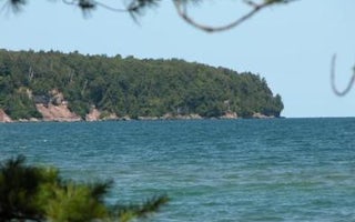
Munising, Michigan
Little Duck Campsite On Grand Island
Overview
Grand Island is located in Lake Superior, about one half mile from the mainland community of Munising, Michigan. Munising is abo...
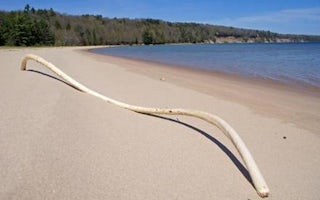
Munising, Michigan
Little Dune Ii Campsite On Grand Island
Overview
Grand Island is located in Lake Superior, about one-half mile from the mainland community of Munising, Michigan. Munising is abo...
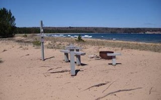
Munising, Michigan
Little Dune I Campsite On Grand Island
Overview
Grand Island is located in Lake Superior, about one-half mile from the mainland community of Munising, Michigan. Munising is abo...
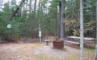
Munising, Michigan
Loon Call Campsite On Grand Island
Overview
Grand Island is located in Lake Superior, about one half mile from the mainland community of Munising, Michigan. Munising is abo...
Munising, Michigan
Duck Lake Campsite On Grand Island
Overview
Grand Island is located in Lake Superior, about one half mile from the mainland community of Munising, Michigan. Munising is abo...
Munising, Michigan
Bermuda Campsite On Grand Island
Overview
Grand Island is located in Lake Superior, about one half mile from the mainland community of Munising, Michigan. Munising is abo...
Unfortunately, we don't have up-to date pricing data for this listing, but you can check pricing through Recreation Gov.
Book NowAdd your business today to reach The Outbound's audience of adventurous travelers.
Community
© 2024 The Outbound Collective - Terms of Use - Privacy Policy


