Blanco River Group Campground
Book this listing through our partner Recreation Gov
About Blanco River Group Campground
Overview
Blanco River Group Campground is located four miles off U.S. Highway 84, on Forest Road 656. It is about 15 miles southeast of Pagosa Springs, on the Blanco River. The campground is a convenient stopping point between the towns of Chama, N.M., and Pagosa Springs, Colo. Secluded and quiet, the campgound is an ideal place for family and friends to gather.Recreation
The Blanco River can be accessed from the campground, offering good fishing. Anglers cast for stocked trout on the lightly fished waterway.A volleyball court is located within the campground, but campers must bring their own net and ball.
Facilities
The campground offers one group site that is made up of several single campsites. They must be reserved at the same time for group use. Four parking spurs are suitable for large RVs and ample space is available for tents. The campground is equipped with three picnic areas with large tables, vault toilets and drinking water.Natural Features
The campground is situated on the banks of the Blanco River, surrounded by ponderosa pine and cottonwoods. The trees offer shade, but the area is quite warm during the summer months. The riparian environment is fairly level with a few adjacent grassy meadows.Nearby Attractions
Three nearby trails access the roadless area to the east of the campground. The Navajo Peak Trail and V-Rock Trail can be reached from the Buckles Lake Road (Forest Road 663), which is located about seven miles south of the campground via Highway 84. The Blanco Basin Road (Forest Road 657) accesses the Leche Creek Trail.Blanco River Group Campground Reviews
Have you stayed here? Be the first to leave a review!
Top Spots in or near Pagosa Springs
Visit Treasure Falls
Pagosa Springs, Colorado
4.8
0.4 mi
/ 200 ft gain
Treasure Falls is reached via short .4 mile walk from the parking lot on highway 160 about 15 miles outside Pagosa Springs (which is home to the worlds deepest hot springs). There is a paved path and dirt trail that both end up at the falls and if you are inclined, make into a loop. There is a bridge that crosses the creek just below the falls or you can continue up a couple hundred feet to the...
Hike the Weminuche Wilderness to Fourmile Falls
Creede, Colorado
5.0
8 mi
Located in Southern Colorado’s Weminuche Wilderness, Fourmile Falls is a beautiful day hike perfect for hikers and photographers. The highlights of the trail are the two massive, thundering waterfalls. The falls make this hike ideal in early to mid summer, when the falls are full of icy snowmelt. Also on this trail, you’ll be rewarded with some gorgeous views of Weminuche’s wild landscape. Th...
Crater Lake in the South San Juan Wilderness
Pagosa Springs, Colorado
9.17 mi
/ 2133 ft gain
Holiday weekends can be frustrating for solitude seekers. The extra day to play always seems to be challenged by the expected crowds of competition for your sought after spots. Fortunately for those of us who prefer quieter pastures, Colorado's 3.5+ million acres of wilderness still hold plenty of hidden gems. One such hidden gem is (yet another) Crater Lake, tucked away in the South San Juan ...
Camp and Fish at Platoro Reservoir
Pagosa Springs, Colorado
5.0
Platoro is the blending of the Spanish words "plata" (silver) and "oro" (gold), and this secluded mountain reservoir strikes it rich when it comes to outdoor recreation. In 1870, gold and silver was discovered in area, which lead to a small boom in 1913 and the settling of the small town which still stands today. The prospectors and mule trains may have left long ago, but today the area attract...
Hike to the Piedra River Hot Springs
Archuleta County, Colorado
4.7
3 mi
About a 45 minute drive east of Durango, sits the trailhead for the Piedra River Hot Springs. This free use, natural hot spring on the Piedra River has several 100 degree pools. The springs are accessible via a 3 mile roundtrip hike, often with wildlife sightings along the way. The hike to the hot springs is downhill, so remember, you'll have a little work to do on the way back out. Please be r...
Cross country Ski around Vallecito Lake
Bayfield, ColoradoDrive north from Durango on Florida Rd, following signs to Lemon and Vallecito Reservoirs. Florida Road will turn into County Road 250. Follow this for 15 miles out of town until you reach County Road 501 - make a left turn here.
Soon, you'll reach the dam. Turn right to begin driving around the lake in a counter-clockwise direction. This dirt (or snow-covered) road will lead you to a small pa...
Camping and Lodging in Pagosa Springs
Creede, Colorado
West Fork Campground
Overview
West Fork Campground sits near the West Fork San Juan River in a secluded 10-acre area, just over a mile from Highway 160. Visit...
Del Norte, Colorado
Carnero Guard Station
Overview
Carnero Guard Station is situated in a high open meadow surrounded by forest at an elevation of 9,840 feet. The high-elevation c...
Del Norte, Colorado
Elwood Cabin
Overview
Elwood Cabin sits in a saddle along the San Juan Mountains
overlooking an open meadow, offering guests a unique lodging
oppo...
Antonito, Colorado
Platoro Cabin 1
Overview
Platoro Cabin 1 is located downtown in the small mining town of Platoro, Colorado, at an
elevation of 10,000 feet in the Rio G...
Antonito, Colorado
Platoro Cabin 2
Overview
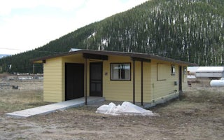
Platoro Cabin 2 is located downtown in the small mining town of Platoro, Colorado, at an elevation of 10,000 feet in the Rio Gra...
Del Norte, Colorado
Lake Fork(Rio Grande Natl Fore
Overview
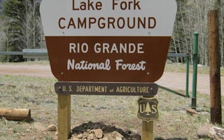
Lake Fork Campground sits in the Rio Grande Forest, 40 miles northwest of Antonito, Colorado. The campground is a true getaway f...
Unfortunately, we don't have up-to date pricing data for this listing, but you can check pricing through Recreation Gov.
Book NowAdd your business today to reach The Outbound's audience of adventurous travelers.
Community
© 2024 The Outbound Collective - Terms of Use - Privacy Policy


