
Hiking the Tallest Peak in Morocco
At 13,600ft, Jebel Toubkal is no joke.
This past January, I spent two weeks in Morocco, and one of the highlights was hiking Jebel Toubkal, the highest peak in the country. We ascended over 8,00ft and covered 23 miles over two days in the Atlas Mountains.
Where does the hike to Toubkal start?
You'll begin in the town of Imlil, a short-ish drive from Marrakech. If you organized a guide, most tour companies will pick you up in the morning at your lodging in Marrakech. However, Imlil is a nice destination by itself and many travelers choose to spend a day or two here.

The trail begins on a short portion of road through town before transitioning to singletrack. You'll make your way up through the valley, stopping at several checkpoints. You'll need to have a guide, and your passport. If you ever find yourself on this hike, definitely get a glass of orange juice from one of the locals selling it on the trail. I can basically guarantee that it'll be the most delicious orange juice you've ever had.

The Toubkal Refuge
After gaining nearly 4500 ft of elevation, the trail arrives at the base of Toubkal, where you'll find two refuges. We stayed at Refuge Toubkal les Mouflons, which was our home for dinner and short nights rest. The refuge is large, but pretty bare bones.

An alpine start
We left the refuge around 6:00, giving ourselves a few hours to get up high for sunrise. The stars were incredible as we climbed towards the summit ridge. The trail up to the ridge was mostly packed snow -- we had crampons, which were useful. The conditions here can be wildly variable, especially in the winter, but we were here in a very dry January.

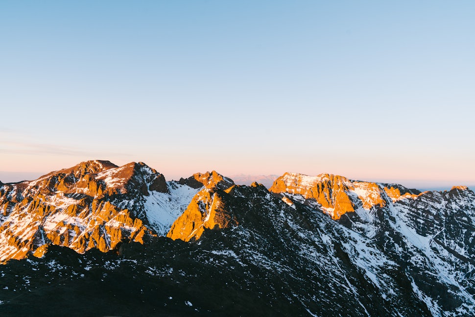
Sunrise on Jebel Toubkal
Sunrise revealed a spectacular landscape that kinda looked like...Colorado? Really though, this area of the High Atlas looked a lot like the Elk Range in Colorado, and I was definitely not expecting to find that in Morocco. Gotta love it when places surprise you.


After spending a bit of time on the summit, it was time to head down. And down. And down. All the way to Imlil. Day 2 ended up being around 13 miles with 3400 ft of up and 8000 ft of down. Tired legs, but all worth it.

We want to acknowledge and thank the past, present, and future generations of all Native Nations and Indigenous Peoples whose ancestral lands we travel, explore, and play on. Always practice Leave No Trace ethics on your adventures and follow local regulations. Please explore responsibly!
Do you love the outdoors?
Yep, us too. That's why we send you the best local adventures, stories, and expert advice, right to your inbox.


