6 Tips For Your Adventure To Virginia's Lake Moomaw
A true gem hidden in the Appalachian Mountains of Western Virginia.

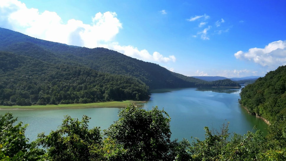
Nestled in the Appalachian Mountains between West Virginia and Virginia is a little-known lake that is unlike any other in the state. With miles of hiking trails, campgrounds, beaches and boat ramps, this lake is truly a unique and perfect destination for any adventurer in Virginia. Here's everything you need to know about planning your adventure:
1. Camping

There are three campgrounds surrounding the lake and all have spectacular views. Bolar Mountain Campground is located on the northwest side of the lake and you can park right next to all the campsites. This is the biggest campsite at the lake with bathrooms, electrical hookups, beaches, playgrounds and more. If you want a lakefront campsite make sure to book well in advance. Morris Hill Campground is on the southeast edge of the lake and situated on a ledge so the campsites are not technically lakefront. The campsite amenities include flush toilets, hot showers, a playground and drinking water. You can park right next to all the campsites and most campsites fit any size RV. Greenwood Point Campground is a primitive campground located on the southern side of the lake and you have to hike a little over three miles or canoe across the lake to access it- it's very primitive but perfect for backpackers of all levels.
Reserve a campsite at Bolar Mountain Campground, Morris Hill Campground, or Backpack Around Lake Moomaw.
2. Swimming
There are two sand beaches at the lake. One is located on the north end near Bolar Mountain Campground and has a bathroom, picnic tables, a playground and parking lot for easy access. The second beach is located on the southern end of the lake at Coles Point. This beach is not as big as the previous mentioned but is also easily accessible by a parking lot and has bathrooms. You can swim, SUP, kayak or lay in a tube while enjoying the always cool waters of Lake Moomaw. Make sure to stay close to the shore if you are free swimming to avoid being in the path of any motorized boats.
3. Hiking

This map shows a majority of the hiking around the lake. The trails are denoted by little dotted brown lines that run all alongside and around the lake. The most well known hike is the hike to Greenwood Point Campground. This hike is usually used by backpackers trying to access the primitive campground but it is also a great day hike! The hike has some great vistas of the lake and even if you're not planning on staying overnight, the primitive campground has some great spots for swimming and relaxing by the water. As you drive around the lake you will see little paths accompanied by wooden signs with the name of the trailhead. Print out the map above and have it with you so you can safely navigate all trails around the lake.
4. Boating
For those that want to explore the lake on their boat there are three boat launches and a marina. Bolar Flats Boat Launch is at the northern end of the lake and this is also where the Bolar Flats Marina is located. At the marina you can rent boats, pontoons, kayaks and canoes as well as park your boat and trailer for the duration of your stay. Coles Point Boat Ramp is located at the southeast end of the lake with bathrooms and a large parking area. Coles Point is also a popular launch for campers headed to Greenwood Point Primitive Campground but would rather row their gear over instead of hike it in. The last boat launch is Fortney Branch Boat Ramp and it is located at the very southern tip of the lake.
- Coordinates for Bolar Flats Marina: 37.993145, -79.948714
- Coordinates for Coles Point Boat Ramp: 37.948712, -79.968483
- Coordinates for Fortney Branch Boat Ramp: 37.928091, -79.981095
5. Fishing

The lake is deep enough for both warm water and cold-water fish. Fish include alewife, trout, black bass, yellow perch, panfish, catfish, chain pickerel, black crappie, rock bass and sunfish. Surprisingly, Lake Moomaw is known for their trout fishing; there is a zone about 15 feet under the surface with cold oxygenated water where brook, brown and rainbow trout thrive. Make sure you have a Virginia fishing permit and be sure to research fishing laws for the area and obey all signs and rules posted at the lake.
Find Lake Moomaw fishing regulations here.
6. How To Get There
Lake Moomaw is located in western Virginia almost on the border of West Virginia in the George Washington National Forest. From Washington D.C. it takes about 4 hours, from Richmond, Virginia it takes about 3 hours, and from Raleigh, NC it takes about 5 hours.
Coordinates and Addresses for Specific Points at Lake Moomaw:
- Bolar Mountain Campground: 756 Twin Ridge Dr, Warm Springs, VA 24484
- Morris Hill Campground: 651 Coles Mountain Road, Covington, VA 24426
- Bolar Flats Marina: 37.993145, -79.948714
- Coles Point Boat Ramp: 37.948712, -79.968483
- Overlook from Road: 37.989447, -79.958353
Have a great adventure!
We want to acknowledge and thank the past, present, and future generations of all Native Nations and Indigenous Peoples whose ancestral lands we travel, explore, and play on. Always practice Leave No Trace ethics on your adventures and follow local regulations. Please explore responsibly!
Do you love the outdoors?
Yep, us too. That's why we send you the best local adventures, stories, and expert advice, right to your inbox.


