Winding Southward, Pt. II: Blue Ridge Parkway
Taking "America's Favorite Drive" Through Southern Appalachia

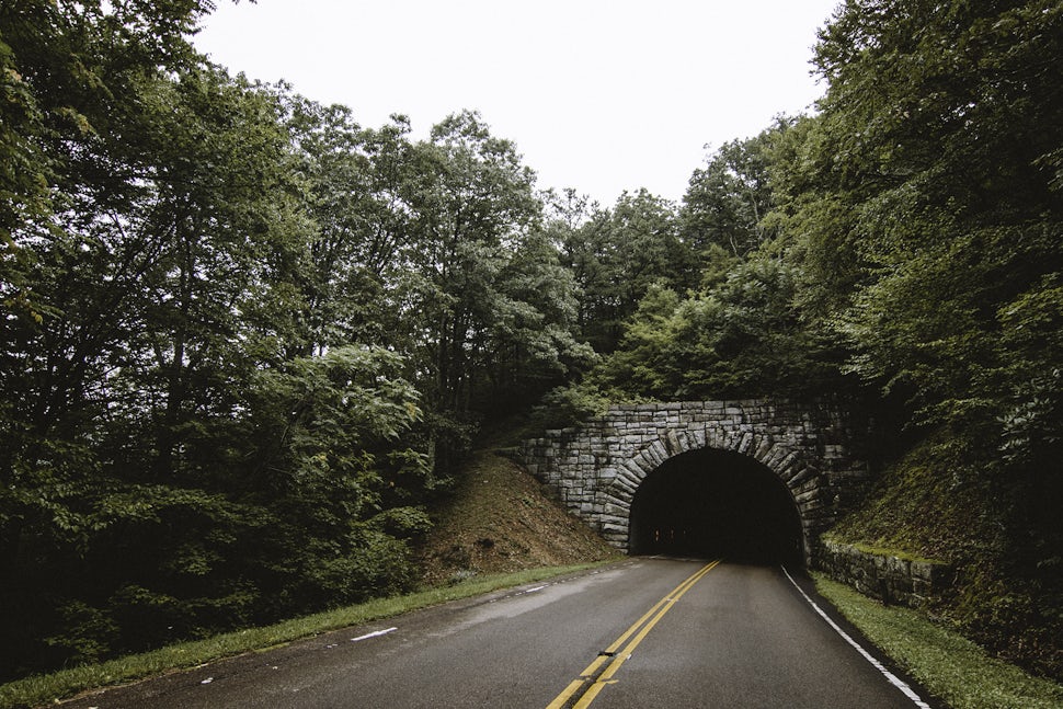
As I pulled off the final stretches of pavement on the Shenandoah Skyline Drive, I knew that I still had 469 miles of Appalachian wilderness ahead of me; more commonly known as the Blue Ridge Parkway. Shenandoah conveniently connects to the Parkway, so passing by the entrance sign almost felt like a "chapter two" of sorts, as far as the road trip was concerned.

There was a late-summer fog that seemed to swallow the entire south. The late-August humidity was almost unbearable at times but it certainly made for some interesting photo ops. Occasionally I would wind to the crest of a ridge and the clouds would part for just a few moments, allowing a glimpse of the sprawling farmlands in the valley below.


With fog came rain - not a downpour, but a steady, deliberate mist that hugged every hair follicle on my body and kept the landscape damp and dreary. While it wasn't the best for camping, it kept my imagination at work as I slowly rounded each corner of America's favorite drive.
Technically a national park, the BRP is truly worth seeing from start to finish. There are more outlets along it than Shenandoah but still only two ways to go; North and South. The speed limit is a bit higher than Shenandoah - 45 MPH - still just slow enough to allow you to absorb your surroundings as the road pulls you further into the clutches of the South.

Being under the umbrella of the NPS has its perks. Campsites are speckled along the way, which truly allows you to slow down and enjoy the full experience instead of rushing through it in a day. The first campsite I stayed at was Peaks of Otter, just under 90 miles into the journey. The whole thing is situated on a hill and slopes down toward the road. I had some very friendly neighbors that evening. They invited me next door to their campsite for beer, chili and hot dogs.
As you ride along the Parkway, you get a deep sense of the region's history - loggers, rail workers and pioneers all left their mark in some way. Ruins still exist here and there but there's plenty of signs that tell the story of the land.


One thing I loved about the Parkway was its charm. Every person you saw on the road - whether in a car, a motorcycle, a bike or on foot; young, old or somewhere in-between - was there as a traveler. People come to experience the journey. I could feel that sense of understanding between each soul that passed by. It was almost like a "tip of the cap" each time.

One of the most pleasant stops along the way was the Mabry Mill. Sure, it was one of the more "touristy" places along the Parkway; but the journey is so long and stretched out that it didn't feel like such with visitors dispersed along nearly 500 miles of road.
The Mill is picturesque; truthfully right out of a storybook. It's nestled on a pond and is surrounded by thick woods. The mill grounds also boast a blacksmith shop, a lovely little diner and an old time whiskey still. If there was ever an image to depict southern Virginia, I imagine this would be it.


Where Virginia ends and North Carolina begins was a mystery to me. The backwoods blend together and at some point during a sleepy stretch of road you realize that the road signs are shaped differently and that you must've crossed into N.C. without knowing. A gentle introduction, indeed.
The elevation was high enough in some places that the pullouts sat above the fog. Roadside foot trails offered awe-inspiring views that I couldn't have dreamt up.


The BRP is also not just a national park; plenty of folks live alongside it. Endless farmlands paint the rolling hills as you wind deeper and deeper into the countryside. I remember thinking to myself it must be cool writing a letter to someone that lives down here, addressing it "Blue Ridge Parkway" on the envelope.
Quite possibly the most famous image of the Parkway is the Linn Cove Viaduct. It was one I would not be able to witness due to the fog. Perhaps someday.
A later overnight stop on the journey was at Mt. Pisgah, over 400 miles in toward the south end of the Parkway. Again, fog shroud the place and I wasn't able to absorb any of the views. However, I was able to capture some roadside images during late afternoon as the sun poked through the trees. It would be the last time I'd see sunlight on the trip - a trip that was truly unforgettable.


We want to acknowledge and thank the past, present, and future generations of all Native Nations and Indigenous Peoples whose ancestral lands we travel, explore, and play on. Always practice Leave No Trace ethics on your adventures and follow local regulations. Please explore responsibly!
Do you love the outdoors?
Yep, us too. That's why we send you the best local adventures, stories, and expert advice, right to your inbox.


