Josephine County, Oregon
Top Spots in and near Josephine County
-
Josephine County, Oregon
Raft or Kayak the Wild & Scenic Rogue River
4.8The Wild and Scenic Section of the Rogue River is a hidden secret in the Pacific Northwest. This virtually untouched 34-mile section boasts some of the most pristine and secluded scenery in Oregon. Bald eagles, osprey, and black bears are frequently (if not always) spotted along the way. This bea...Read more -
Del Norte County, California
Backpack to Raspberry Lake
1.012 mi / 1800 ft gainIf you wish to experience the beauty of the Siskiyou Wilderness and avoid the crowds associated with The Devil’s Punchbowl, then consider a visit to Raspberry Lake. Beginning at the Young’s Valley Trailhead (Coordinates: 41.889919, -123.654755), this hike is a great option for those seeking wide...Read more -
Agness, Oregon
Fly Fish the Rogue River at the Mermaid Riffle
The Steelhead run on the Rogue River is famous the world over and for good reason. Like anywhere, local guides are the gatekeepers to the right spot and should be contacted accordingly. Steelhead run December through March and Chinook April through Fall, with Coho making an appearance in the lat...Read more -
Agness, Oregon
Stand Up Paddleboard the Mermaid Riffle on the Rogue River
The Rogue River is famous the world over for rafting and for its Steelhead runs, possessing a dramatic undeveloped canyon untouched by road and man, and being one of the Original 7 Wild & Scenic Rivers designed by Congress. And not only is it fantastic for rafting but entire sections are perf...Read more -
Crescent City, California
Devil's Punchbowl, Six Rivers National Forest
4.08.33 mi / 1660 ft gainLocated in extreme Northern California, the Siskiyou Mountains are the largest sub-range of the Klamath Mountain range and among the most rugged. The Siskiyou Wilderness, designated in 1984, encompasses three national forests: Siskiyou, Klamath and Six Rivers for a total of 182,802 acres. Because...Read more -
Ashland, Oregon
Summit Mt. Ashland
5.05 mi / 1550 ft gainSituated in Southern Oregon right near the California border lies the Siskiyou Mountain Range's tallest peak, Mount Ashland. Mount Ashland is a very popular area for many recreational activities, one of the most popular activities is skiing. The ski area was opened up in 1963 and has changed hand...Read more -
Brookings, Oregon
Picnic at Arch Rock
5.0This vista point is located in Southern Oregon, near the coastal town of Brookings. Arch rock is just off the 101 freeway and is a cool stop if you are passing through. The main rock arch is located directly west. It's a great place to stop during road trips for a picnic lunch.Read more -
Brookings, Oregon
Explore Natural Bridges at Samuel H. Boardman State Scenic Corridor
4.86 mi / 0 ft gainThe Samuel H. Boardman Scenic Corridor is 12 miles of rugged, steep coastline with many hidden & secluded beaches and coves, and the Natural Bridges section is one of the most iconic (and most photographed) along the entire Corridor.There are several hikes above and around the natural bridges...Read more -
Brookings, Oregon
Natural Bridges Cove - North Island Viewpoint (China Beach) Trail
5.00.43 mi / 262 ft gainThe Natural Bridges Cove trail in Brookings, Oregon is a short, moderately challenging hike that offers stunning views of the Pacific Ocean. The trail is approximately 0.43 miles long and features a steep descent to the beach, making it suitable for hikers with a moderate level of fitness. The ...Read more -
Brookings, Oregon
Camp at Harris Beach SP
4.0Harris Beach State Park on the Southern Oregon Coast and about a quarter mile north of the town of Brookings, Oregon features a variety of campsites, including yurts, full RV hookups, and even a hiker/biker camp for individuals hiking the Oregon Coast Trail and/or biking the PCH. From either the...Read more -
Brookings, Oregon
Explore Thunder Rock Cove at Samuel H Boardman State Scenic Corridor
1.5 mi / 400 ft gainOne of many magical nooks and crannies to explore all along the Samuel H. Boardman State Scenic Corridor, Thunder Rock Cove sits between the iconic (and more popular) Natural Bridges and Secret Beach. The hike to the cover overlook is an easy .75 mile hike down from the Thunder Rock pull-off tha...Read more -
Brookings, Oregon
Secret Beach
0.4 mi / 100 ft gainThe main parking for Secret Beach is a nondescript, unlabeled pull out on Hwy 101, between mile posts 254 and 255, as you are traveling north on the west side there will be a guardrail. Pull off the road where the guardrail ends and you can park behind it. About 6 cars can fit there. Super short ...Read more -
Brookings, Oregon
Explore the Marine Garden at Harris Beach SP
The Marine Garden at Harris Beach State Park is one of the 7 designated Marine Garden's on the Oregon Coast where the ecosystem is protected and the collection and disturbance of tidal flora and fauna is prohibited. Interpretive hikes and guides are available through the State Park system, as are...Read more -
Crescent City, California
Smith River Confluence
Smith River Confluence located in Jedediah Redwoods State Park is a great swimming area especially from June to October. From the parking area for the boat launch, follow the trail back toward Nels Christensen Memorial Bridge (aka "Second Bridge"). A rope swing is usually attached to the bridg...Read more -
Gold Beach, Oregon
Hike Cape Sebastian
5.02.7 mi / 718 ft gainA short hike on the southern Oregon Coast. It's a beautiful and scenic hike with amazing vistas of where the mountains meet the ocean. The hike is not very difficult, unless you decide to hike down to the beach. There are several vista points along this hike where you can stop to take pictures ...Read more -
Crescent City, California
Drive Walker Road
5.0Walker Road is one of the places where parts of Star Wars IV: A New Hope were filmed! It's a beautiful site in the Redwoods with an extra amount of huge, leafy ferns. Once you turn onto Walker Road, it's a quick drive through the redwood trees and ferns to the Smith River at the end. There are a ...Read more
Top Activities
Camping and Lodging in Josephine County
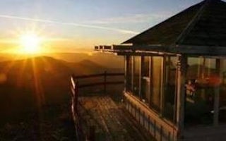
Josephine County, Oregon
Bolan Mountain Lookout
Overview
Bolan Mountain Lookout is surrounded by glass windows on all sides, providing visitors with an unparalleled view of the sheer dr...
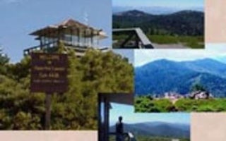
Grants Pass, Oregon
Onion Mountain Lookout
Overview
THIS FACILITY IS CLOSED TO RESERVATIONS UNTIL FURTHER NOTICEOnion Mountain lookout sits atop a 12-foot tower at an elevation of ...
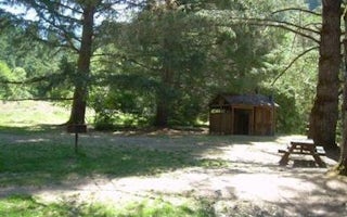
Cave Junction, Oregon
Chinquapin Group Campground
Overview
The Chinquapin Group Campground is located at the former site of the Camp Oregon Caves Civilian Conservation Corps (CCC) camp. D...
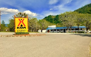
Josephine County, Oregon
Grants Pass KOA Journey
Located next to Jumpoff Joe Creek, this KOA is just 15 minutes from the Rogue River, a National Wild and Scenic River. Book a tour with H...
Jacksonville, Oregon
Squaw Lakes
Overview
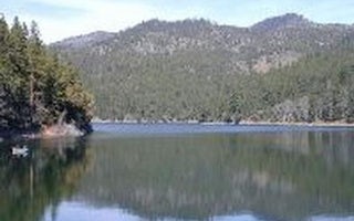
Squaw Lakes Campground is nestled in the deep shade of a mixed-conifer forest on the banks of Squaw and Little Squaw Lakes. The ...
Jacksonville, Oregon
Mckee Bridge Community Kitchen
Overview
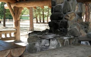
Situated along the rocky banks of the Applegate River, the McKee Bridge Community Kitchen is a fantastic day-use picnic shelter ...


