Cropseyville, New York
Top Spots in and near Cropseyville
-
Cropseyville, New York
Hike Dickinson Hill Fire Tower
4.53 mi / 200 ft gainOnce you drive onto N. Long Pond Road you will follow it appproximately 1.5 miles to the end. From the parking you can take the short walk back on the road to the start of the trail. The trail is actually a rough Fire Tower Road. You will follow this for about 1.3 miles. Here you will see a se...Read more -
Cohoes, New York
Capture a Sunset at the Colonie Town Park
5.0Not all adventures have to involve scaling crazy-steep mountains or paddling down intense white-water rapids. Some of the best adventures are the relaxing and mellow ones right in our backyards. When I cannot get into the woods every day, I go to the Colonie Town Park, just 10 minutes from my hou...Read more -
Schenectady, New York
Hike the Lisha Kill Preserve Loop
5.02.3 mi / 324 ft gainThis 2.3 mile loop trail is lightly trafficked and great for all skill levels. Starting out the trail register, you will see signs from The Nature Conservancy which manages the preserve. Descending down a hill with lots of exposed tree roots, you will then cross over the meandering Lisha Kill and...Read more -
Albany, New York
Blueberry Hill East
1.73 mi / 59 ft gainBlueberry Hill East is a loop trail where you may see beautiful wildflowers located near Albany, New York.Read more -
Albany, New York
Blueberry Hill West Red and Yellow Trail
1.37 mi / 52 ft gainBlueberry Hill West Red and Yellow Trail is a loop trail where you may see beautiful wildflowers located near Albany, New York.Read more -
East Nassau, New York
Kinderhook Creek
5.01.62 mi / 308 ft gainKinderhook Creek is a loop trail that takes you by a river located near Stephentown, New York.Read more -
Williamstown, Massachusetts
Hike Mt. Greylock via Money Brook Trail
9.7 mi / 3034 ft gainPark in the parking lot on Hopper Rd. Walk to the end of the road where you will find the Hopper Trailhead. Take the right fork. The Money Brook trail will take you to a waterfall, the Mt. Greylock summit, and back to the end of Hopper Rd. The trail is long but worth the hike, exploring parts of ...Read more -
Williamstown, Massachusetts
Hike the March Cataract Falls Trail
4.02.2 mi / 511 ft gainPark at the Junction of Sperry Rd and Rockwell Rd. To get to the trailhead, hike along Sperry Road for about 30 minutes. (Not to the end of the road, see map below.) Then hike along the March Cataract Trail, an out-and-back. You can bring dogs on leash. The trail is short but steep in some parts ...Read more -
Voorheesville, New York
Hike the Indian Ladder Trail
4.53.5 mi / 200 ft gainThere are many parking areas within the park. Park at the overlook parking. From here you head west following the wood fence. This is the Cliff Top trail. Approximately after walking 0.5 miles you will reach the stairs that will lead you to the base of the cliffs. This marks the start of the...Read more -
Adams, Massachusetts
Explore Bellevue Falls
5.0When you reach the falls, you can cliff jump into a large swimming hole at the base. The best time to visit the falls is from April to November. Please note that dogs are not permitted here. Parking is at a cemetery, and the gates are open from 8am to 9pm. Use common sense before cliff jumping - ...Read more -
Voorheesville, New York
Hike the Keleher Preserve Loop
2.03 mi / 1636 ft gainThe historic preserve is operated by the Mohawk Hudson Land Conservancy, so trails are clearly marked and extremely well maintained. There are features of the original farm that the land was used for from the 18th Century, including hand-thrown stone walls and an old logging road that cuts throug...Read more -
Schenectady, New York
Hike Plotter Kill Preserve
4.35.5 mi / 820 ft gainThere are a few entries into the preserve' however, this hike has you entering off of Mariaville Road. There is a kiosk here and you will enter on the Red trail. Shortly after you can go out and back on the Blue trail to view the Upper and Lower Falls from lookouts above. Once back to the Red t...Read more -
Altamont, New York
Hike through the Wolf Creek Falls Preserve
3.03 mi / 200 ft gainOver 3 miles of trails provide access to all parts of the preserve, and end up winding through mixed terrain including a wetland, waterfalls, and old stone walls. The property crosses the Bozenkill Road at two points on either side of private parcels (with beautiful homes), so be vigilant there; ...Read more -
Shaftsbury, Vermont
Hike Around Lake Shaftsbury
1.3 mi / 42 ft gainLake Shaftsbury State Park is a small park in Southern Vermont between Bennington and Manchester. It is well-loved by locals as swimming spot in the summer, especially for families with kids. Less well known is the nature trail that meanders around the perimeter of the lake. While only a mile in...Read more -
Woodford, Vermont
Woodford State Park Loop
2.41 mi / 203 ft gainA great loop for the summer, Woodford is also amazing when winter winter comes to the State Park. It also comes earlier than just about anywhere else in Southern Vermont. At 2,400 feet above sea level, this is an easy spot to find winter without spending a fortune at the local ski resorts. Woodfo...Read more -
Savoy, Massachusetts
Tannery Falls Loop
0.54 mi / 135 ft gainThe hike to Tannery Falls may be a little confusing, I'll clear it up for you before you even go there! To get to The falls you will travel down a dirt road that isn't very well maintained during the winter. As you keep driving down the dirt road you will notice a pond , which means you are almos...Read more
Top Activities
Camping and Lodging in Cropseyville
Catskill, New York
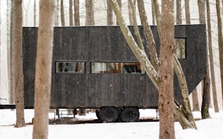
Getaway Catskills East
Our second Outpost in New York is now open. Be the first to stay at Getaway Catskills East.
From $209 / night

Catskill, New York
Getaway Catskills West
One hundred miles up the Hudson, our first New York Outpost is nestled away in the beautiful woods of Catskill, NY.
From $209 / night
43.341565,-73.837308, New York
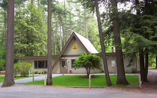
Lake George / Saratoga KOA Journey
Cruise along the waters of Lake George near this family-owned KOA. The Adirondack Mountains rise above the shores that promise scenic vis...
Chesterfield, Massachusetts
Indian Hollow
Overview
With abundant wildlife, lush scenery and waterfront views, Indian Hollow Group Campground, located at the Knightville Dam and Re...
Londonderry, Vermont
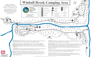
Winhall Brook
Overview
Winhall Brook Camping Area is nestled in the Green Mountains of Vermont along Winhall Brook and the West River, seven miles from...
Townshend, Vermont
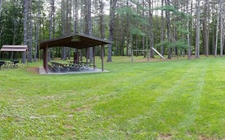
Townshend Lake Day Use Area
Overview
Townshend Lake is nestled in the Green Mountains of Vermont. Families from near and far come to enjoy the outdoor recreational ...


