Prestonsburg, Kentucky
Top Spots in and near Prestonsburg
-
Haysi, Virginia
Explore Breaks Interstate Park
5.0Breaks Interstate Park lies on the border of western Virginia and eastern Kentucky, and is known as the “Grand Canyon of the South”. This park surrounds a 5-mile long gorge created by the Russell Fork River, which lies 1650 feet below the park.Once you enter the park, stop at the first overlook o...Read more -
Olive Hill, Kentucky
Hike to Lick Falls
5.03 miThe Grayson Lake State Park has two trails – the Lick Falls Loop Trail, and the 0.8 mile Beech-Hemlock Forest Trail. Lick Falls is best done after a rain, to make sure the falls are flowing. A trail map of the park can be found here.Read more -
Gillmore, Kentucky
Hike the Creation Falls and Rock Bridge Loop
4.81.38 mi / 285 ft gainFrom the Slade, KY exit take KY15 toward Campton to KY715 to Rock Bridge Rd. Park at the Rock Bridge picnic area and take the trailhead closest to the entrance. The trailhead will quickly descend surrounding you with lush vegetation. A rockshelter can be found on the right hand side of the tra...Read more -
Campton, Kentucky
Hike Rock Bridge Loop to Pooch Turtle Falls and Turtle Back Arch
5.05 miExtend your Rock Bridge Loop and explore more areas of the Clifty Wilderness Area of Daniel Boone National Forrest. From Rock Bridge Loop (#207) take Swift Camp Creek Trail (#219). Along the way catch views of Hell's Kitchen over the steep drop-off on the right-hand side of the trail. Half way ...Read more -
Wellington, Kentucky
Rock Climb Foxfire at the Red River Gorge
Directions to Eagle Point Buttress from the Shell gas Station.Head west on KY-15 for 1.6 miles then turn left onto KY 77. Stay on KY-77 for 5.1 miles. While you are on this road you will go through a oneway tunnel so be careful of cars coming out from the other side. Once you cross a bridge over ...Read more -
Sky Bridge Loop - Trail #214, Kentucky
Hike Sky Bridge Loop
0.9 mi / 300 ft gainThe trailhead parking lot is located just off of KY 715. If coming from the North you will cross the Red River at Osborne Bend and continue up the steep hill until the very top. The parking lot access road is in a hairpin curve at the top of the hill. It is marked very well with signs so it is ve...Read more -
Pine Ridge, Kentucky
Rough Trail to Hanson's Point
5.05.84 mi / 1099 ft gainThe Rough Trail to Hanson’s Point is a challenging but rewarding hike in Kentucky’s Red River Gorge, offering a mix of rugged terrain and breathtaking views. Covering about 6 miles, this hike takes you through steep climbs, descents, and some unique geological features, including Hansen’s Point. ...Read more -
Rogers, Kentucky
Rock Climb Bruise Brothers in Muir Valley
Directions to Muir Valley (from Miguel's Pizza)Drive south on KY 11 for 6.3 miles. Turn left onto KY 715. Stay on this road for 2.7 miles. Turn right onto road 2016. Stay on this road for 1.4 miles. Keep an eye out for a carpet store on your right. Once you pass the carpet store, the road will st...Read more -
Rogers, Kentucky
Rock Climb Tectonic Wall in Muir Valley
Directions to Muir Valley (from Miguel's Pizza)Drive south on KY 11 for 6.3 miles. Turn left onto KY 715. Stay on this road for 2.7 miles. Turn right onto road 2016. Stay on this road for 1.4 miles. Keep an eye out for a carpet store on your right. Once you pass the carpet store, the road will st...Read more -
Stanton, Kentucky
Hike to Gray's Arch
5.03.3 miThe trail approaches the arch through a ravine, passing by cliffs, dense forest, and a stream (Kings Branch) en route.Read more -
Huntington, West Virginia
Hike Overlook Trail
4.01.4 mi / 250 ft gainLocated about 30 minutes from Huntington, the Overlook Trail gives hikers an overlooking view within Beech Fork State Park. Maps and brochures can be obtained at the park entrance. Admission is free. Upon entering the park, the trailhead is located in the first lot on your right. This trail is on...Read more
Top Activities
Camping and Lodging in Prestonsburg
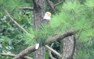
Prestonsburg, Kentucky
Dewey Lake Shelter
Overview
Dewey Lake Shelters offer a day-use area on the shores of Dewey Lake in eastern Kentucky. Located just west of the Appalachian M...
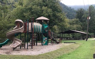
Phyllis, Kentucky
Fishtrap Lake Shelters
Overview
Nestled among mountains and dense forests, the Fishtrap Lake area will appeal to anyone who loves boating, fishing or hiking. A...
Mallie, Kentucky
Littcarr Campground
Overview
Littcarr Campground is located on the shores of Carr Creek Lake in southeastern Kentucky's mountainous region. The area provides...
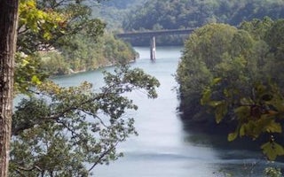
Sassafras, Kentucky
Carr Creek Lake Shelters
Overview
Carr Creek Lake Shelters are located on Carr Creek Lake on the same side of Kentucky Highway 160 as Littcarr Campground. The U.S...
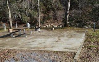
Clintwood, Virginia
Pound River Campground (Va)
Overview
The John W. Flannagan Dam & Reservoir Area boasts an expansive lake nestled in the rolling green Cumberland Mountains of sou...
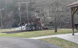
Haysi, Virginia
John W. Flannagan Day Use
Overview
The John W. Flannagan Day Use Area boasts an expansive lake nestled in the rolling green Cumberland Mountains of southwest Virgi...


