Landers, California
Landers, California, is a top destination for outdoor adventures with some of the best trails and outdoor activities. One must-visit is the scenic Big Morongo Canyon Preserve. The trail offers a moderate difficulty level with a variety of natural features like rivers, rock formations, and unique plant species. It's a fantastic spot for bird watching and wildlife spotting. Near Landers, Joshua Tree National Park is another must-see. Known for its rugged rock formations and stark desert landscapes, it's perfect for hiking, rock climbing, and camping. King Clone, one of the oldest creosote bush ring in the Mojave Desert, is also worth a visit. These attractions make Landers a top choice for outdoor adventures.
Top Spots in and near Landers
-
Landers, California
Explore Giant Rock
This is an adventure that my wife and me have been wanting to do for a while now. We finally decided to make the 30 minute journey out to Landers from Yucca Valley. There are quite a few points of interest along the way, but that is a story for another adventure.Giant Rock is 5.2 miles northwest ...Read more -
Pioneertown, California
Pioneertown to Big Bear via Burns Canyon Road and 2N02
18.8 mi / 3287 ft gainThe Pioneertown to Big Bear trail via Burns Canyon Road and 2N02 is a unique hiking route in Pioneertown, California. This trail is known for its diverse terrain and stunning views. The trail starts in the historic Pioneertown and winds its way up to Big Bear, a popular mountain resort. The tra...Read more -
Pioneertown, California
Indian Trail Loop at Pipe's Canyon
6.16 mi / 892 ft gainIndian Trail Loop at Pipe's Canyon is a loop trail where you may see beautiful wildflowers located near Pioneertown, California.Read more -
Pioneertown, California
Visit Historic Pioneertown
Here in California we have a lot of desert to sift through. When trying to figure out how to navigate the mass, you have to know the places worth fighting the brutal heat or chilling cold. Pioneertown will lure you in regardless. You will see why as you make your way up the 4-mile winding road of...Read more -
Yucca Valley, California
Backpack the California Riding and Hiking Trail in Joshua Tree
36.97 mi / 2792 ft gainThe starting point for this hike is at the Black Rock campground, 5 miles from the town of Yucca Valley. You'll need to self register for a free backcountry permit before starting. The first section of the trail follows a wash then the trail narrows and, after only a mile or two, you'll begin cl...Read more -
Joshua Tree, California
Joshua Tree West Side Trail
4.03.22 mi / 302 ft gainJoshua Tree West Side Trail is a loop trail where you may see beautiful wildflowers located near Twentynine Palms, California.Read more -
Morongo Valley, California
Big Morongo Canyon Trail
11.65 mi / 1401 ft gainBig Morongo Canyon Trail is a loop trail where you may see wildflowers located near Morongo Valley, California.Read more -
Yucca Valley, California
Eureka Peak
5.00.47 mi / 82 ft gainAccessing Covington Flats in Joshua Tree National Park requires a high ground-clearance overland vehicle. Bring spare water and emergency tools incase of a breakdown. From Route 62 in Yucca Valley, CA take La Contenta Dr. South toward Joshua Tree. This is a backcountry entrance that does not hav...Read more -
San Bernardino County, California
Off-Road Jacoby Canyon
2.9 miThis is now my favorite trail in the San Bernardino National Forest. Ranging from desert scenes at the bottom and pine trees at the top, you experience such high levels of outdoors feel you can't resist. This trail has so many awesome spots for camping and off-roading that it has a great mix for ...Read more -
Twentynine Palms, California
Boy Scout's Trail in Joshua Tree
4.516.12 mi / 1539 ft gainThe Boy Scout trail connects the main part of the National Park to the outer rim campground, Indian Cove Campground. All backcountry overnight trips must be registered at a registration board (free, self-registration). Start this trip at the registration board located in either Indian Cove Campgr...Read more -
Twentynine Palms, California
Canyoneer Joshua Tree's Rattlesnake Slot Canyon
The trailhead is located at the end of Indian Cove road. From Indian Cove Campground, take the road to the east about a mile to a picnic area where there is parking at the mouth of the canyon.From the picnic area hike up the Canyon in a south to south-east direction. After a few hundred yards a d...Read more -
Riverside County, California
Hike the Covington Crest Trail
4.2 mi / 200 ft gainAccessing Covington Flats in Joshua Tree National Park requires a high ground-clearance overland vehicle. In the summer months a standard car might make it to the parking lot after the 7.5 mile off-road drive, but should always be prepared for soft sand. Bring spare water and emergency tools inca...Read more -
Twentynine Palms, California
Hike the Fortynine Palms Oasis Trail
5.03.08 mi / 653 ft gainJust off highway 62 lies an easy 1/2 day hike with incredible views of the Morongo Valley. Though technically part of the park, the out-of-the-way-ness of the hike means you don't need to pay the $20 National Park fee. Parking is ample, and there's a pit toilet at the trailhead (beware of bees an...Read more -
Twentynine Palms, California
Willow Hole Trail in Joshua Tree National Park
6.8 mi / 341 ft gainThe Willow Hole hike begins at Boy Scout trailhead and winds past and through the Wonderland of Rocks to a marshy stand of willows. The trail is flat, but with little shade so be sure to bring lots of water! As you leave the parking lot you'll enter an expansive stand of Joshua Trees that grows...Read more -
Big Bear, California
Explore Van Dusen Cabin
4.0This is a great day trip to spend in the mountains. from Highway 18 at the Big Bear Dam you turn left onto highway 38 around the north shore of Big Bear. Continue till you see the sign Van Dusen Rd and turn left. The paved road takes you through residential neighborhoods where the dirt road begin...Read more -
Big Bear, California
Rock Climb Holcomb Valley
5.0Most of the drive to Holcomb Valley is done on regular paved roads until about the last hour when you get above Big Bear Lake and you start your journey on dirt roads. The road is extremely bumpy and has lots of pot holes but there are generally quite a few cars up there that don't have 4 wheel d...Read more
Top Activities
Camping and Lodging in Landers
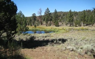
Juniper Springs Group Camp
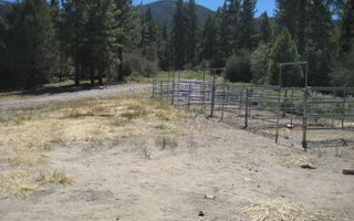
Green Spot Equestrian Group Camp
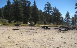
Coon Creek Group Campground


