Rock Island State Park, Tennessee
Looking for the best camping in Rock Island State Park? We've got you covered with the top trails, trips, hiking, backpacking, camping and more around Rock Island State Park. The detailed guides, photos, and reviews are all submitted by the Outbound community.
Top Camping Spots in and near Rock Island State Park
-
Rock Island, Tennessee
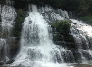
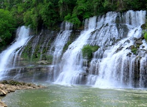
Twin Falls, Rock Island State Park
4.40.3 mi / 125 ft gainUpon entering Rock Island State Park from the east, the parking area for this trail is located right after the old cotton mill (my friend and I actually ended up getting lost because it is tucked away there quite nicely). The trail that leads to Twin Falls actually starts at the westernmost part ...Read more -
Rock Island, Tennessee
Camp at Rock Island State Park
4.8This little campground is nestled in Rock Island State Park. There are two campgrounds, this one is specifically tents only. Each campsite is pull in and provides you with enough room to set up two tents. In addition each campsite has a four sided picnic bench, fire pit, trash can, charcoal grill...Read more -
Sparta, Tennessee
Virgin Falls State Natural Area Loop
5.04.46 mi / 400 ft gainBeginning at the Virgin Falls SNA parking area, the Virgin Falls trail is approximately a 9 mile round trip (excluding any side trails) which will allow you to experience three waterfalls: Big Branch Falls, Big Laurel Falls, and the namesake Virgin Falls. There is a fourth, Sheep Cave Falls, that...Read more -
Beersheba Springs, Tennessee
Hike to Stone Door and Alum Gap Campground
6.8 mi / 825 ft gainThis is a fun and easy overnight trip that is good for all ages. Start at the Stone Door Ranger Station which has plenty of parking and public restrooms as well. Follow the signs to the Stone Door Trailhead and in a short 0.8 miles you'll arrive at the edge of the gulf (canyon) and the first sign...Read more -
Palmer, Tennessee
Hike the North Plateau-North Rim Loop at Savage Gulf
4.014.7 mi / 2483 ft gainFrom the Savage Ranger Station, take the Savage Day Loop for roughly 2.2 miles until you reach the junction. From there take the North Plateau trail and return on the North Rim trail. The elevation gain on this trail is rather gradual and and subtle, but it is a long trek that requires endurance ...Read more -
Gruetli-Laager, Tennessee
Hike to Suter and Horsepound Falls
4.06 mi / 1794 ft gainLocated in South Cumberland State Park in the Savage Gulf section, this is a somewhat difficult 5 mile out-and-back viewing two waterfalls, cascades, creeks, rock shelters, and high bluffs. 2 miles past Suter Falls you'll come to Horsepound Falls, a unique waterfall formation with overlooks and l...Read more -
661-799 Stone Fort Drive, Tennessee
Hike Old Stone Fort Trail
5.02.9 mi / 265 ft gainThe main hiking trail at this small state park follows the wall of Old Stone Fort which was used by the Native Americans as a ceremonial gathering place. The trail threads through dramatic scenery where you can see the original entrance of the fort which was designed to face the exact spot on the...Read more -
Tracy City, Tennessee
Hike the Fiery Gizzard Trail
5.013.5 miStart this journey from the Grundy Forest Trailhead, where you will quickly begin a decent along the Little Fiery Gizzard Creek. At the 0.7-mile split, be sure to turn left and cross the bridge to stay on the Fiery Gizzard Trail. For the next 0.8-mile journey, you'll encounter the gorgeous Black ...Read more -
Sequatchie, Tennessee
Foster Falls Loop
4.62.19 mi / 574 ft gainFoster Falls State Park is part of the South Cumberland State Park system. A short 45 minute drive from Chattanooga, Foster Falls boasts a stunning 60 foot waterfall that is worth visiting during any season of the year. The trailhead for this 2 mile hike starts from the Foster Falls parking lot a...Read more -
Grandview, Tennessee
Hike to Piney Falls
5.01.5 mi / 500 ft gainThe gravel road heading to the trailhead is on the rougher side to take it slow. When you get to the trailhead it’s a small gravel pull off right off the road. There are no maps at the trailhead but there are only a few trails to take and they are marked with a blue marker. To get to the upper fa...Read more -
Soddy-Daisy, Tennessee
Hike the Hogskin Upper and Lower Loop
5.01.4 miAfter an easy 25 minute drive from Chattanooga you will reach North Chickamauga Gorge on Montlake Road in Soddy Daisy. Park any where in the gravel loop just make sure other cars can get through. From the Montlake Road Trailhead Kiosk the trail begins on an old mining road. Hogskin Upper Loop Tr...Read more

