The Best Hiking in Matamoras
Looking for the best hiking in Matamoras? We've got you covered with the top trails, trips, hiking, backpacking, camping and more around Matamoras. The detailed guides, photos, and reviews are all submitted by the Outbound community.
Top hiking spots in and near Matamoras
-
Matamoras, Ohio
Archers Fork Trail
12.8 mi / 1998 ft gainArchers Fork Trail is a loop trail that provides a good opportunity to view wildlife located near New Matamoras, Ohio.Read more -
Washington County, Ohio
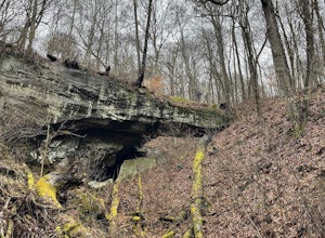
Hike to Irish Run Natural Bridge
9.5 miTo begin, park next to the cemetery located on T-411 in Wayne National Forest. The trail begins on the north side of the cemetery and leads into the woods from there. In less than a 1/4 mile the trail forks into two separate trails, being both the beginning and terminus of the Archers Fork Loop T...Read more -
Ellenboro, West Virginia
North Bend Rail Trail: North Bend State Park to Cairo
7.42 mi / 594 ft gainNorth Bend Rail Trail: North Bend State Park to Cairo is an out-and-back trail that provides a good opportunity to view wildlife located near Ellenboro, West Virginia.Read more -
Cairo, West Virginia
North Bend Park Trails
7.49 mi / 1342 ft gainNorth Bend Park Trails is a loop trail that provides a good opportunity to view wildlife located near Cairo, West Virginia.Read more -
Walker, West Virginia
Mountwood Trail Network: White Oak Ridge and Little Gnarly Loop
4.08 mi / 614 ft gainMountwood Trail Network: White Oak Ridge and Little Gnarly Loop is a loop trail that takes you through a nice forest located near Waverly, West Virginia.Read more -
Walker, West Virginia
Mountwood Trail Network: Warrior Ridge and Four Corners Trail
9.23 mi / 1732 ft gainMountwood Trail Network: Warrior Ridge and Four Corners Trail is a loop trail that provides a good opportunity to view wildlife located near Waverly, West Virginia.Read more -
Walker, West Virginia
Mountwood Trail Network: Tecumsah and Medicine Man Loop Trail
5.31 mi / 873 ft gainMountwood Trail Network: Tecumsah and Medicine Man Loop Trail is a loop trail where you may see beautiful wildflowers located near Waverly, West Virginia.Read more -
Walker, West Virginia
Mountwood Trail Network: Haystack and Collar Bone Loop
4.38 mi / 577 ft gainMountwood Trail Network: Haystack and Collar Bone Loop is a loop trail that takes you by a lake located near Waverly, West Virginia.Read more -
Walker, West Virginia
Mountwood Park Mountain Bike Loop
22.21 mi / 3376 ft gainMountwood Park Mountain Bike Loop is a loop trail that takes you by a lake located near Waverly, West Virginia.Read more -
Walker, West Virginia
Walter Taite Trail
3.15 mi / 364 ft gainWalter Taite Trail is an out-and-back trail that takes you by a lake located near Waverly, West Virginia.Read more -
Vienna, West Virginia
McDonough Trail Loop
3.18 mi / 354 ft gainMcDonough Trail Loop is a loop trail that is good for all skill levels located near Vienna, West Virginia.Read more -
Parkersburg, West Virginia
North Bend Rail-Trail
69.26 mi / 3842 ft gainNorth Bend Rail-Trail is a point-to-point trail that takes you by a river located near Parkersburg, West Virginia.Read more -
Lost Creek, West Virginia
Burr Smith Trail
3.01 mi / 531 ft gainBurr Smith Trail is a loop trail that takes you through a nice forest located near West Milford, West Virginia.Read more -
Lost Creek, West Virginia
Black Cherry Trail
1.08 mi / 200 ft gainBlack Cherry Trail is a loop trail that takes you by a lake located near Lost Creek, West Virginia.Read more -
Lost Creek, West Virginia
White Oak Loop Trail
3.09 mi / 584 ft gainWhite Oak Loop Trail is a loop trail that takes you through a nice forest located near West Milford, West Virginia.Read more -
Lost Creek, West Virginia
Highwall Byass Trail
2.17 mi / 322 ft gainHighwall Byass Trail is an out-and-back trail where you may see beautiful wildflowers located near West Milford, West Virginia.Read more