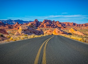
Moapa Valley, Nevada
Top Spots in and near Moapa Valley
-
Clark County, Nevada
Hike to the Fire Wave
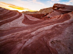
4.61.3 miOnce a secret unmarked location The Fire Wave has quickly become a huge draw for park visitors in The Valley of Fire. The hike to the sandstone wave is just over a half mile of sand and sandstone and it's worth every step. While not as popular as The Wave in Utah the Fire Wave can be accessed wit...Read more -
Clark County, Nevada
Hike the White Domes Trail
1.1 mi / 173 ft gainStart the hike from the parking area. First, the trail is fairly level and sandy. Further down the trail, there is a fairly sharp descent in the canyon below. There is a place and a marker from a film set. The trail also passes through a narrow slot. There are very good views of the surroundings ...Read more -
Clark County, Nevada
Hike the White Domes Trail in Valley of Fire State Park
5.01 mi / 0 ft gainThe White Domes Loop Trail is at the end of Mouse's Tank Road. Travel north from the visitor center until you get to the White Domes Parking Lot. This short loop trail wanders through short slot canyons and towering sandstone formations. From the parking lot, head south down the sandstone steps. ...Read more -
Clark County, Nevada
Exploring Nevada's Pastel Canyon
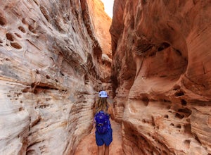
4.7Pastel Canyon or Pink Canyon is part of wash no. 5 in The Valley of Fire State Park and sits close to The Fire Wave and the White Dome trail yet since there is no official trail and isn't on any map it's hardly noticed.To get to the slot canyon drive on Mouse's Tank Rd. in the Valley of Fire to P...Read more -
Clark County, Nevada
Hike to Pink Canyon in Valley of Fire State Park
4.02 mi / 180 ft gainValley of Fire is a place that will exceed your expectations. It’s kind of small but packs a punch. Just an hour outside of Vegas, it’s the perfect retreat for anyone who is in need of a reprieve from the city lights.Anyone who has heard of this park is likely familiar with the Fire Wave . What y...Read more -
Clark County, Nevada
Five Canyon Overlook
5.00.1 mi / 39 ft gainFive Canyon Overlook is an out-and-back trail that takes you past scenic surroundings located near Overton, Nevada.Read more -
Clark County, Nevada
Photographing Rainbow Vista
4.5Rainbow Vista is located in the heart of Nevada's Valley of Fire State Park and only a short drive, north on I-15 out of Las Vegas.To get to Rainbow Vista drive the loop road toward the park's visitor center. It's a good idea to stop here if you need water, snacks, or a map. Remember the desert g...Read more -
Clark County, Nevada
Hike the Rainbow Vista Trail
5.01.1 mi / 95 ft gainStart the hike from the parking area. At the beginning, the trail is rather sandy. Further in, the trail gets easier and has wonderful views of the surrounding rocks and there is interesting desert vegetation. The colors in the rocks are incredible! This is one one the prettier hikes in the park.Read more -
Clark County, Nevada
Hike to Mouse's Tank in Valley of Fire State Park
5.01.5 miThis short hike takes you through a red sandstone canyon covered in beautiful Native American rock art. The incredible amount and concentration of petroglyphs on this hike make this a must-see in Valley of Fire State Park.There is a parking lot roughly one mile north of the visitor center where t...Read more -
Clark County, Nevada
Hike the Petroglyph Canyon Trail to the Mouse's Tank
0.8 mi / 25 ft gainStart the hike from the parking area for the Petroglyph Canyon Trail. The trail is not difficult to hike, but has deep sand in some places. There are very good views of the rock formations and of the desert vegetation and there are a couple of places where petroglyphs can be seen. The view at the...Read more -
Clark County, Nevada
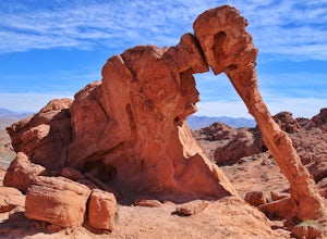
Explore Elephant Rock, NV
4.3Elephant Rock is a beautiful red sandstone arch right at the West Entrance of Nevada's first state park, The Valley of Fire.Elephant Rock is easy to find. From I-15 take exit 75 and travel west. The exit is easy to find and there's an indian smoke shop and casino. If you forgot to get supplies yo...Read more -
Clark County, Nevada
Hiking Charlie's Spring in The Valley of Fire
6.7 miCharlie's Spring is a small oasis in the Valley of Fire State Park just outside of Las Vegas, Nevada. The unmarked trail is flat and follows a wash for 2.5 miles down dry sandstone waterfalls, a small slot canyon and ends in a small spring surrounded by cattails and bushes, a start contrast to th...Read more -
Clark County, Nevada
Hike the Prospect Trail in the Valley of Fire
4.511 miComing from the adventure guide map you can buy at the Visitors Center, which you should do, they describe the Prospect Trail in the following:"Hikers and equestrians enjoy 5.5 miles of outback trail between Valley of Fire Highway and White Domes. Many work out the logistics of being picked up o...Read more -
Clark County, Nevada
Hike the Pinnacle Loop in the Valley of Fire
5.0Pinnacle Loop is an unmaintained poorly marked trail leading to a cluster of sandstone towers, hidden close to some of the more popular areas of the Valley of Fire like Atlatl Rock and a campground.Getting TherePinnacle Loop shares the same trailhead as the popular Atlatl Rock picnic area and pet...Read more -
Clark County, Nevada
Camp at Arch Rock Campground in Valley of Fire State Park
Arch Rock Campground is first come first serve campground in Valley of Fire State Park. It is the more "primitive" of the two campsites in the park. That is, there are far less RVs in this site and it is often easier to get a spot.To get here, take the Valley of Fire Highway to the entrance, whic...Read more -
Clark County, Nevada
Hike the Bowl of Fire in the Muddy Mountains Wilderness
8 mi / 500 ft gainThe Bowl of Fire, tucked away in the Muddy Mountains Wilderness, is made up of the same dramatic conglomerate as that of the Valley of Fire, only almost no-one stops to visit as they blitz by on Northshore Road in the Lake Mead National Recreation Area.To get there take the Northshore Road 16 mil...Read more
Camping and Lodging in Moapa Valley
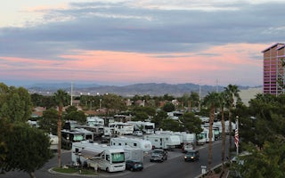
Las Vegas, Nevada
Las Vegas KOA Journey at Sam's Town
Here's betting you've never camped quite like this: Welcome to the Las Vegas KOA at Sam's Town, adjacent to Sam's Town Hotel & Gambli...

