Sun River, Montana
Top Spots in and near Sun River
-
Sun River, Montana
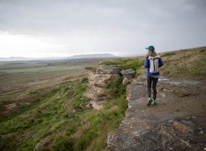
Hike the First Peoples Buffalo Jump Loop
5.03 mi / 400 ft gainWhile the trail doesn't offer the typical scenery of a Montana hike, the views are spectacular. At the top of the jump, you're at one of the highest points of the basin, allowing you to take in the full magnitude of the surrounding mountains, which include the Big Belt, Little Belt and Highwood R...Read more -
Great Falls, Montana
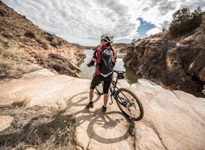
Hike or Bike the South Shore River's Edge Trail
10 mi / 975 ft gainThe South Shore River's Edge Trail runs along the Missouri River. The trail is rated as moderate and is perfect for hiking, trail running, and mountain biking. It's an out-and-back, so you can go as far as you like. To start, park at the South Shore Trail Trailhead (click the Get Directions link ...Read more -
Choteau, Montana
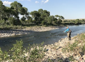
Fly Fish the Sun River South of Choteau
Looking for a place to fish trout that's far less populated than other common fishing spots in the area?The Sun River is over 100 miles long, and about 70 miles of that is available for trout fishing. A good portion of the river is challenging to fish due to accessibility and because of irrigatio...Read more -
Great Falls, Montana
North Shore Rivers Edge Trail East
6.9 mi / 700 ft gainThe North Shore Rivers Edge Trail East is a moderate trail that has been created mostly by the local biking associations. The trail follows the bluffs on the edge of the river with plenty of twists and turns to keep it interesting. To access the East section of the North Shore Rivers Edge trail,...Read more -
Great Falls, Montana
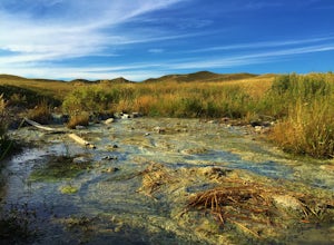
Hike Sulphur Springs Trail
3.32 mi / 278 ft gainYou can find the Sulphur Springs trailhead near the Morony Dam and Reservoir. There's a graveled parking lot, an outhouse and an informative story board to quell your curiosity. For your convenience, I'll give you a Reader's Digest version of the history of this specific area. As we all know, Lew...Read more -
Wolf Creek, Montana
Fly Fish the Missouri River from Holter Dam to Cascade.
5.0Due to the cold water being released from the bottom of Holter Lake, it creates excellent habitat for trout. The section of the Missouri River from Holter Dam to Cascade, MT is the main area for trout fishing, and has excellent access to the river. This section of river runs through the valley w...Read more -
Augusta, Montana
Devil's Glen - Dearborn 206
5.06.19 mi / 554 ft gainDevil's Glen - Dearborn 206 is an out-and-back trail that takes you by a river located near Augusta, Montana.Read more -
Belt, Montana
Sluice Boxes State Park
5.07.71 mi / 643 ft gainThe soaring limestone cliffs and ledges mark the Belt Creek Canyon. Back in the day, this area in the Little Belt Mountains was a haven for mining. Now, the old railroad bed serves as the main access route of Sluice Boxes State Park. Sluice Boxes State Park was established in 1970 and consists o...Read more -
Highwood, Montana
Ride Your Bike Near the Highwood Mountains
40 mi / 3000 ft gainRide across high plains, over rolling hills, or even through mountain passes, all depending on how long you want to ride for. A popular day ride goes from Highwood, MT to Belt, MT and back. This 40-50 mile ride, whether you chose to make it a loop by riding back on a main road, or make it an out...Read more -
Helena, Montana
Four Wheel Drive and then Hike to Historic Mann Gulch
2.4 mi / 1535 ft gainIn 1949, a fire started in a remote area of the Gates of the Mountains wilderness, a gulch east of the Upper Missouri River. Fifteen smokejumpers were dropped in to fight it. Thirteen died. The United States Forest Service drew lessons from the tragedy of the Mann Gulch fire by designing new trai...Read more -
Augusta, Montana
Hike to Cataract Falls
5.00.5 miLocated in the Lewis and Clark National Forest on the Rocky Mountain Front, this hike will give the best bang for your buck -- it's about as easy as they come but still boasts outstanding views. The falls are roaring in the spring with snow melt, tranquil in the summer and fall, and permit some d...Read more -
Lincoln, Montana
Hike the Continental Divide Trail via Roger Pass
2.33 mi / 665 ft gainAfter driving over Rogers Pass more times than I can count, we finally made it a point to stop and check out the Continental Divide Trail No. 440 -- glad we did. If you've driven the pass, you've seen the trail head about 66 miles west of Great Falls -- the wooden stairs off the right side of th...Read more -
Augusta, Montana
Hike to Willow Creek Falls
5.04.5 mi / 1000 ft gainThe hike up Willow Creek Gorge is one of my favorites so far. Unfortunately, because of the terrain and elevation gain, I wouldn't recommend taking young kids but if you do, make sure they're attached to you in some way. There are no services at the trail head, so make sure to bring everything yo...Read more -
Helena, Montana
Explore Refrigerator Canyon
0.5 mi / 100 ft gainThe Refrigerator Canyon Trail is a scenic trail that leads into the Gates of the Mountains Wilderness. While this trail goes back for up to 16 miles, for this adventure, we will focus on the first half-mile of the trail. The first half-mile of Refrigerator Canyon Trail is the most scenic and uniq...Read more -
Augusta, Montana
Hike Crown Mountain, Augusta
8 mi / 4200 ft gainLocated an hour and forty minutes east of Great Falls Montana, Crown Mountain is a fun day hike, and you'll see few if any other people. The nearest town is Augusta and a great place to stop for a burger and beer at Buckhorn Bar afterward. From Augusta, head West on Benchmark Road for 20 miles. ...Read more -
Teton County, Montana
Hike toward Ear Mountain on the Rocky Mountain Front
10 miEar Mountain's trailhead is located about 125 miles north of Helena. Besides being a hefty hike, Ear Mountain's unique shape draws attention to it every year. It has a flat top while also having sheer cliffs on either side. It sticks out from the main walls on the Rocky Mountain Front, and if you...Read more
Top Activities
Camping and Lodging in Sun River

Great Falls, Montana
Great Falls KOA Holiday
Located in an oasis of trees, flowers and gardens, Great Falls KOA offers unique views similar to the ones that Lewis and Clark experienc...
Meagher County, Montana
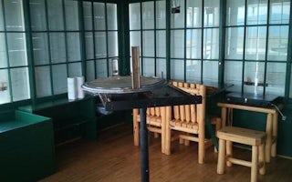
Monument Peak Lookout
Overview
Monument Peak Lookout offers guests an impressive yet rustic room with a view. The lookout, built in 1936 by the Civilian Conser...
Helena, Montana
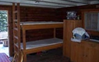
Indian Flats Cabin
Overview
Indian Flats Cabin is nestled in a hollow of old-growth trees in the shadow of Hogback Mountain, offering a remote lodging exper...

