
Hike to Summit of Mount Aeneas
Kalispell, Montana
Details
Distance
6 miles
Elevation Gain
1700 ft
Route Type
Out-and-Back
Description
Added by Katch Silva
Distance: 6 miles round trip. Elevation gain: About 1,700ft. A hidden gem of the Jewel Basin. Amazing views of Glacier National Park, The Bob Marshal Wilderness and The Flathead Valley.
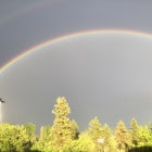
This hike can easily be overlooked since it is in such a geographically rich area, with Glacier National Park and the Bob Marshall Wilderness so close, but it is absolutely a hidden gem that doesn't get enough attention. Mount Aeneas sits at just over 7,500 feet and from the summit it gives amazing 360 degree views of Glacier National Park, the Bob Marshall Wilderness, Flathead Valley, and Hungry Horse Reservoir.
It is classified as a strenuous hike, but the hardest part is about a mile of steep switchbacks, and it's totally worth the workout for the incredible views. Be sure to check the current status of the trail online, because after particularly harsh winters it tends to open pretty late in the season.
The trail starts at Camp Misery in the Jewel Basin behind the closed gate. This is an old service road that goes up for about 1 miles and narrows into trail #717. This part of the trail offers great views of Lodgepole Pine forests with Flathead Valley down below.
After about another half mile, you will reach a junction with three routes. Take the trail that continues on #717, it begins to climb immediately. Soon, the switchbacks begin which you'll follow up towards the ridge-line. You will come to Microwave Tower, a small relay station. You are almost guaranteed to run into mountain goats up here. It's a good spot for a water or snack break.
On this upper ridge-line and beyond is the most scenic part of the hike. Be very careful, especially if the snow is still melting (as was the case when I hiked it), since the ridge-line drops off drastically on one side. There are other ways to come back down, including a loop that takes you on the other side of the summit, along the nearby lakes, but I just did the shorter hike back along the same trail.
Download the Outbound mobile app
Find adventures and camping on the go, share photos, use GPX tracks, and download maps for offline use.
Get the appFeatures
Hike to Summit of Mount Aeneas Reviews

My favorite place to hike in the whole world. I spend hours up here hiking around. Plenty of goats to see and maybe a black bear or two. Absolutely stunning
5.0
I went with a couple friends and it was awesome! Make sure to bring lots of water because there are a lot of tiring parts. I would also recommend to go with a friend because I did see some bear droppings. There were plenty of huckleberries and we ended up picking quite a bit. It does get fairly cold and windy up on the summit so make sure to bring a windbreaker jacket. The picnic lakes at the bottom were crystal clear and beautiful! I hope you enjoy the adventure as well!
5.0

The day could not have been better… Blue sky, warm temperatures and a breeze. Although quite a few hiking parties were on the trail, we never felt crowded. Toward the summit, we ran into several mountain goats… The view from the top is breathtaking. 3 miles up, 3 miles down. Just to be clear.
5.0
Leave No Trace
Always practice Leave No Trace ethics on your adventures and follow local regulations. Please explore responsibly!
Nearby

Backpack to Black Lake

Backpack to Clayton Lake

Flathead Lookout

Aneas Loop

Swim in Graves Bay Swimming Hole

Explore Graves Creek Falls
Community
Mobile Apps

© 2024 The Outbound Collective - Terms of Use - Privacy Policy