Matt Hosford
Travel, Photography, Camping, Skiing, Environmental Consultant, Guitar, Beers, Friends.... Life's good : )
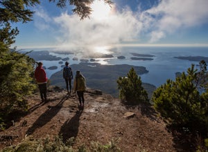
Hike Lone Cone
Tofino, British Columbia
4.1 mi
/ 2400 ft gain
The trailhead for Lone Cone is located on Meares Island, accessible by water taxi ($40 return). Some choose to rent kayaks and paddle to the trailhead. The dock for the water taxi is located at the end of Main St.49°09’12.8”N 125°54’40.5”WThe water taxi is roughly 15 minutes and travels across the inlet. Keep an eye out for whales and otters! Once at the dock follow the dirt road for 10 minutes...
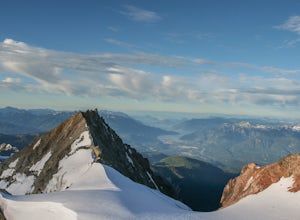
Climb Mt. Garibaldi
Squamish-Lillooet, British Columbia
12.5 mi
/ 4350 ft gain
Duration: 2 DaysClosed Gate (described below): 49.831834, -123.088424Camp Ground: 49.855926, -123.016797
Driving north from Vancouver along the Sea to Sky Highway (HWY 99) pass through Squamish. Turn right on to Cat Lake Road (Cheekye FSR).49°48’52.6”N 123°07’25.5”W
From here the route becomes a logging road and is not well maintained. High clearance is necessary for this road. Follow Cheekye...
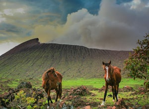
Hike up Volcan Telica
San Jacinto, Nicaragua
12.5 mi
/ 2600 ft gain
Due to the logistical issues of this trip (i.e. camping gear, route finding, transportation, language barrier) many travelers choose go with a guided group. Quetzaltrekkers offer this 2 day trip for $55 US. With the right gear, it would be possible to do this trip without one.The journey begins at the local bus station in the town of Leon. Take a chicken bus (local bus) 30 minutes to San Jacint...
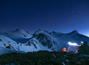
Winter Traversing of Spearhead
Whistler, British Columbia
1.0
21.7 mi
/ 6560 ft gain
Distance: 21.7 miles / 35 kmDuration: 1 - 3 DaysElevation Gain: ~ 6560 ft. / 2000 m.
Take the Sea to Sky Highway (HWY 99) up to Whistler.50°06’48.9”N122°57’13.8”W
Turn right off the highway at the Village Gate Boulevard, then left at the 3 way stop at Blackcomb Way. The entrance to the parking area is the next right. Day parking is allowed anywhere in these lots. Overnight parking can be foun...
Backpack to Lake Lovely Water
Squamish, British Columbia
3.7
6.24 mi
/ 3714 ft gain
This adventure is one of the best kept secrets in the Whistler area, let alone, British Columbia. The trailhead for Lake Lovely Water is located on the west side of the Squamish River. There is no road access to the trailhead so you need to cross the river via boat. Make reservations with the jet boat operation prior to the trip. There is overnight parking in the parking lot across from The Wat...
Panorama Ridge
Whistler, British Columbia
4.8
17.17 mi
/ 5289 ft gain
Take the Sea to Sky Highway (HWY 99) north from Vancouver up towards Whistler. Turn off the highway about 30 minutes before Whistler Village onto Daisy Lake Road. There are signs along the highway indicating the Garibaldi Lake turn off. The trailhead is located at the end of Daisy Lake Road. There is day and overnight parking available here ($10 for overnight parking).
The trail is very well m...
Hiking the Howe Sound Crest Trail
West Vancouver, British Columbia
18 mi
/ 6000 ft gain
Distance: 18 miles / 29 kms.Duration: 1 - 3 DaysElevation Gain: 6000 ft. / 1800 m.Magnesia Meadows: 49.483708, -123.190377The Howe Sound Crest Trail (HSCT) is one of the most epic hiking trips one can do in the Vancouver area. The trail is entirely located within the Cypress Mountain Provincial Park. The route follows the ridge line along the Howe Sound from Cypress Mountain to Porteau Cove (so...
Hike Mt. Brunswick
Lions Bay, British Columbia
5.0
8.75 mi
/ 5100 ft gain
Driving north from Vancouver along the Sea to Sky Highway (HWY 99) turn off at Lions Bay exit and park at the end of Sunset Dr.N 49.470653225392105, -123.23479324579239 WThe trail begins on a gravel service road which winds up for 30 minutes. Take a left at the fork where a sign on the tree reads “Mt. Brunswick”.The trails flattens out on an overgrown service road for 20 minutes. Shortly after ...
Camp in Golden Ears Provincial Park
Maple Ridge, British Columbia
11.2 mi
/ 3937 ft gain
Backcountry permits are required to camp on Panorama Ridge ($5) and can be paid online.The trailhead is located at the West Canyon Parking lot. The trail starts out on a relatively flat old logging road. The trail slowly gains elevation over three kilometers taking you through thick green forest and carpets of dense ferns.At the 3 km marker (1.86 miles) you come to a fork. The right descends do...
Hike Volcan Acatenango
Acatenango, Guatemala
5.0
11 mi
/ 5150 ft gain
If you enjoy stunning views with volcanoes spewing lava while camping in a volcanoes crater at 13,000 ft, then this is the adventure for you.There are a number of tour companies in Antigua that offer day and overnight trips up Volcan Acatenango. They will plan the logistics and supply all the camping gear you need. With that being said, it is possible to go without a guide.The trail head is loc...
Backpack Observation Mountain
Yukon, Unorganized, Yukon Territory
42.3 mi
/ 6233.6 ft gain
This trip is within the Kluane National Park and Reserve. The park is neighboured by BC’s Tatshenshini-Alsek Provincial Park and Alaska’s Glacier Bay / Wrangle St Elias National Parks to cover roughly 110 000 km2 of some of the last truly untouched wilderness on this planet.The park is very rugged with only a small portion of it accessible. Many of the peaks remain unclimbed and some still unna...
Community
© 2024 The Outbound Collective - Terms of Use - Privacy Policy

