
Bridge to Nowhere via East Fork Trail
La Verne, California
Details
Distance
9.65 miles
Elevation Gain
1798 ft
Route Type
Out-and-Back
Description
Added by Ben Lertsakdadet
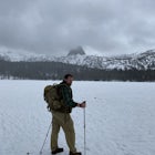
Bridge to Nowhere is an almost 10-mile round-trip hike with about 900 feet in elevation gain. You’ll have to cross the river a few times. Be careful when stepping on rocks and fording during rainy months. Enjoy the swimming hole and picturesque bridge once you arrive at the end of the trail. Duration: 5-6 hours.
The trail on this 10-mile hike is predominately slow and steady, but can be a little rocky, so be prepared to scramble. When you’re fording the river, the water level can range from knee to chest high, especially in the wet months. A good pair of waterproof hiking boots is helpful, but water shoes can offer value when the water is really high. You will run into river crossings early in the trail, so just remember that you’ve got quite a bit to hike afterward.
Keep in mind that this trail gets popular especially during the summer months. It’s best to arrive early if you’re hoping to park in the lot. If you arrive a little too late, you can park along the road near the trailhead.
To start the hike, head up the dirt road toward Heaton Flats Trail Camp. From here, you’ll continue on the Bridge to Nowhere Trail. The only junction you’ll pass is at the camp. Keep heading up the Bridge to Nowhere Trail and be prepared for a few river crossings as well as a bit of boulder scrambling.
Once you reach the bridge, reward yourself with the swimming hole that’s a steep 0.1 miles downhill once you pass the bridge. Take a dip and relax before your hike back.
Don't forget your wilderness permit / adventure pass.
Download the Outbound mobile app
Find adventures and camping on the go, share photos, use GPX tracks, and download maps for offline use.
Get the appFeatures
Bridge to Nowhere via East Fork Trail Reviews

The crowds can be tough here. For detailed hike directions, check out my post here: https://hikingguy.com/hiking-trails/best-la-hikes/bridge-to-nowhere-hike/
4.0

This is an amazing hike. The only difficult part is staying on the trail, as it can be pretty confusing! There seem to always be people on the trail, so its very hard to get lost. Be prepared to get your feet wet as there are a lot of river crossings. If you're feeling up for it, and the water level isn't too high, I definitely recommend hiking down below the bridge. Beautiful vantage point of the bridge, and fun to explore the river below!
5.0
Or bring a LifeStraw (or similar). The terrain can be pretty difficult, and if you have a late start and it's warm, that'll only up the difficulty. It's an awesome hike there and back, my gripe is that sometimes you can lose sight of any discernible trail, and, well, there IS somewhere when you get nowhere. That somewhere is a bungee jump station.
4.0
Leave No Trace
Always practice Leave No Trace ethics on your adventures and follow local regulations. Please explore responsibly!
Nearby

Cattle Canyon Trail

Sunset Peak via South Trailhead

Smith Mountain Trail
")
Stoddard Canyon Falls (Baldy Slide Waterfall)

Stoddard Peak Trail

Lewis Falls
Community
Mobile Apps

© 2024 The Outbound Collective - Terms of Use - Privacy Policy