
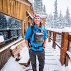
Jason HatfieldExplorer
Adventure and travel photographer based out of Denver, Colorado. I teach photography workshops and offer private guiding around the west. More at jasonjhatfield.com

Photograph Bear Lake
Estes Park, Colorado
4.6
Bear Lake is a popular tourist destination in Rocky Mountain NP, but when the sun is low in the sky or the stars are out you'll find the big crowd are gone. The lake is beautiful at sunrise and sunset but especially photogenic in the fall or at winter's end. While it doesn't have the darkest night skies it can still serve as an excellent location to watch meteors or photograph star trails abov...

Photograph the Night Sky Over Trail Ridge Road
Estes Park, Colorado
4.0
The highest continuous paved road in North America, Trail Ridge Road takes you above 12,000 ft to an alpine tundra. Being above treeline means you have unclogged panoramic views of the night sky and any possible meteors. You can start your trip from Grand Lake in the west or Estes Park in the east. There will be some light pollution at night from the towns, but it's subtle enough to add intere...

Ski to Fowler-Hilliard Hut
Red Cliff, Colorado
6.5 mi
/ 2500 ft gain
Fowler-Hilliard hut sits at 11,500 ft on a forested ridge of Resolution Mountain, with easy access to intermediate and expert backcountry skiing right out the door. This newer hut was built in 2010 after the original hut burned down from a lightning strike. The hut comes stocked with padded mattresses, wood stoves & fuel, propane burners, all cookware and utensils, some games/puzzles/books,...

Ski Hut-to-Hut from Uncle Bud's to Skinner Hut
Leadville, Colorado
5.0
24.5 mi
/ 4700 ft gain
The trek starts just outside of Leadville near Turquoise Lake at 9800 ft. The first day you'll travel 6.5 miles and gain 1700 ft. to Uncle Bud's Hut, which sits around 11,400 ft. The second day you'll ski 7.1 miles to Skinner Hut and gain 2100 ft, mostly in the last 3 miles after having dropped back down to 10,000 ft in the valley; the hut sits around 11,600 ft. The third day is 10.9 miles ...

Hike the Yurok Loop Trail
Klamath, California
4.0
1 mi
/ 20 ft gain
The Yurok Loop Trail is a small loop on the northern end of the growing California Coastal Trail. This family-friendly hike starts at a picturesque lagoon near False Klamath Cove before crossing a bridge and entering the Sitka spruce forest. From the trail junction, you have the choice of passing deeper into the forest on the left or heading to views of the Pacific Ocean and towering sea stack...

Run the 4-Pass Loop in the Maroon Bells-Snowmass Wilderness
Aspen, Colorado
27.1 mi
/ 8000 ft gain
*The 4-Pass Loop likely won't be doable until July due to the heavy snowpack this year and wet slide danger on the steep pass approaches.Taking on the 4-pass Loop is no easy feat but completely worth the training and effort. The run starts at Maroon Lake and heads up to Crater Lake where the loop splits left or right. Counter-clockwise is the preferred direction as it allows you to tackle the...

Hike the Canyon View Nature Trail, Castlewood Canyon
Franktown, Colorado
4.5
2.4 mi
This is a well maintained, easy trail best hiked in spring and fall. Conditions make this trail great for families. The park is also popular for bird watching and rock climbing.

Estes Cone
Estes Park, Colorado
4.0
8.22 mi
/ 2275 ft gain
The trail begins on the left on a park service road before reaching a junction with the Storm Pass Trail just past .2 miles. Follow the trail as it enters the forest and continue past the private property signs and over a footbridge. Past the bridge the trail climbs more steadily for just under 2 miles before becoming more moderate again around 10,050 feet.
Just after 3 miles you'll reach ano...

Photograph the Northern Lights at Jökulsárlón
Þjóðvegur, Iceland
5.0
Jökulsárlón is a night photographer's paradise with "fresh" iceberg subjects washed up on the beaches daily, providing unique images every time. The glacial lagoon is full of much larger icebergs that can be harder to photograph due to the changing tides, but it's well worth the effort. When photographing the aurora a fast lens and high ISO are key, and a partial moon can provide light for th...

Explore Heceta Head Lighthouse State Scenic Viewpoint
Florence, Oregon
5.0
1 mi
/ 150 ft gain
At the mouth of Cape Creek sits a beautiful cove with one of the best views in Oregon. Above the sandy beach and sea stacks, rises the Heceta Head Lighthouse, a 100-year-old+ structure that's been laboriously restored and kept in working condition. At night, this quiet piece of the Oregon coast gains a magical quality as the sound of distant crashing waves mixes with the sight of stars overhead...

Tour Jewel Cave
Custer, South Dakota
4.0
0.5 mi
/ 20 ft gain
Established in 1908, Jewel Cave National Monument is home to over 179 miles of mapped cave passages. The cave features larger chambers and more interesting formations then nearby Wind Cave NP, and much of it is covered in spar crystals.A guided tour is the only way to see the cave system unless you are in the park's limited volunteer cave exploring group. Depending on the time of year, up to 4...

Tour Wind Cave
Hot Springs, South Dakota
4.8
0.67 mi
/ 6 ft gain
Established in 1903, Wind Cave National Park is home to over 140 miles of mapped cave passages. The cave features 95% of the world's known boxwork calcite formations and got its name from the sound of rushing wind created at its few small openings.A guided tour is the only way to see the cave system unless you are in the park's limited volunteer cave exploring group. Depending on the time of y...

Explore Pragser Wildsee
Braies, Italy
4.0
2.2 mi
/ 400 ft gain
Pragser Wildsee, also known as Lago di Braies, lies in a mostly German-speaking area of northern Italy close to the border with Austria. This glacial blue lake is surrounded by towering mountains and thick evergreen forests, which can be experienced on the 2.2-mile loop trail or Alta Via 1 trail. A photogenic boathouse offers canoe rentals to enjoy the lake in the warmer months while winter off...

Ski or Snowshoe to Section House Hut
Breckenridge, Colorado
5.0
6.25 mi
/ 1200 ft gain
There are a couple routes to Section Hut on Boreas Pass, but the best adds trekking through the forest on Baker's Tank trail. Starting at 10,350' at the TH, look for a trail in the woods that starts climbing relatively quickly. Follow this for about 2.5 miles to the junction with the road and Baker's Tank, a historic water tank for the old rail line. From here you slog up the road for 3.5 mi...

Ski to Janet's Cabin
Frisco, Colorado
6 mi
/ 1900 ft gain
Janet's Cabin is located on the eastern slope of the Continental Divide at 11,610 ft, near Copper Mountain ski resort. This hut is one of the rare huts with not only a sauna but indoor bathrooms (composting pits)! The cabin was built in 1990 and due to the location helicopters were required to bring in materials; I recommend reading about the construction issues and helicopter crashes while bu...

Run Rim-to-Rim-to-Rim in the Grand Canyon
Grand Canyon Village, Arizona
5.0
40.79 mi
/ 11000 ft gain
This run is an extreme adventure and requires lots of planning and training. The risk for injury or heat related illness is high, so take precautions and don't run alone. Group sizes of 12-30 require a $175 permit from the NPS. These trails are popular with runners, hikers, and backpackers; please be respectful on the trail.
There are a few ways to run R2R2R, with the popular option being d...

Capture the Night Sky over Devils Tower
Devils Tower, Wyoming
5.0
Devils Tower, also known as Bear Lodge, was the first designated National Monument. Sitting on the edge of the Black Hills, the towering formation of rock is surrounded by ponderosa forest and little civilization. There are numerous places to photograph the night sky in the park, with Tower Trail and W Road providing the best viewpoints. If you plan to light paint the tower you'll need a ver...

Ptarmigan Lake via Bear Lake Trailhead
Estes Park, Colorado
11.33 mi
/ 3850 ft gain
The hike to Ptarmigan Lake has plenty of elevation gain for mountain lovers and views for miles from the Continental Divide. If you want to reach this spot for sunrise you'll need a very early start in the morning, but that also means you won't have to use the shuttle system to Bear Lake. The last half mile of the hike is off-trail so make sure to watch your step and practice Leave No Trace Pri...

Snowshoe Deer Creek Canyon Park
Littleton, Colorado
5.1 mi
/ 1250 ft gain
Deer Creek Canyon Park offers up to 13 miles of wind-sheltered trails perfect for enjoying after a fresh snow. The Plymouth Mountain Trail offers steep climbs and big views while Homesteader Trail offers the best forest scenery in the Denver area. The recommended route is Plymouth Creek Trail to Homesteader Trail and back. The climb up the canyon from the TH can be steep and icy so more aggress...

Camp at Hamburger Rock
Moab, UtahHamburger Rock is a small BLM campground with 10 sites based around an interesting rock outcropping. Each site can accommodate around 6 campers, 2 tents, and 2 cars. The bathrooms here are very basic, open-top pits, and no other services are offered. Camping fees are only $6/night.

Photograph Ancient Bristlecone Pines on Mt. Goliath
Evergreen, Colorado
5.0
On the way to the summit of Mt. Evans sits a small 160 acre preserve of some of the world's oldest living trees. The Mount Goliath Natural Area protects a rare site of Bristlecone Pines that make excellent photographic subjects.Immediately after parking you're surrounded by a miniature forest full of gnarly twisted shapes. While there are many interesting trees close to the small visitor center...

Photograph the Rio Grande Gorge Bridge
El Prado, New Mexico
4.6
Completed in 1965, the Rio Grande Gorge Bridge is the seventh highest bridge in the United States. The design is a steel deck arch bridge than spans 1280 feet and sits 565 feet high. The bridge has sidewalks and viewpoints of the gorge on each side with parking at the Rio Grande Gorge Rest Area providing the best access. To photograph the bridge and gorge take the trail south of the rest area a...

Visit Kamiak Butte Park
Palouse, Washington
4.0
3.5 mi
/ 900 ft gain
Formerly a Washington State Park, Kamiak Butte County Park is a hidden treasure on the eastern border of the state. An "ecological island" rising more than 800 ft from the surrounding hills of Palouse, the butte is home to a high country desert on its southern side and a lush forest on its shaded northern side. The park features a 3.5 mile loop trail that takes you to the summit of the butte w...

Run the Crag Crest Loop
Cedaredge, Colorado
4.3
10.4 mi
/ 1500 ft gain
The Crag Crest Trail is a 10-mile loop that takes runners over one of the highest points on Grand Mesa. When traveling in a clockwise direction, the trail traverses a narrow rocky ridge for 5-miles before descending into the dense pine forest below. Grand Mesa's trails are less maintained due to a smaller number of visitors, so be prepared to encounter fallen trees and overgrown sections. Despi...
Community
Mobile Apps

© 2024 The Outbound Collective - Terms of Use - Privacy Policy