
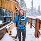
Jason HatfieldExplorer
Adventure and travel photographer based out of Denver, Colorado. I teach photography workshops and offer private guiding around the west. More at jasonjhatfield.com

Angels Landing
Springdale, Utah
4.7
4.24 mi
/ 1488 ft gain
Angels Landing has long been one of my favorite Zion National Park hikes. The hike is thrilling, extremely photogenic, and appeals to those who enjoy exchanging leg power for views. The hike to the top isn't long, 2+ miles, but you'll definitely feel the 1500 feet of gain! The trail features a mostly paved surface (to protect from erosion and high use), steep switch backs, a cool canyon, rock s...

Havasu Falls in the Havasupai Reservation
Supai, Arizona
4.7
10.4 mi
/ 1647 ft gain
The Havasupai Reservation is a remote area just outside Grand Canyon National Park, full of blue-green water and dramatic waterfalls. Despite being an extremely isolated location, camping in the canyon is overwhelmingly popular and reservations are required. On popular weekends you will be sharing the campgrounds with hundreds of others but shoulder seasons can bring some respite.
The trail ...

The Narrows, Zion NP
Springdale, Utah
4.9
9.73 mi
Hiking the narrows in Zion National Park is one of my favorite hikes and something I return for almost every year, I can still remember my first visit as a kid. There's no other place like it in the National Park system and the stunning beauty of its towering walls and vibrant river make it a top destination for visitors to the park.
Depending on the water level most of this hike is partially...

Camp at Rio Grande del Norte National Monument
Questa, New Mexico
4.3
2.4 mi
/ 800 ft gain
Created in 2013 from partly existing public lands, The Rio Grande del Norte National Monument encompasses a large amount of land along the Rio Grande River from the Colorado border to south of Taos. Far from any major city, you'll likely enjoy trails to yourself in the morning and few other visitors in the off-season. One of the main activities offered on the monument is white water rafting, bu...

Explore Ash Cave
South Bloomingville, Ohio
5.0
0.5 mi
Getting to Ash Cave is extremely easy with a short quarter-mile hike from the parking area; there's also a rim trail above the cave that adds 90 feet of elevation and some extra distance. The cave is great for relaxing in the shade during a hot day, enjoying a spring picnic, or grabbing some images during the morning/evening. There's a waterfall from the rim of the cave that typically has good ...

Explore Avalanche Creek
West Glacier, Montana
5.0
0.7 mi
Avalanche Creek is one of Glacier National Park's easiest features to access and also one of its most unique. The old-growth cedar forest is home to towering trees, moss-covered boulders, and a rushing stream of glacial water. A small loop trail winds through the lower forest and leads to a bridge with views of a canyon carved by the creek. The best spot to photograph the canyon is at the be...

Explore Echo Lake Park
Idaho Springs, Colorado
4.0
1.2 mi
/ 88 ft gain
Located at the base of Mt. Evans Road, Echo Lake sits next to Squaw Pass Road, providing a great jumping-off point for numerous adventures. The park serves as a trailhead for hiking or snowshoeing into the Mount Evans Wilderness, offers picnic areas, and includes a nearby campground with 17 sites. The area has dark night skies for photographing the Milky Way, and when the lake is frozen inter...

Run the Bryce Canyon Traverse
Kane County, Utah
1.0
30.3 mi
/ 6600 ft gain
The Bryce Canyon Traverse is a point-to-point run covering over 30 miles from Rainbow Point at the southern end of the park to Sunrise Point at the North. The majority of the run is on the remote Under-the-Rim Trail where you might pass the occasional backpacker, but won't find a tourist group for miles. To coordinate this run, you'll need to work in a group to stage cars at the start and fini...

Explore Red Rocks Park in Winter
Morrison, Colorado
4.3
Red Rocks is a bustling park in the summer when its famous amphitheater is filled with concerts. In winter though, the park dies down and becomes even more quiet when snow is falling. Grab your camera and head to the park during a winter storm to truly enjoy the beautiful red sandstone formations capped with contrasting powder. Parking is available throughout the area with the Trading Post bein...

Capture Sunrise from Lookout Mountain
Golden, Colorado
3.7
Lookout Mountain sits just above Golden and provides one of the best easy-access viewpoints near Denver. The mountain provides numerous vantage spots along the road up, with the best at a rock outcropping just below Buffalo Bill's Gravesite & Museum (with easy parking).If you're hoping to catch a sunrise above the clouds, wait for a foggy winter inversion and head to the top. You can also...

Photograph the Glade Creek Grist Mill
Danese, West Virginia
5.0
Hidden deep in the Appalachian Mountains near the New River Gorge sits an extremely photogenic grist mill. A recreation of the original mills that dotted West Virginia, Glade Creek Grist Mill was completed in 1976 at Babcock SP. Built fully operational from the parts of 3 other WV mills, it was placed near the site of the former Cooper's Mill.Fall is the ideal time for photographing the park, b...

Explore Nellie Creek Falls
Lake City, Colorado
5.0
0.8 mi
/ 300 ft gain
Nellie Creek Falls is a beautiful little falls, up County Road 23. The waterfall is surrounded by a forest of aspens leading up the valley. To get to the falls take the northern route of the Alpine Loop from Lake City towards Engineer Pass. In about 5 miles you come to Nellie Creek Road on the right. The waterfall is just under a mile up the road, which you'll need a high-clearance 4WD vehicle ...

Capture Sunrise or Sunset at Lake McDonald
West Glacier, Montana
5.0
Lake McDonald doesn't offer the close-up views of glaciers and mountains like some of the other spots in Glacier NP, but it does offer sweeping views of park's west side. The most popular spot to photograph this grand perspective is along the southwest beach and dock. The dock makes the most interesting subject, but after parking walk along the shore and look for interesting rocks or boats to...

Alberta Falls Trail
Estes Park, Colorado
4.0
1.66 mi
/ 200 ft gain
Heading into the park from Beaver Meadows Entrance Station turn left at the first road in .2 miles. Follow Bear Lake Road for 8 miles until reaching the Glacier Gorge parking area on the left. Take the trail from the parking area and follow it to the intersection with the Sprague Lake Trail. Stay straight on the trail and turn left at the next intersection with the Bear Lake connector trail (Yo...

Photograph Santa Maddalena Church in the Dolomites
Villnöß, Italy
3.0
Santa Maddalena, also known as St. Magdalena, is a picturesque medieval church sequestered in the northern mountains of Italy. The Odle Mountain Group of the Dolomites tower above the surrounding valley and provide an incredible backdrop for images. To reach the best vantage point to photograph Santa Maddalena, start from the spot marked on the map and follow the small trail a short way up th...

Explore Needles Overlook
Monticello, UtahAbout 1.5 hours from Moab on BLM land, Needles Overlook sits on a peninsula of rock 1600 ft. above southern Canyonlands NP. The views from here are just as commanding as Island in the Sky in Canyonlands, but with a lot fewer people due to its isolated location; there's a good chance you'll have the whole place to yourself. The overlook is fairly expansive and offers a plethora of views along ...

Photograph Abraham Lake in the Winter
Clearwater County, AlbertaAbraham Lake is one of the Canadian Rockies most incredible winter photography locations. The 32 km long reservoir is full of numerous opportunities for exploring and photographing frozen ice, flowing rivers, and the surrounding dramatic peaks. Due to it's general North/South alignment, it's also the perfect spot for photographing the northern lights during auroral activity of Kp 4 or higher.
...

Capture Sunrise at Dead Horse Point SP
Moab, Utah
5.0
Dead Horse Point State Park sits next to Canyonlands National Park with expansive views of the canyons carved by the Colorado River. The park can be accessed year-round and the best views are within feet of the parking lot. To capture the warm light of sunrise on the red rocks, head for the western rim and look for interesting trees to include in your foreground. Most of the area does not ha...

Photograph St. Johann Church
Funes, Italy
5.0
This small church sits in a cow pasture just outside of Puez-Geisler Nature Park. The church is next to a hotel, making parking and visiting a little easier. To get the best vantage point of the church and mountains, walk down the road and shoot through the fence. The mountains are fairly luminous, so you'll want to bracket your shots.

Camp at Big Basin Redwoods State Park
Boulder Creek, California
4.0
0.5 mi
Big Basin is currently closed including the campgrounds. Please visit the Parks.ca.gov site for updated details.
An hour away from the thrumming city of San Jose, ancient immense trees live in a forest full of vibrant ferns and rushing waterfalls. Big Basin Redwoods State Park encompasses 10,000 acres of rare old-growth forest, and the scale of time can be most felt when wandering its paths. ...

McNamara Hut
Aspen, Colorado
5.0
12.46 mi
/ 2631 ft gain
McNamara Hut sits in the national forest on the slope of Bald Knob, with easy access to intermediate backcountry skiing and more challenging terrain further away. Built in 1982, it's one of the original huts in the 10th Mountain Division system along with Margy's Hut. The hut comes stocked with padded mattresses, wood stoves & fuel, propane burners, all cookware and utensils, some games/p...

Ski or Snowshoe to Vance's Cabin
Leadville, Colorado
3.1 mi
/ 750 ft gain
Vance's Cabin is a private hut near Tennessee Pass booked by the 10th mountain division. The hut was completed in 1988 and sleeps 16; 6 beds upstairs in a loft and 10 bunk beds downstairs in a communal bunked area around the wood stove.
It's a compact cabin compared to some of the other huts in the system but there's still enough space. The hut comes stocked with padded mattresses, wood &...

Explore Mesa Top Loop
Mesa Verde National Park, Colorado
4.5
The 6-mile Mesa Top Loop Road, open 8 am to sunset, stops at 12 sites including surface ruins and cliff dwelling overlooks. The most famous feature of the park, Cliff Palace, is visible from the Sun Point and Sun Temple overlooks. Sunrise photography isn't possible on the loop due to operating hours, but stunning sunsets can be captured from the cliff trails before the road closes.

Explore the Rogue River Gorge
Prospect, Oregon
5.0
This 500 ft. long gorge carved out of an old lava tube sits right along highway 62 near Crater Lake. The original road that brought travelers to the National Park passed right next to the gorge but it now remains hidden from view of the current highway. The area isn't large but has a nice parking area and 500 ft. long paved trail that follows right along the edge. At the head of the gorge sits...
Community
Mobile Apps

© 2024 The Outbound Collective - Terms of Use - Privacy Policy