

Run the Ironweed Trail in Glacier Ridge Metro Park
Plain City, Ohio
4.0
2.8 mi
From the main entrance on the north side of the park, the Ironweed Trail connects the northern, more wooded section of the park with the wetlands to the south. This 2.8 mile one-way trail is paved, making cycling, running, and hiking an easy activity. The topography of the park also makes it easy, as very little elevation change occurs, aside from a slight hill that represents the remnants of t...

Explore the Rock House
Laurelville, Ohio
5.0
0.5 mi
/ 150 ft gain
From the Rock House parking lot, follow the trail for 0.1 mile down the hill until you come to a fork in the trail, at which point follow the yellow marked Lower Rim Trail that continues downhill through a set of carved sandstone steps and then turns to parallel the cliffs. From there, it's less than a 0.1 mile to the entrance of Rock House.Once inside Rock House, be certain to note just how hu...

Photograph Indian Run Falls
Dublin, Ohio
4.0
1 mi
Indian Run Falls is a family friendly destination for the metro lifestyle. Sitting just outside downtown Dublin, the falls are easily accessible from the nearby parking lot, with the roar of the fall audible as soon as you get out of your car. For those seeking a hike, there is a 1/2 mile trail that leads to SR 745 near the Scioto River following the top of the cliffs that Indian Run carves.Be ...

Hike to Cedar Cliff Falls
Cedarville, Ohio
4.4
2.6 mi
/ 250 ft gain
Starting from the Indian Mound Reserve parking lot, follow the private drive back until the signs indicate to follow the trail through the woods to the right, about 1/4 mile. Make sure you stay right of the painted yellow line on the road, trespassers on the private land surrounding the park are not tolerated. From there, the trail winds for 1/3 of a mile until the trail forks into two distinct...

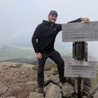
Photograph Mt. Jeez
Perrysville, Ohio
3.0
While it might not seem like much, Mt. Jeez stands 1,310' feet above sea level, making it one of the higher "peaks" in Ohio. Because of that, it's one of the few spots in the Buckeye State that allow for grand, sweeping vistas with a 270 degree view for a few miles in most directions. Originally named Poverty's Knob, it earned its now modern-day name mainly because of the difficulty of climbing...

Hike to Red Granite Falls
Mellen, Wisconsin
2.5 mi
/ 100 ft gain
Starting at the parking lot for Loon Lake, follow the signs for Red Granite Falls across a grassed yard and into the woods. The trail is a wide, well-maintained gravel trail that creates a figure-eight loop as it crosses itself twice.
Halfway along the trail (regardless of which loop direction you take) you end up along the Bad River, and can hear the roar of Red Granite Falls. Several small tr...

Hike the Joan Jones Portman Trail
West Union, Ohio
1.6 mi
/ 405 ft gain
Located right off the road next to an old shed, across the road from the main pavilion and barn, the trailhead for the Joan Jones Portman Trail winds upwards 0.8 miles one way across a creek and through a narrow section of prairie clinging to the hillsides of Southern Ohio. This is one of the steeper trails in Ohio (it actually has switchbacks!), gaining over 400' in less than a mile. The payof...

Hike the Buzzard Roost Trail
West Union, Ohio
4.4 mi
/ 450 ft gain
Owned and operated by The Nature Conservancy, Ohio's Edge of Appalachia Preserve is home to over 19,000 acres of protected wilderness and rugged Appalachian terrain. And the greatest prize of the preserve is none other than the Buzzards Roost.Perched atop a slab of resistant limestone roughly 500' above the valley of Brush Creek, the Buzzards Roost has a nearly 180 degree view of the surroundin...

Kayak Camp on Panther Key
Naples, FloridaTo reach Panther Key, kayaking and navigation of the tides and mangrove islands is a necessity. The Everglades National Park ranger station in Everglades City is the closest put-in point for kayaks, and from there its a 12 mile paddle to Panther Key.This is a great adventure on which to visit multiple keys to stop and camp on, to make the paddling distance each day more manageable. Tiger Key wi...

Hike to Rose Lake
Logan, Ohio
5.0
3 mi
/ 150 ft gain
Starting at the main parking lot for Old Man's Cave and the Hocking Hills, follow the Gorge Overlook Trail from the Visitor's Center, staying on top of the rim. About 0.1 mile from the Visitor Center, you'll cross over the gorge on a large trussed bridge. Once across, follow the signs that direct towards Cedar Falls. Posts with an inset red strip routered into the top of them mark the trail. Fr...

Hike the Quarry Rim-Chestnut Trail
Heath, Ohio
5.0
6 mi
/ 400 ft gain
Starting at the eastern trailhead off of Gratiot Rd, follow the paved Blackhand Trail for 0.2 mile till you arrive at the sign of the Quarry Rim Trail, a 0.9 mile trail that roughly parallels the bike trail, but takes you along the rim of the old sandstone quarry that was in operation in the late 1800's, as a source for sand for nearby glass factories. After the Quarry Rim Trail, a short 0.1 mi...

Hike the Shawnee Ridge Trail
Chillicothe, Ohio
10 mi
Starting at the northern parking lot, head south along the Shawnee Ridge Trail. Several spur and loop trails intersect the trail along the 10 mile out-and-back hike. Many of these spur trails include difficult hikes up large hills like Sugarloaf Mountain, Sand Hill, and Mt. Ives. At each trail intersection, there is a detailed map of the park with color-coordinated trails and a lettering system...

Clifton Gorge
Yellow Springs, Ohio
4.0
2.5 mi
/ 118 ft gain
The entirety of this hike is within the Clifton Gorge State Nature Preserve, a protected park with strict restrictions on off-trail travel with pets prohibited.
Starting at the parking lot off of Jackson St, follow the trail northwest along the narrows of Clifton Gorge. Here, the river has carved a deep chasm into the limestone bedrock, with the river being anywhere from 40-60 feet below the t...

Explore Ohio Caverns
West Liberty, Ohio
4.8
1 mi
/ 80 ft gain
Ohio Caverns is a locally owned private establishment with guided tours through the cave system that lies beneath the rolling farmland of Central Western Ohio. The caves were formed by the dissolution of the Devonian limestone bedrock below, giving way to some of the most phenomenal cave features in the state, including the Crystal King, a roughly 400 lb stalactite that is the largest in Ohio.A...

Hike the North Rim of the Little Miami River
Yellow Springs, Ohio
4.5
2.7 mi
/ 250 ft gain
Starting at the lower parking lot, follow the signs that direct you to the trails near the shelterhouse. Within 0.2 of a mile the trail forks; follow the left fork heading east along the Little Miami River. This is the Pittsburgh-Cincinnati Stagecoach Trail, which for 1.3 miles winds its way along the banks of the Little Miami, and rises above it in several places for some beautiful views of th...

Hike to Ramona Lake
Rockbridge, Ohio
11 mi
/ 1600 ft gain
Starting at the Creekside Meadows Parking Lot, follow the Creekside Meadows Trail for 0.3 of a mile until it forks into two trails. Follow the left fork towards the road, and as soon as you cross the road, the Cemetery Ridge Trail begins. Once across Clear Creek Road, the trail gains elevation fast, with the first 1/4 mile gaining almost 400 ft. From there, the trail follows the ridge line, pas...

Hike the Devil's Punch Bowl
Waveland, Indiana
4.0
1.5 mi
/ 320 ft gain
Starting at the central parking lot near the pond, follow the signs for Trail 1, which will take you down through a set of steps and boardwalks to the bottom of a steep canyon. From there, simply follow the canyon downstream.
The canyon trail terminates at Silver Cascade Falls, a unique convex waterfall that flows over a series of siltstone before dropping to the river valley floor below. From...

Hike the Mineral Fork Trail
Salt Lake City, Utah
4.0
9.3 mi
/ 3500 ft gain
The trailhead begins along Big Cottonwood Canyon Road, with a relatively small parking lot at the trailhead. Starting early in the day is advised, as on nice summer days it will fill up quickly. The trail has a steady ascent for the first 2 miles starting around 6700' through aspen forests and criss-crosses streams as it makes its way up the valley.After 2 miles the valley opens up into a wide ...

Spruce Knob Observation Tower
Riverton, West Virginia
4.5
0.34 mi
/ 33 ft gain
Driving to the top of Spruce Mountain is perhaps the most difficult part of the journey. Once at the top of Spruce Mountain, park and head south along a short, 0.2 mile long trail that leads to the official state highpoint of Spruce Knob. Be sure to find the USGS marker near the base of the observation tower off to the left side of the gravel trail, anchored in cement. The observation tower at ...
Community
Mobile Apps

© 2024 The Outbound Collective - Terms of Use - Privacy Policy