
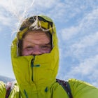
Grays and Torreys Peaks
Silver Plume, Colorado
Details
Distance
7.97 miles
Elevation Gain
3458 ft
Route Type
Out-and-Back
Description
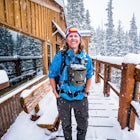
Added by Amy Kesic
Climb up Colorado's 9th and 11th tallest peaks - both 14ers. Total trek is 8.5 miles roundtrip. Total elevation gain of 3600'Duration: Full day or overnight.
At about an hour's drive from Denver, Grays Peak (14,270 ft./4338m) and its sister mountain, Torreys Peak (14,267 ft./4337m), are two of the most popular 14ers in the state. Because of this, a wealth of information is available on the internet. Rather than go into all the details of the technicalities of the hike, my purpose here is to give you some tips that you might not find elsewhere.
Grays Peak and Torreys Peak are the 9th and 11th highest mountains in Colorado, respectively. The two peaks are connected by a saddle about three-quarters mile distance, making them a perfect two-fer. Located right off I-70, these are the two most accessible 14ers to Denver. They draw not only locals, but a large number of vacationers who are determined to climb a 14er (or two) while visiting the area, as well. Add the irresistibility of checking two 14ers off your list in one day, and well ... no wonder they're so popular!
(Do not mistake their popularity for being "easy" 14ers. This is a strenuous hike and not everyone completes it. Torreys, being a Class 2 mountain, is the more difficult of the two.)
Climbing any 14er presents special weather concerns in all seasons that you may not encounter elsewhere. July and August are your best bet for warmer temperatures, green tundra, and beautiful wildflowers. This is also the busiest season, for those reasons. However, this is also monsoon season and rife with unpredictable weather, especially afternoon thunderstorms, which can be very dangerous when you're exposed at a high altitude. Always check the weather forecast before going and be prepared! Recently, an unexpected, sudden summer storm in the Front Range sent hundreds of hikers running down the mountains, getting soaked and some even hailed on.
In late spring, you'll encounter crusty snow, ice, and mud. Need I say more?
The Road:
From I-70, take the Bakerville exit (exit 221). There's a sizeable parking area on the south side of I-70. Stevens Gulch Rd. is a dirt road marked for Grays Peak. It continues three miles south to the Grays Peak Trailhead. This road is very rough in some places, so use a 4WD vehicle if possible. There is a parking area with bathrooms at the trailhead.
In the summer, the parking fills up very quickly, forcing people to park along the roadside and in the lower lot. Parking in the lower lot adds three miles each way to your already strenuous hike! If this happens to you, try hitching a ride up or down.
***If there is one thing I cannot stress enough, it is GO EARLY. And by early, I mean arrive by 6:00 am or earlier. Besides the weather concerns, you will find the parking situation to be a disaster, especially on the weekends, if you arrive much later than this. This summer, I arrived at 7:30 on a weekday and added an extra 2.5 miles to my hike that I was not planning on!
(Note: Torreys Peak is also accessible from Loveland Pass to the west. In fact, both mountains have several routes, depending on how difficult a climb you want. This article is concerned with the standard Bakerville route only.)
Hike Stats (Grays and Torreys Combo):
- Summit Elevation: 14,270
- Trailhead Elevation: 11,280
- Trailhead: Grays Peak
- Class: Grays-1; Torreys-2
Download the Outbound mobile app
Find adventures and camping on the go, share photos, use GPX tracks, and download maps for offline use.
Get the appFeatures
Grays and Torreys Peaks Reviews
We arrived at 6:15 am to a completely full upper trailhead parking lot, but there was still ample parking along the road. When people tell you to get there early, they're not kidding. Some parts of the trail were so crowded you couldn't even step off to the side to let someone pass. That being said, it was well worth it. As far as fourteeners go, Grays was about as easy as it gets. The trail is well defined and wide the entire way up. The top is wide enough that we didn't feel crowded. In my opinion, the ridge down from Grays to the saddle was the hardest part, followed closely by the snow bank you have to traverse after Torreys (still there on July with no real signs of disappearing). Just go slowly and you'll be just fine!
5.0
This hike was especially great when we camped the night before! There is a very small parking lot, so using the free, dispersed campsites completely eliminated the stress of not being certain of a parking spot. We also didn't have to wake up super early to drive to the trailhead!
5.0
If you're new to Colorado these are great first fourteeners, just be prepared for the big weekend crowds. This can be a great long run if you start from the parking lot next to I-70.
4.0
Leave No Trace
Always practice Leave No Trace ethics on your adventures and follow local regulations. Please explore responsibly!
Nearby

Torrey's Peak via Kelso Ridge

Grays Peak Trail

Bakerville Scenic Snowshoe/XC Ski Trek

Grays Peak via the South Ridge

Argentine Railroad Grade

Hike the 7:30 Mine Road in Silver Plume
Community
Mobile Apps

© 2024 The Outbound Collective - Terms of Use - Privacy Policy