Charlie Jasper
Creator of Grubbing with Grizzly, a show on the YouTubes, slowly but surely, destined to make Californians rugged again.
Cookout at Sycamore Cove Beach
9000 Pacific Coast Highway, CaliforniaIf you ever wanted to see dolphins and seals playing and feeding in the surf while getting ready to barbecue, this is the spot for it. Whether you want some summer rays or some of our wicked wacky winter weather, Sycamore Cove will deliver. Usually isolated enough to keep large crowds away, this little slice of heaven is perfect for small to medium-sized groups (12 or so people) to head up and ...
Mt. San Antonio (Mt. Baldy) via the Ski Hut Trail
Mount Baldy, California
5.0
9.7 mi
/ 3990 ft gain
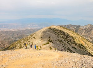
Mt. San Antonio, or Mt. Baldy as it is known locally, is one of the cans of the challenging "six-pack of peaks" in Southern California.
For this one, start before the Manker campground and head up the fire road. This is known as the "Baldy Bowl or Ski-Hut Trail". You'll see some cabins on your left and will approach a steadily flowing, spring-fed waterfall. Take the turn, and then hit the dirt...
Hike the Backbone East from Latigo Canyon
Malibu, California
3.8 mi
/ 780 ft gain
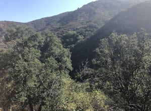
Starting in a dusty, generally empty parking lot, at about 2,000' ASL, you'll go immediately due north, up a few more feet before you drop down into another canyon covered in live oaks (and poison oak), thistles, ferns, and wildflowers.
There's only one trail. It's windy, it's not hilly, it just drops here, climbs there, levels out there, climbs there, levels out, and climbs some more. Because ...
Cooper Canyon Trail Camp
Pearblossom, California
5.37 mi
/ 1214 ft gain
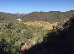
There's a small parking lot just below Cloudburst Summit on the way to Mount Waterman. Start your adventure there. I'd be hard-pressed to say it's more than 15 yards from the sign for the summit (7018' AMSL).
There's a fire road, if you're newer to altitude and don't know how to read a map (or even if you do but you get confused), stick to that. If you get altitude sick at all (even woozy on a...
Calabasas Peak Motorway
Topanga, California
7.23 mi
/ 1565 ft gain
Getting There
You can, from Los Angeles, go one of three ways: take I-405 to US-101 and head west, or from downtown, take US-101 the whole way, OR, get on I-10 from the Westside or east of there and take that until it becomes PCH, then take that to Topanga Canyon (turn left onto Old Topanga Canyon after a bit) or, for the more adventurous types, take Las Flores Canyon to Rambla Pacifica, Scheu...
Backbone Trail via Kanan Dume
Malibu, California
5.0
4.47 mi
/ 1089 ft gain
Fair warning, it can get very hot in Malibu, especially in the summer or fall.
We started at the Kanan Dume Road lot. It fills up quick, both directions offer beautiful hiking, but most people tend to go west, it seems. While that's beautiful, you end on a decent uphill, so if hiking is new or challenging to you, consider that. Oh hey, I'm writing about another section of the trail anyway!
Fi...
Hike to Conder Observatory (Mt. Piños) from the Nordic Ski Hut
Frazier Park, California
3.32 mi
/ 457 ft gain
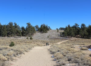
Any drive up the I-405N or I-5N is going to result in some pain: Either you leave early enough to avoid traffic, or you are sitting in some slowness for a while. But once you turn onto Frazier Mountain Road from the interstate, you are in a completely different world. It could be 85° in Los Angeles, and it will be raining and/or snowing in the region. So dress in layers. Also, the drive can be ...
Hike the Pacific Crest Trail from Horse Trail to Bear Campground
Lake Hughes, California
11.63 mi
/ 2396 ft gain
This is part of the Pacific Crest Trail. If you're through-hiking or sectional hiking, you'll have to hit it eventually. Try and avoid it in the late summer or early fall because of heat, and gnats. Find a way to check the bug report, we got marauded by gnats 90% of the way (early October) and apparently my DEET must have expired. The gnats almost ruined the experience.
Park on the road below t...
Echo Mountain and Inspiration Point Loop
Altadena, California
4.1
10.16 mi
/ 3369 ft gain
The trail switchbacks up the mountain before reaching the first historic marker, in 3 miles. These are the remains of the Mount Lowe Railroad, which brought customers to Echo Mountain Resort, also in ruins, nearby. Explore the historic sites, then head up Castle Canyon Trail.
A steep climb will bring you to Inspiration Point, where telescopes give views of the area. To head back down, take the...
Community
© 2024 The Outbound Collective - Terms of Use - Privacy Policy


