Sutton, Quebec
Top Spots in and near Sutton
-
Orford, Québec
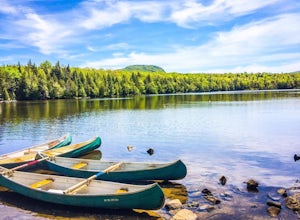
Canoe or Kayak at Lake Stukely
Discover Lake Stukely beach, a magnificent supervised beach with clear water and equipped with a playground for children. Guaranteed pleasure for the whole family! On-site services: Snack bar, convenience store, boutique, boat rental, toilets). On site, you can rent canoe, kayak, pedalo, SUP padd...Read more -
Coaticook, Quebec
Mount Pinacle
1.5 miWe came from Parc de la Gorge on Ch de Baldwin-Barnston road, which leads you to the Parc Harold F Baldwin area. Turn left onto Ch May and park your car in the parking area that is next to a small shop/cafe. There are signs at this point. Walk up the hill a bit until you reach the blue Mt. Pinac...Read more -
Cambridge, Vermont
Sterling Pond Trail
5.02.28 mi / 876 ft gainSterling Pond trail begins across the street from a parking area on Route 108, about 3 miles south of Smugglers' Notch Resort. Keep in mind that the road is closed to vehicles once the snow falls, so if you want to hike this area in the winter, you'll have to park about 40 minutes away and hike ...Read more -
Cambridge, Vermont
Spruce Peak and Sterling Pond Loop
5.03.38 mi / 1204 ft gainIf you're in New England during September or early October, a drive up north into Vermont is an absolute must for prime fall foliage. I-89 brings you through the state from I-93, and is in itself a beautifully scenic drive. Stowe, Vermont is a small ski resort town located just outside of Mt. Man...Read more -
Wolcott, Vermont
Hike to Elmore Mountain Fire Tower
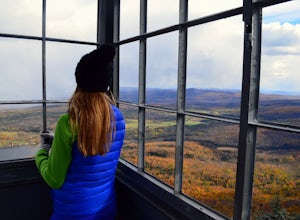
4.05.6 mi / 1485 ft gainIf hiking in off season when the park is closed, begin from the lower parking lot or the "day use area". If hiking while the park is open you can drive to the upper parking lot (subtract about 1.4 miles from total distance)Beginning from the lower parking lot make you way through the gate and int...Read more -
6385 Vermont 5A, Vermont
Hike to Mount Pisgah
4.04.1 mi / 1597 ft gainThe hike to Mount Pigsah is 4.1 miles out and back, just outside of Westmore, Vermont. The trail is most commonly used from March through October, but some people traffic this trail in the winter with crampons and sturdy hiking boots. This is an incredibly dog friendly trail. Be aware that there...Read more -
Coaticook, Québec
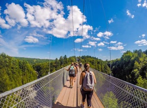
Hike the Parc de la Gorge de Coaticook Yellow Trail
5.02.18 mi / 164 ft gainHiking trails at Parc de la Gorge de Coaticook are spread into 3 sectors to reveal the park’s attractions.For a day trip I will suggest doing the yellow trail, which is the one we did. It will bring you directly into the heart of the Gorge. It is quite a short hike, 1h30-2h00 and you'll get the c...Read more -
Stowe, Vermont
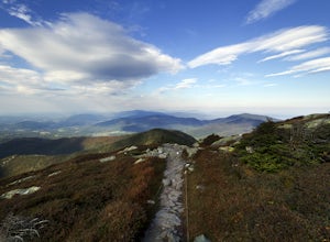
Mt. Mansfield via the Long Trail
5.05.27 mi / 2743 ft gainThere are several options to reach the summit of Mount Mansfield. The Toll Road (which, appropriately, has a toll to use it), the Laura Cowles trail, the Sunset Ridge trail, Haselton Trail, the Hellbrook Trail… The most popular trail from the east side of the mountain, however, is the section o...Read more -
Stowe, Vermont
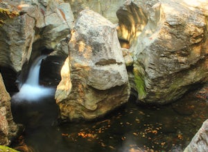
Hike to Bingham Falls
4.00.5 miHiking to Bingham Falls is rewarding for many reasons; people not only come to see the falls, but also to swim in the refreshing, icy cold swimming holes as well. The main falls are tucked away along the walls of a deep, rocky gorge that has been formed naturally over time. At the base of these ...Read more -
Jericho, Vermont
Americana and Mobbs Hill Loop
4.02.83 mi / 515 ft gainAmericana and Mobbs Hill Loop is a loop trail that is moderately difficult located near Jericho, Vermont.Read more -
Waterbury Center, Vermont
Hike Mt. Hunger
5.04.2 mi / 2263 ft gainMt Hunger stands at 3540 ft and face Vermont's tallest mountain, Mt Mansfield. At 45 min drive from Burlington, this is a challenging out and back hike. The views it offers and the waterfalls you will find along the path, makes it a good alternative to the overcrowded trails of Mt Mansfield. Th...Read more
Top Activities
Camping and Lodging in Sutton
45.3456079807,-73.4889543056, Canada
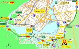
Montreal South KOA Journey
As the campground closest to downtown Montreal, this KOA is in a comfortable, rural/suburban area away from highway noise. It's perfect f...

