Hike Turk Mountain
Crozet, Virginia
4.0
2.2 mi
/ 700 ft gain
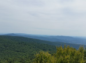
From the parking area at Turk Gap (MP 94.1), cross over the Skyline Drive. The Appalachian Trail (AT) intersects right here, and take the AT south by taking the trail on the left. After 0.2 miles you will turn right off of the AT onto the blue-blazed Turk Mountain Trail. The trail junctions mentioned above are well marked with stone posts.
The Turk Mountain Trail descends down into a saddle...
Hike the Mullaghmore Loop
Clare, Ireland
4.7 mi
/ 459.3 ft gain
This trail in Burren National Park traverses the limestone pavement typical of the Burren and summits Mullaghmore Mountain with a beautiful view of the unique geology of the area. This loop climbs 140 m (460 ft), is 7.5 km (4.7 mi), will take about 3 hours, and is difficult due to the rocky and pitted nature of the landscape.Burren National Park is in northern Co. Clare. To get to the lay-by f...
Linville Falls Trail
Newland, North Carolina
4.1
0.98 mi
/ 177 ft gain
Linville falls is one of North Carolina's treasures and perhaps the most photographed water fall in the state. Bring the whole family out and explore the area surrounding the falls. There are about 4 total miles of trails meandering around and through the gorge and right up to the falls. There are plenty of picnic spaces and large flat rocks near the creek where you can relax, take in some sun,...
Hike Apple Orchard Mountain
Buchanan, Virginia
4.0
4 mi
/ 400 ft gain
The top of Apple Orchard Mountain is easily accessible via the Appalachian Trail. Access the trail at the Sunset Field Overlook at MP 78.4 on the Blue Ridge Parkway. The concrete path will end shortly and turn into a blue blazed trail. Follow this for 0.25 miles until it intersects the Appalachian Trail. Turn right on the AT, and cross over the forest road. From here it is only a few switchback...
Visit Lewis Ginter Botanical Garden
Henrico, Virginia
5.0
Lewis Ginter has over 2 miles of pathways to follow through more than a dozen themed gardens including a Children's Garden, Rose Garden, Asian Garden and a conservatory. Admission for adults is currently $13.
Throughout the year there are various events. In April-June are the "Million Blooms" which includes daffodils, tulips, roses, and more. From mid-April to mid-October there is a butterfl...
Hike to Compton Peak
South River, Virginia
5.0
This unique hike on the Appalachian Trail in Shenandoah National Park is 2.4 miles round trip with an 835' elevation gain, and leads you to two viewpoints as well as a cool rock outcrop.Access this hike from the Compton Gap parking area (elevation 2,145') on the Skyline Drive at Mile 10.4. Cross the Skyline Drive and take the white-blazed Appalachian Trail south for a moderate but rocky 0.8 mil...
Visit Fort Sumter National Monument
Charleston, South Carolina
5.0
Fort Sumter is a sea fort out on an island in the middle of Charleston Harbor and is a great place to visit if you like history and/or exploring ruins. The National Park Service collaborates with Fort Sumter Tours, so you will have to book a boat tour with this company to visit the fort. Tickets are $21/adult and there are three tours a day that depart from Liberty Square by the South Carolina...
Walk around Audubon Swamp
Charleston, South Carolina
1.3 mi
/ 0 ft gain
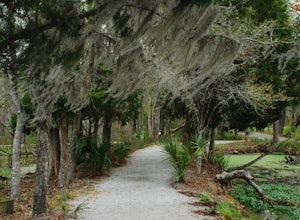
If visiting Magnolia Plantation and Gardens for the day, consider paying the extra $8 admission to walk around the Audubon Swamp Garden. Parking for these gardens is on the way out of Magnolia Plantation on the left side. The trail begins to the left side of the parking area, and you will have to enter the code given to you at the admissions office to open the gate and enter the swamp.
Immed...
Hike Buffalo Mountain
Willis, Virginia
4.7
2 mi
/ 700 ft gain
COVID-19 CLOSURE: Due to Covid-19, this trail will be closed effective April 10, 2020 at 8 PM until June 24, 2020.
A short 1.0 mile hike to the summit with 700’ elevation gain, the trail switchbacks steeply up to the exposed rocky summit. To the north you can see Sharp Top and Flat Top at the Peaks of Otter, and to the south you can see Pilot Mountain in North Carolina.
The summit has many pla...
Photograph Mabry Mill
Meadows of Dan, Virginia
4.7
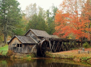
Mabry Mill is one of the most photographed spots on the Blue Ridge Parkway, and rightfully so. Located at MP 176.1 the mill is beautiful in any season and easily accessed from the parking lot. Since this place is so popular, be prepared for crowds.This place is a nice " leg-stretcher" if driving the Driving the Blue Ridge Parkway or a short side trip from the trailhead if you're hiking Rock Cas...
Hike to Wolf Rock and Cedar Rock
Traphill, North Carolina
5.0
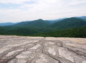
This easy 3.0 mile hike begins at the Lower Trailhead Parking Lot at Stone Mountain State Park and includes a 400' ascent to two granite outcrops with nice views. This hike can be combined with the Stone Mountain Loop hike for a 6.5 mile strenuous hike.From the parking lot, walk towards the stream by the bathrooms to take the Stone Mountain Loop Trail. After 0.2 miles, intersect the Wolf Rock T...
Hike the Jomeokee Trail at Pilot Mountain SP
Pinnacle, North Carolina
4.3
0.8 mi
/ 100 ft gain
This unique peak, also known as the Big Pinnacle, is in Pilot Mountain State Park. From the main parking area on top of the mountain on Pilot Knob Park Road, you can first view the Big Pinnacle from the overlook attached to the parking lot. The prominent mountain behind the Big Pinnacle is Hanging Rock.
Walk towards the bathrooms and on your right side will be the trailhead for the Jomeokee ...
Hike Around the Trails of Nuttallburg
Fayetteville, West Virginia
5.0
3 mi
/ 200 ft gain
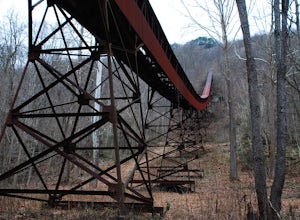
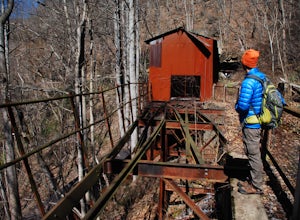
**The road to Nuttallburg is part gravel and only wide enough for one car. Take caution driving along this road-you may have to back up some if you meet another car. Nuttallburg is an old coal mining town that once thrived in the early 1900's, but fell into ruin and then was restored by the National Park Service in the early 2000's. Starting from the parking lot, take the Tipple Trail (0.6 mile...
Hike to the Nuttallburg Headhouse
Fayetteville, West Virginia
1.4 mi
/ 400 ft gain
From Lansing-Edmond road, turn right onto Beauty Mountain Road. Go for 0.1 miles and the road will appear to split into three roads. The main road goes left, but take the middle road here. After another 0.1 miles you will arrive at a gate with a few parking spaces on the left side. Do not block the gate or the driveway for the house by the trailhead.The trail follows a gravel road and is steep ...
Hike Sentinel Point and Mill Creek Falls
Narrows, Virginia
5.0
7.8 mi
/ 1800 ft gain
There are many trails in the area so here is a map to start out because it can get confusing:http://gilescounty.org/images2/Map-Town%20Farm-Hiking%20Trails%20%282010%29.pdf.From the parking area, keep to the left side of the stream and head up the gravel road. You'll soon come to the Mill Creek dam, which has a shelter and picnic area. Continue to stay to the left of the stream, as the gravel ...
Bald Knob Trail
Pembroke, Virginia
4.8
0.93 mi
/ 387 ft gain
Unobstructed views with little hiking effort make Bald Knob one of the best locations to see the sunset in southwestern Virginia.
Easy to access from US-460 in Giles County, take Mountain Lake Road (VA-700) for 7 miles and park in the gravel lot on the left by the intersection of VA-613 and Mountain Lake Outfitters. Cross VA-700 and begin your hike up the gravel road. After 0.1 miles turn rig...
Hike the Long Point Trail
Fayetteville, West Virginia
4.8
3.2 mi
/ 200 ft gain
With minimal elevation gain, this 3.2 mile hike can be done in a short amount of time. From the parking lot, take the trail to the right of the bathroom. There will be two trail intersections at 0.4 miles and 0.7 miles, both of which are well marked. Stay straight at both intersections to remain on the Long Point Trail. Near the end of the trail, you will descend fairly steeply through some thi...
Walk around Smale Riverfront and Sawyer Point Parks
Cincinnati, Ohio
4.0
2.5 mi
/ 0 ft gain
There are numerous parking lots and street parking available around Smale Riverfront Park. Start your walk on the side closest to Paul Brown Stadium (where the Cincinnati Bengals play). From here you can take a minute to sit on the large swings that look out over the river.
Continuing along the river, walk up the stairs to the Roebling suspension bridge. You can walk all the way across the br...
Hike to Doyles Falls
Crozet, Virginia
4.9
3.2 mi
/ 1190 ft gain
From the parking lot at MP 81.1 on the Skyline Drive, take the trailhead to the left of the sign with the trail map. Immediately you'll cross over the Appalachian Trail-stay straight on the blue-blazed trail to Doyles Falls.
The trail will descend rapidly for 1.3 miles to Upper Doyles Falls (28' waterfall), then another 0.3 miles to Lower Doyles Falls (63' waterfall).
Both of these waterfalls a...
Brush Creek Falls
Princeton, West Virginia
4.5
0.5 mi
/ 75 ft gain
Brush Creek Falls is a beautiful 25' waterfall that spans across Brush Creek. It is accessed via a short 0.5 mile hike with minimal elevation gain.
From the parking area on Brush Creek Falls Road, take the trail to the right of the picnic shelter. This easy and relatively-flat trail through rhododendron winds 0.5 miles to a fenced overlook of the falls.
Take in the view of the falls from the ...
Hay Rock
Daleville, Virginia
4.6
7.48 mi
/ 1276 ft gain
If you're looking for a hike in the Roanoke area without the crowds that McAfee Knob draws, but still want a challenging hike with great views, try hiking to Hay Rock.
This 7.5 mile round trip hike begins at the Park and Ride just off I-81 at the US-220 Troutville/Fincastle exit (150B). The gravel lot is by the first turn on your left after you cross under I-81, next to the Exxon. There is an...
Visit the Stykkishólmur Lighthouse
Stykkishólmur, Iceland
3.0
From the parking area which is adjacent to where the Ferry Baldur loading area is, walk up the hill and shortly after you'll see the brightly-colored lighthouse.
It gets very windy here and there are birds everywhere. From the lighthouse you can look out over some islands between the Snæfellsnes peninsula and the Westfjords, as well as look back over the town.
Once finished, take a stroll ar...
Take a Stroll around Maymont Park
Richmond, Virginia
5.0
There are two entrances to Maymont: the Nature Center Parking area and the Estate Parking Lot. The Estate parking lot is closest to all of the gardens, so if you want a longer walk around the estate, park at the Nature Center.
From the Estate parking lot, enter through the gate and the entrance to the Italian Gardens will break off shortly to your left. This garden has numerous water features...
Hike the Devil's Bathtub
Duffield, Virginia
5.0
3.96 mi
/ 250 ft gain
The Devil’s Bathtub is a deep pool of blue-green water known for being a great swimming hole and a beautiful natural feature. This hike is a 3.2 mile out and back hike with 250 feet elevation gain. There are at least 15 stream crossings, so extreme caution should be taken during periods of medium-to-high flow as the stream crossings may be slippery and submerged.
This hike has gotten very cro...
Community
© 2024 The Outbound Collective - Terms of Use - Privacy Policy


