James HueserExplorer
Some call me the Jerry Macguire of the outdoors. The places special to me should be special to everyone. It is not my intention to hoard the best views around me. It's my responsibility to invite everyone to join, and give them every opportunity to do so.
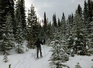
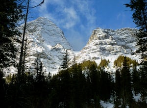
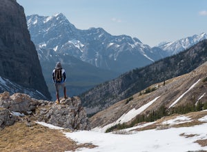
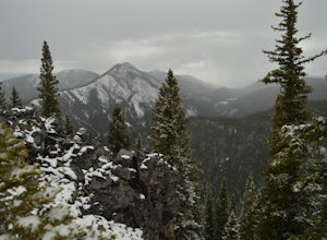
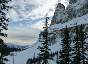
Snowshoe to Rummel Lake and Pass
Kananaskis, Alberta
4.0
7.5 mi
/ 2000 ft gain
The trailhead to Rummel Lake/Pass is off of Kananaskis Trail (Smith Dorrien Trail) directly across from the turn to Mt. Shark at the south end of Spray Lakes - it will likely be marked by cars attempting the same trail. The trail is well packed and snowshoes aren't even necessary until after Rummel Lake.The main trail meanders through the montane forest by a series of switchbacks as well as ste...
Mist Mountain Scramble
Turner Valley, Alberta
4.5
This is a pretty big objective, but doesn't feature any technical climbing, so anyone who keeps a clear head and can put one foot in front of the other can do it.Mist Mountain is located in Highwood Pass - whose highway is only open between June and December, so scheduling Mist Mountain as a big summer objective is an absolute must! Highwood Pass is one of my favourite highways to drive along i...
Winter Climb Mount Allan
Kananaskis, Alberta
5.0
8.7 mi
/ 4429.1 ft gain
Mount Allan is a 14 km hike that gains 1400 metres of elevation and was one of my favourite hikes when I first moved to Calgary. On a recent snowshoe, a couple I crossed paths with mentioned they had just done Mount Allan in December, so I knew I had to put it on my winter list!The trail begins at the Ribbon Creek parking lot, near the Nakiska ski hill. The trail begins in the northeast corner ...
Summit Door Jamb Mountain and Loder Peak
Bighorn No. 8, Alberta
4.0
If you're looking for views, vistas, and great scrambles in the Rockies, this is a great place to start. For any geology enthusiast, furthermore, this hike cannot be missed, offering great opportunities to search for some seriously ancient fossils.The trail begins on the west side of the parking lot – you will see a wide trail heading west, and a narrower trail heading north. Follow the narrowe...
Snowshoe to Old Goat Glacier
Kananaskis, Alberta
6.2 mi
/ 2296.6 ft gain
The trialhead is found on West Side Road on the west side of Spray Lakes Resevoir. In winter, West Side Road is closed to vehicles due to dogsled tours, but is still open to walking - it's a pretty neat experience to get passed by a dozen sled dog teams. Since the road is closed, it adds an extra kilometre or two to the day, but it's an easy walk so not very noticeable.There's an open space tha...
Hike Hvannárgil and Réttarfell
Þórsmerkurvegur, Iceland
2.5 mi
/ 492.1 ft gain
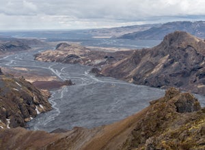
Starting at the Básar facilities, the loop can be completed clockwise and do Réttarfell to Hvannárgil, or counter-clockwise. We did it counter-clockwise which was nice as we made our way through gorge and ended on a high note.The counter-clockwise loop follows the road until a sign and markers point out the path to Hvannárgil. It gains a bit of elevation and you get a great view down the gorge,...
Scramble Kirkjufell Mountain
Snæfellsnesvegur, Iceland
5.0
1.2 mi
/ 1542 ft gain
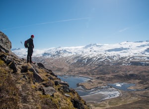
You can park at the Kirkjufellsfoss parking lot and head north across the road. Just a bit northwest there's a farm and some guest houses - head towards that. The trail up Kirkjufell starts ascending before you enter the fences of the guest houses. If you end up going too far, the nice woman who lives on the farm will yell at you, but also guide you to the correct spot. She yells because she ca...
Scramble Up Black Rock Mountain
Bighorn No. 8, Alberta
4.0
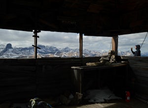
Fortunately, or unfortunately depending on your point of view, getting to/finding the trailhead is the most difficult part of this hike! On top of Black Rock Mountain is an abandoned fire lookout that was utilized from 1928 to 1950. Through all those years, the lookout was supplied by pack horses, so not only is the trail well defined, it's also a very easy scramble that can be done by anybody....
Hike Spencer Creek
Kananaskis, Alberta
2.5 mi
/ 1968.5 ft gain
South of the Driftwood turnoff (approximately 4 km) on Spray/Smith-Dorrien Trail a large creek bed on the east of the road is the beginning of Spencer Creek. The trail is easy enough to find, just have to do a bit of looking.Once on the trail, you'll basically have no trouble at all. The trail itself rises above the creek until you gain the plateau, but you can also drop down into the creek bed...
Scramble Mount Glasgow
Bragg Creek, Alberta
3.0
14.3 mi
/ 4265.1 ft gain
As with most hikes in the Bragg Creek/Little Elbow area, the trail begins at the Little Elbow campground. To make the hike a tiny bit shorter, most people bike for the first 4 km on the Big Elbow trail to South Glasgow Creek. If you're not using a GPS trail, you'll know you're at the creek once you hit the open creek bed - very wide, cannot miss.Now that I'm writing this, I'm at a loss of words...
Scramble the North Summit of Mount Yukness
Field, British Columbia
6.5 mi
/ 2690.3 ft gain
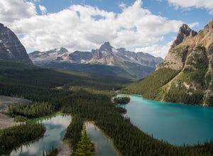
Beginning at Lake O'Hara, head counter-clockwise around the lake - you'll get distracted by the reflections in the water if the water is calm enough, that's ok. You'll want to take the Opabin East route, but Opabin West will work too. Just remember to get on the east side at some point in time!The trail up to the east side of the Opabin Plateau is mostly switchbacks to make the elevation gain a...
Scramble Little Odaray
Field, British Columbia
6.2 mi
/ 3116.8 ft gain
First things first: prior to August 15, there are only 4 groups of people allowed in this area per day, and after August 15, only 2 groups are allowed in. Start early!Starting at Lake O'Hara, head towards the Elizabeth Parker ACC Hut. Continue past the hut and meander through meadows and forests. If the signs don't mention the Odaray circuit, keep following signs towards McArthur Lake. The turn...
Scramble the Wedge
Kananaskis, Alberta
5 mi
/ 3444.9 ft gain
Drive south on Highway 40 and your adventure begins at Wedge Pond. Parking in the parking lot is easy enough if you're there early enough in the day (before 10:00). The trail up the Wedge starts near the bathrooms, and heads south - not southwest towards the pond. After only a few minutes of walking down the path/old road, a smaller trail will branch off a bit southeast. Once on the trail, you'...
Icewalk in Grotto Canyon
Bighorn No. 8, Alberta
3.5
To get to the trailhead, take Highway 1 and take the Seebe exit (Highway 1X). Continue north on Highway 1X and take a left at Highway 1A. A few kilometres after the town of Exshaw, turn into the parking lot marked by the Grotto Pond sign.The trailhead is well marked and follow the trail until the clearing at Grotto Creek. From there, just follow the creek/canyon until you come to the ice/waterf...
Rock Climb Plutonian Shores in Banff
Banff, Alberta
1.0
To get to the base of the climb, you must brave the (hordes of) tourists at the Cave and Basin Historical Site in Banff. This requires a park pass and calloused elbows fit for pushing your way through crowds. Or an alarm clock to get up early - the visitor centre is only open after 9 AM and this climb sees a lot of traffic so it's a good idea to get there early. Once you're parked and geared up...
Hike Mount Lineham
Waterton, AlbertaI’ve heard a lot about the hiking in Waterton and the stunning scenery, but I never really bought into it from the pictures alone – I’m glad I finally took the opportunity to find out for myself. Mount Lineham is a short extension of Lineham Ridge, and while it might not eclipse the views from the ridge, it’s definitely worth the extra hour ascent.I think one of my favourite parts about this hi...
Winter Hike Up Vent's Ridge
Bragg Creek, AlbertaWhether it was the unseasonably warm weather; the forested, uneven, foot-wide, root-covered trail; limestone cliffs towering above me; the view of Myosotis Peak from the ridge; or exploring along Powderface Creek on the descent, this trail was an absolute blast.If you do this hike in February like I did, Hwy 66 past Elbow Falls Parking Lot will be closed (from December to May every year) so par...
Hike Iyarhe Ipan
Bragg Creek, Alberta
3.0
2.5 mi
/ 1476.4 ft gain
Iyarhe Ipan means "mountain point" in Stoney, and while it's far from the highest peak you'll ever climb, it certainly is worth it. Iyarhe Ipan was the fix for the scrambling itch I've had all winter.Before Highway 66 opens in the summer, you'll have to park your car at Elbow Falls parking lot and start hiking from there. You won't have far to go before you meet the first - and only - major obs...
Scramble up Mount Sparrowhawk for Sunrise
Kananaskis, Alberta
7.5 mi
/ 4527.6 ft gain
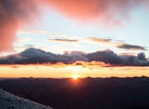
Mount Sparrowhawk was the first mountain I ever fell in love with -- I knew it well, and I knew that the summit would still be accessible with a bit of snow on it in October. With waning daylight hours, it was a perfect option - albeit intense - for a sunrise hike.The trailhead is located on the east side of the Smith Dorrien Trail/Spray Lakes Road at the Sparrowhawk day use area (which is mark...
Scramble up Mount Niblock
Improvement District No. 9, Alberta
5.0
9.3 mi
/ 4068.2 ft gain
Thousands of tourists flock to Lake Louise and Lake Agnes every year (maybe even every month) and by scrambling Mount Niblock you'll see the same magnificent sites while leaving the crowd behind and seeing so much more!Mount Niblock offers a bit of a challenge in that there are some rock ribs that need to be climbed, mixed with some very faint trails that need to be navigated, but it's an excel...
Snowshoe to Rockbound Lake
Improvement District No. 9, Alberta
3.0
11 mi
/ 2460 ft gain
This is an amazing trail, but not for the feint of heart!The trailhead is located on the Bow Valley Parkway (Highway 1A) in Banff National Park, AB at the Castle Mountain sign. The trailhead is marked by an information sign in the north of the parking lot and the trail initially heads north - not to be confused with cross-country ski trails that also utilize parts of this trail. Once past the f...
Heart Mountain and Grant MacEwan Scramble
Bighorn No. 8, Alberta
2.0
A bit of a jaunt is required to get to the start of the scramble - follow the Heart Creek Trail, and after crossing the creek, look for a yellow sign that marks the scramble route. There will be exposure as well as use of hands, but it is totally do-able as long as you keep your head right!After the sign, the trail starts gaining elevation - rather quickly, depending on your fitness level. The ...
Hike Maze Peak
Clearwater County, Alberta
4.0
5.3 mi
/ 2624.7 ft gain
There's not much of a trailhead for Maze Peak - in fact there isn't a trailhead at all. Bring up the start location from this post and pull over on the side of the dirt road once you get to it! The hardest part about this trail is just kind of finding it, really. The good news is that you're going to stumble across it eventually as long as you keep gaining elevation!As you move up the southwest...
Scramble Smutwood Peak
Kananaskis, Alberta
5.0
11.8 mi
/ 2772.3 ft gain
The trailhead is is located at the first left after the bridge past Engandine Lodge in Kananaskis. The trail forks after a while and you need to take a right which takes you into Smuts Pass. This trail is actually really cool and fun to walk - undulating, narrow, rooted, and right along the edge of Commonwealth Creek.Once at the end of the pass, you'll gain elevation very quickly on the north s...
Community
© 2024 The Outbound Collective - Terms of Use - Privacy Policy

