Riana Abiquiu Lake
Book this listing through our partner Recreation Gov
About Riana Abiquiu Lake
Overview
Riana Campground is located on a 150 ft. bluff overlooking the scenic Abiquiu Lake in northern New Mexico, just one hour northwest of charming Santa Fe. The lake sits at an elevation of 6,400 feet on the Rio Chama, a tributary of the legendary Rio Grande.Recreation
Abiquiu Lake offers many opportunities for outdoor recreation. The fishing here is some of the finest in northern New Mexico.Visitors enjoy boating, water skiing, and hiking. Lake shore access for boat launching is 1 mile from the campground.
Facilities
Riana Campground hosts 52 campsites, 13 of which have electric and water hookups. Flush toilets, showers, and drinking water are provided, as are picnic shelters, grills, lantern posts, and tent pads. A playground and dump station are located on-site.Natural Features
Fragrant Pinion pine, juniper, and sage cover the campsite, providing a distinct smell of northern New Mexico, but offering limited shade. Colorful rock formations surround the park.Visitors are awarded a panoramic view of the narrow mesa, Cerro Pedernal, locally known as "Pedernal." Famous American painter, Georgia O'Keefe, had her ashes scattered over its top.
Nearby Attractions
Northern New Mexico is full of beauty and history. The educational and historical Ghost Ranch is about 10 minutes from the park.The Georgia O'Keeffe Museum, San Pedro Wilderness, Cumbres Toltec Railroad, Chaco Canyon, and Bandelier National Monument are all nearby.
The ski-town of Taos is just over an hour away, and colorful Santa Fe is an hour southeast, both with restaurants, shops, and museums.
Riana Abiquiu Lake Reviews
Have you stayed here? Be the first to leave a review!
Top Spots in or near Gallina
Hike to Chimney Rock at Ghost Ranch
Abiquiu, New Mexico
4.5
3 mi
/ 600 ft gain
Start your adventure by checking in at the Ghost Ranch Visitor Center, then find the trailhead just behind the building. You'll quickly drop down through an arroyo and then walk through a gate. The trail begins to climb briefly then flattens out with beautiful views across to Pedernal and the Piedra Lumbre basin, the heart of Georgia O'Keefe country.
Continue to climb gradually up the ridge wit...
San Antonio Hot Springs
Jemez Springs, New Mexico
4.6
1.46 mi
/ 312 ft gain
These hot springs are a short hike from the parking area along the top of Forest Service Road 376. I've added additional details below in the event that the road is closed due to seasonality or you prefer to stretch your legs for a significantly longer, yet scenic hike. The GPX track is displaying the shorter version.
Starting from Jemez Springs New Mexico you will drive north on NM-4 for app...
San Antonio Hot Springs via Thompson Ridge Route
Jemez Springs, New Mexico
5.0
2.66 mi
/ 469 ft gain
Although you can reach these hot springs via the main trail in the winter, the Thompson Ridge route is a shorter option that comes in from above the springs rather than below. If you go in winter, you'll need winter route finding skills for the trail (there's no signage at any point) and an all wheel or 4 wheel drive for the road in.
The trailhead starts on a Forest Service Road (accessible du...
Vacas Trail Loop
Rio Arriba County, New Mexico
4.0
14.56 mi
/ 1581 ft gain
You start at the hiking at base of the the San Pedro Wilderness at the San Gregorio Lake Trailhead! This particular hike is called the Vacas Trail loop.
For directions: Take US 550 to Cuba (north west of Albuquerque), turn east on NM 126 and go for about 9 miles. Just past the community of Deer Lake, look for the forest road heading north, possible marked Forest Road 70 or there may be a sign ...
San Gregorio Reservoir
Cuba, New Mexico
2.26 mi
/ 253 ft gain
The San Gregorio Reservoir Trail in New Mexico is a moderately challenging hike known for its serene views of the reservoir and surrounding forest. The out-and-back trail provides a peaceful atmosphere and well-maintained paths, making it a great spot for fishing, camping, and hiking. Dogs are allowed on the trail, though they must be leashed.
No permits are required, and visitors highlight ...
Spence Hot Springs
Jemez Springs, New Mexico
4.0
0.67 mi
/ 161 ft gain
Exit Interstate 550 and head North on Highway 4 heading towards Jemez Springs. The Spence Hot Springs Parking Lot and Trailhead is about 25 miles North off Highway 4. The trail starts on a decline into the canyon for about 800 feet before you cross the bridge over the scenic river. Continue following the trail up a brief, yet steep incline towards the two hot springs. Take a dip and enjoy the J...
Camping and Lodging in Gallina
Jemez Springs, New Mexico
San Antonio Campground
Overview
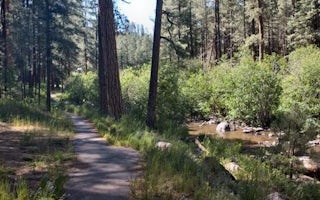
San Antonio Campground is adjacent to the San Antonio River, tucked into a forest of ponderosa pine at 7,600 feet above sea leve...
Los Alamos, New Mexico
Ponderosa Campground (Nm)
Overview
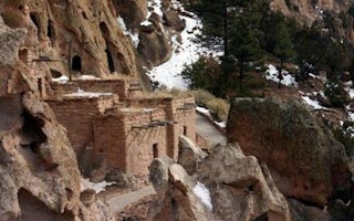
For large groups coming to Bandelier National Monument, Ponderosa Campground is an ideal place to stay. Located 6 miles from the...
Jemez Springs, New Mexico
Jemez Falls Campground
Overview
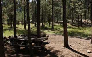
Jemez Falls Campground is located in a stunning Ponderosa Pine and forest meadow environment. The campground elevation is 7,880 ...
Jemez Springs, New Mexico
Jemez Falls (Nm) Picnic Area
Overview
Jemez Falls Picnic Area is great place to spend the day, especially when planning a day hike to nearby Jemez Falls on the Jemez ...
Los Alamos, New Mexico
Juniper Campground
Overview
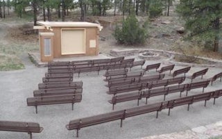
For visitors to Bandelier National Monument, Juniper Group Campground is an ideal place to stay. Located just inside the main pa...
Nambe, New Mexico
Black Canyon
Overview
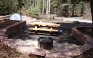
Black Canyon Campground is in a great location to experience some of the finest mountain scenery the Southwest has to offer. The...
Unfortunately, we don't have up-to date pricing data for this listing, but you can check pricing through Recreation Gov.
Book NowAdd your business today to reach The Outbound's audience of adventurous travelers.
Community
© 2024 The Outbound Collective - Terms of Use - Privacy Policy


