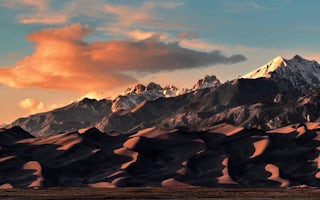
Purgatoire Campground
Book this listing through our partner Recreation Gov
About Purgatoire Campground
Overview
Purgatoire Campground is nestled near the headwaters of the Purgatoire River in the beautiful Culebra Range of the Sangre de Cristo Mountains. The primitive campground is laid out on two loops. One is a large grassy meadow with sites that accommodate equestrian campers and one that is wooded with aspen and spruce. The access road is very rough and is not suitable for low-clearance trailers.Constructed by the Youth Conservation Corp in 1976, Purgatoire was originally named Potato Patch Campground. The river provides nice fishing and a trailhead attracts hikers and horseback riders.
Recreation
The North Fork Trail # 1309 is located on the north end of the campground and offers non-motorized access to hikers, cyclists, and horseback riders. The 5-mile trail delights with mountain vistas and shade from forested terrain. The river, which is creek-sized at these upper reaches, provides opportunities for anglers to cast for trout.Facilities
Campsites come with campfire rings, picnic tables and vault toilets. Equestrian sites can fit large horse trailers. Drinking water is from a hand pump and parking aprons are grass and gravel. Trash service is provided.Natural Features
The campground is in an aspen and conifer forest near the North Fork River at an elevation of 9,800 feet. The river, also known as the Purgatoire River, flows 196 miles to the confluence of the Arkansas River.Pike-San Isabel National Forest includes over a million acres of wilderness and over half of Colorado's mountain peaks that reach above 14,000 feet.
Nearby Attractions
The nearby towns of Stonewall and Cuchara offer shopping and restaurants.Purgatoire Campground Reviews
Have you stayed here? Be the first to leave a review!
Top Spots in or near Weston
Camp at Bear Lake
La Veta, Colorado
4.5
There are two main campgrounds with enough room for RVs. A secret for dispersed campers, if the campgrounds are full, turn south on the dirt road by the lower campground and you can drop a tent anywhere. Caution as this turns into an extreme 4x4 trail within half a mile.From Walsenburg, take CO-12 E to Co Rd 422. Head west on Co Rd 422 and follow the signs 5.2 miles to Bear Lake Campground. ...
Hike West Spanish Peak
Aguilar, Colorado
5.0
7.2 mi
/ 2.38 ft gain
The West Spanish Peak is best reached by way of CO Hwy 12, which connects south and west through the town of La Veta, Colorado. From Denver travel I-25 south to Walsenburg (about 3.5 hours). At Walsenburg take US 160 to CO 12 southwest through the towns of La Veta and Cuchara.Cordova Pass Trailhead (11,248 ft): Follow the directions above. Continue past Cuchara 6.25 miles to Cucharas Pass. Once...
Summit Little Bear Peak
Mosca, Colorado
12 mi
/ 5000 ft gain
This hike starts on Lake Como Road with the goal of eventually reaching Lake Como. If you have a modified 4WD car you can get all the way to the lake in it, but if you do not feel like risking damage to your vehicle park as low as you deem necessary to do that. Most 4WD stock vehicles can make it quite a ways up the road. The total mileage and elevation gain depend on how far you get on this ...
Summit Blanca and Ellingwood Peaks
Lake Como Trailhead, Colorado
7 mi
/ 6800 ft gain
Blanca Peak is nestled at the heart (and the top) of a four peak ceiling located at the southern-most tip of Colorado's intimidating Sangre de Christo range. The peak is known for its impeccable 360 degree views, as you can see well over 100 miles in every direction thanks to Colorado's clean, crisp, thin air. The entire hike is roughly 17 miles round trip and should be done in two days. Ambi...
Mount Lindsey (CLOSED)
Gardner, Colorado
1.0
8.5 mi
/ 3300 ft gain
NOTE: As of September 2021, Mount Lindsey has been closed to public access indefinitely. (Source)
At 14,042 Mt. Lindsey is not one of the tallest 14ers, but it is a fun objective regardless. The Lily Lake trailhead can be somewhat difficult to access without a high clearance car, but most cars can probably make it. There is quite a bit of private property along the road so just be careful if ...
Zapata Falls
Alamosa County, Colorado
4.7
0.5 mi
/ 150 ft gain
Driving towards the Sand Dunes, you will see a sign marker that indicates the road up to Zapata Falls. Turn right onto the road a follow it for about 2 miles until you hit the parking lot at the top. The road is in pretty rough condition so if your car doesn't have high clearance make sure you take it slow. Once you reach the parking lot, you will see an 10ft sign indicating the trail head. You...
Camping and Lodging in Weston
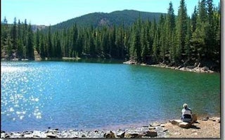
La Veta, Colorado
Bear Lake Campground (Co)
Overview
Bear Lake Campground is located in the beautiful San Isabel National Forest at an elevation of 10,480 ft. Views of the nearby C...
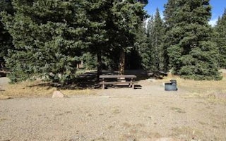
La Veta, Colorado
Blue Lake Campground
Overview
Blue Lake Campground is located in the beautiful San Isabel National Forest at an elevation of 10,500 ft. Views of the nearby C...
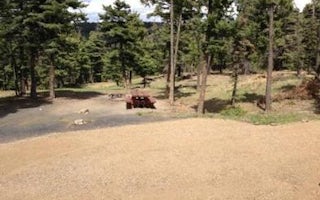
Colfax County, New Mexico
Cimarron Campground
Overview
Cimarron Campground is located in the scenic Valle Vidal within Carson National Forest in northern New Mexico, at an elevation o...
Questa, New Mexico
Fawn Lakes Campground
Overview
Fawn Lakes Campground is located in Carson National Forest, one of a few campgrounds located along the scenic canyons of Red Riv...
Alamosa, Colorado
Alamosa / Great Sand Dunes KOA Journey
Nestled between the breathtaking San Juan Mountains and Sangre de Cristo Mountains at 7,550 feet, the San Luis Valley is your gateway to ...
Unfortunately, we don't have up-to date pricing data for this listing, but you can check pricing through Recreation Gov.
Book NowAdd your business today to reach The Outbound's audience of adventurous travelers.
Community
© 2024 The Outbound Collective - Terms of Use - Privacy Policy


