Markham Springs
Book this listing through our partner Recreation Gov
About Markham Springs
Overview
Markham Springs Campground is set on the Black River in a scenic and historic recreation area in the southwestern corner of Missouri's Mark Twain National Forest. The area provides access to multiple trails and recreational opportunities.Markham Springs Recreation Area gets its name from former owner, M. J. Markham, who acquired the property in 1901 and operated a lumber mill at the site until the 1930s.
The Fuchs House, a five-bedroom concrete and native stone home, also sits on the property, along with a neighboring mill. At times, it is also available for rent.
Recreation
River and stream fishing are popular activities near the campground. The Black River boasts bass, sunfish, walleye and catfish. Many anglers fish from boats, but others fish from the riverbanks. Canoeing and kayaking is also possible on the river.Various day hikes within the Markham Springs Trail System are accessible from the campground. Eagle Bluff Trail is a 1.5-mile loop along the river, where birding and wildlife viewing are favorite pastimes.
Facilities
The campground offers single and double sites for tent and RV camping. Some rather primitive sites are located in a wooded setting near the river.Electric hookups are provided, as well as tables and campfire rings with grills. Lantern posts are also available. Accessible vault toilets, drinking water, showers and trash collection are provided.
Natural Features
Located adjacent to the Black River, the recreation area contains a small pond that dates back to the 1800s. The area is covered by a dense forest of colorful trees, including ash, elm, maple and poplar.Nearby Attractions
The small town of Williamsville is just 3 miles from the campground, offering a general store and fuel station.Markham Springs Reviews
Have you stayed here? Be the first to leave a review!
Top Spots in or near Ellsinore
Big Spring
Van Buren, Missouri
5.0
1.8 mi
/ 413 ft gain
With an average daily water discharge rate of 276 Million gallons of water and the largest spring in Missouri it is easy to see how Big Spring got its name. Located in the Ozark National Scenic Riverways, this spring and over 20 other springs nearby feed the Current River in Southeast Missouri. The spring flows from three outlets at high flow.
Churning out beautiful aqua-blue water (caused by...
Hike to Blue Spring
Ellington, Missouri
1 mi
/ 29 ft gain
If you were to place the Statue of Liberty in Blue Spring, the torch of the monument would still be 5 feet below the surface. As part of the Ozark National Scenic Riverways, Blue Spring is a must see and pinnacle of the nature preserve. The 6th largest spring in Missouri with water discharge at an average of 90 million gallons per day, Blue Spring helps feed the Current River with a year round ...
Explore Rocky Falls
Winona, Missouri
4.3
0.4 mi
/ 60 ft gain
Rocky Falls are located only a short hike away from the parking lot. The swimming hole is also popular, and the adventurous can climb up to the rock face to reach the top of the falls.
Johnson Shut-Ins
Lesterville, Missouri
4.5
2.29 mi
/ 354 ft gain
The Shut-Ins Trailhead is located located next to the River Store in the Johnson Shut-Ins State Park day use area.
Simply follow the paved trail for 0.3 miles to the boardwalk and viewing deck. Here you’ll find stairs accessing the Shut-Ins. Take your time exploring the unique rock formations spreading across the Black River. The trail to the observation deck is family friendly and handicap...
Hike Mina Sauk Falls Trail
Ironton, Missouri
3 mi
/ 400 ft gain
The hike begins with a paved trail leading to a plaque marking the highest point in Missouri. Although there is no view here it is still a fun spot to take a picture. Continue back on the main trail until you reach the junction marked by the backcountry camping registration box. Turn right at the junction to hike a counterclockwise loop.
The trail slowly descends through the woods. As you con...
Explore Alley Spring and Mill within the Ozark National Scenic Riverways
Eminence, Missouri
1.4 mi
/ 200 ft gain
Alley Spring is the seventh largest spring in Missouri. It is known to extend at least 3000 feet into the hillside and has a known depth of 155 feet. Water surfacing here is known to begin its journey 15 miles away near the town of Summersville as rain enters sinkholes and then travels through many cave systems of limestone. Then after a half mile journey on the spring branch creek, the water e...
Camping and Lodging in Ellsinore

Ellsinore, Missouri
Fuchs House
Overview
In the late 1930s, Rudolph Fuchs built a five bedroom concrete and native stone house for his family, and also built the present...
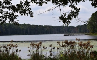
Ellsinore, Missouri
Pinewoods Lake Rec Area
Overview
Pinewoods Lake Recreation Area sits next to Pinewoods Lake in southeastern Missouri. It is an ideal location to enjoy lake fishi...
Greenville, Missouri
Greenville Recreation Area
Overview
Greenville Recreation Area is located on the northern end of Wappapello Lake, on the St. Francis River. The spacious campground ...
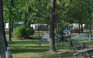
Piedmont, Missouri
River Road Park
Overview
Set on the banks of a calming river, just below the entertaining Clearwater Lake lies River Road Park, known as a jolly ol' plac...
Piedmont, Missouri
Piedmont Park
Overview
Piedmont Park is a spacious, activity-dense recreation area on the shores of Missouri's Clearwater Lake. Water sport enthusiasts...
Ellington, Missouri
Webb Creek Park
Overview
Webb Creek Campground on Clearwater Lake greets visitors with excellent camping, fishing, swimming, boating and picnicking oppor...
Unfortunately, we don't have up-to date pricing data for this listing, but you can check pricing through Recreation Gov.
Book NowAdd your business today to reach The Outbound's audience of adventurous travelers.
Community
© 2024 The Outbound Collective - Terms of Use - Privacy Policy


